
The Mt William Hike is a very lightly trafficked trail that branches off from Smiths Track near Stoney Creek, just north of Cairns. Read this complete hiking guide that takes you to the top of Mt William where a plane wreckage site now rests.
The Mt William hike begins on a very accessible trail on the road near Stoney Creek. Although easily accessed, the Mt Williams trail is fairly demanding, being steep, dense and absolutely full of leeches!
At the top, you’ll find the remains of a 1986 plane crash, which tragically claimed the lives of eight people when it struck the ridgeline 250 metres from the highest point on Mount William. It seems that the wreck has been moved to the summit, where there are now prayer flags and a memorial where one can pay respects.
For those wishing to tackle the Mt William hike near Cairns, I’d suggest leaving early and dedicating at least half a day to the endeavour! In this hiking guide, I’ll detail how to get to the trailhead, as well as a detailed section on how to complete the hike.


How to Get to the Mt William Trailhead
The Mount William track is very little known and is more of a marked route than an official National Parks trail. The route forks off the popular Smiths Track, which can be accessed from Stoney Creek or Speewah.
I started the hike by picking up the Smiths Track just off of Stoney Creek Road, the same road that leads to the Glacier Rock trailhead. It's a little tricky to spot the trail at first. However, you'll spot the small Smiths Trail signpost just right of the concrete underpass on the left side of the road (when facing en-route to Stoney Creek).

- GPS Coordinates: 16°52'31.1"S 145°40'38.1"E
Above I've pinned the exact location of the starting point to help you find it. There is a large space on the opposite side of the road, directly in front of the trail where you can park your car. Alternatively, you could also drive up the steep driveway to a broad clearing adjacent to the trailhead.
Mt William Hike Cairns - Hiking Guide
- Hike Distance: 13 kilometres
- Duration: 4-6 hours
- Elevation: 1220 m elevation gain |
~1000M AMSL at the summit - Difficulty: Hard
The Mt William hike Cairns is a fairly long hike with plenty of elevation gain. The first section along Smiths Creek is wide easy to follow. However, after turning onto the Mt William trail, you will need to diligently stick to the ribbons and markings to avoid getting lost.
I completed the hike in just over 4 hours at a decent pace. However, it could be a much longer day on the trial depending on your speed. I'd suggest leaving early to avoid navigating down in the dark.
Also, remember to bring deet! I hiked the Mt William trail in the dry season even then, the leeches above the cloud line were absolutely devastating.

#1 Water Bottle Filter
Enter the Grayl GeoPress Water Filter & Purifier Bottle! I take this bottle on every hike and use it as my go-to source for filtering water all over the world. I've even used it to drink tap water in India!
// Compare how the GeoPress stacks up against the best water bottle filters on the market.
Smiths Track From Stoney Creek Road
Almost immediately after picking up the trail, the Smiths Track ascends steeply up a lightly exposed and predominant eucalypt forest. Make sure to stretch the legs because there's no warm up here, just a sharp leg burner to kick off the hike.

At almost any point during this first climb, you can turn around for great views of the Northern Cairns suburbs and over to Glacier Rock to the right.
Follow this wide, obvious track as it levels off, then ascends steeply once again. You'll notice the trees and plants change rapidly with the rising altitude.
More: Cairns Hikes: 38 Best Trails
Diverting Onto the Mt William Track
After approximately 1.9 kilometres, at an altitude of about 490M, there is a sharp left fork to veer off onto the Mt Williams trail.

This is super easy to miss, so make sure to keep an eye out for a rather ambiguous trail to the left. To help you not miss the turn, plug in these coordinates: 16° 53' 3.366" S 145° 39' 54.216" E.

How I Stay Connected Off-Grid
I've been using the Garmin InReach Mini satellite communicator for all serious treks and expeditions since 2020. It lets me send unlimited SMS anywhere on earth and has an emergency SOS feature that could save your life.
Wet, Muddy Climb to the Mt William Summit
You will notice immediately that this track is much less trafficked than the first stretch. You'll need to navigate over and around heavy treefall and dodge fields of thorny wait-a-while as you slowly climb over dense, rooty undergrowth up the ridgeline towards Mt William.

This track is well-marked by ribbons in the trees. I highly recommend keeping an eye out for these because otherwise, it'd be easy to get lost.
Unfortunately, the Mt Williams hike doesn't offer much in terms of epic views. However, there is a rocky point known as "North Peak" at approximately the 3.8KM mark, where you can look out over Cairns and the surrounding suburbs.

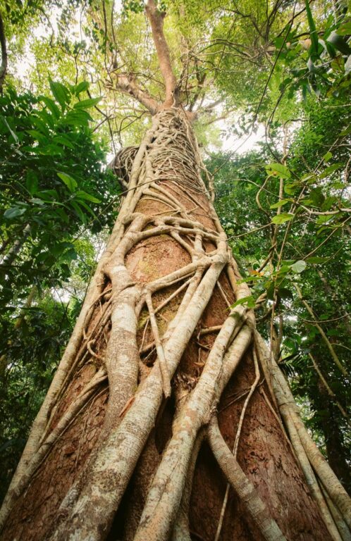
Following this viewpoint, the track levels out as you cross the saddle towards Mt William. This section was my favourite, with ancient trees towering over fields of fern and tropical shrub.

At around 700M altitude, I entered the clouds which turned everything into a wet, soggy and muddy battle to the summit. To tell you the truth, I've never seen so many leeches in my life. Even after dousing my legs and shoes with Bushmans, I had to stop every 20 metres or so to peel and flick the pricks off of my legs, arms and face. Tip: bring extra deet!
Push on passed the saddle before a final, light but slippery scramble to the summit.

50+ More Cairns Bucketlist Items
- Visit the Cairns Islands
- Kuranda Railway & Skyrail
- Rusty's Markets
- Day trip to Cape Tribulation
- ... +51 more things to do in Cairns!
Wreckage Site of the 1986 Cairns Plane Crash
Since there wasn't much information online about the Mt Williams hike, I was worried I wouldn't be able to find the wreckage amid the dense vegetation. However, before I even knew I was at the summit, I stumbled upon the wrecked fuselage and memorial plaque.

According to the Bureau of Aircraft Accidents, the plane: PA-31-310 Navajo went down in 1986 due to a fatal miscalculation by the pilot, where following some apparent miscommunications regarding flight routes, was flying too low in the cloudy conditions towards Biboohra. Apparently, the aircraft crashed just 250 metres south-west of the summit. It seems that the fuselage and wreckage remains have been moved to the top of Mt William for the purpose of the memorial site.
I decided I wasn't going to stick around for too long as the leeches were still giving me grief. I paid my respects and quickly headed back down to drier ground.
The Descent
The Mt William hike is an out-and-back trail, which means you'll need to turn around and follow the same route back down. However, once you rejoin the Smiths Track, it is possible to take a left at the fork and continue onto Speewah.
That being said, after the heavy, wet slog, I was pretty keen on finishing up for the day. I got in my car and headed straight for Stoney Creek Falls to take a dip and clean the mud and remaining leeches off my body.
More Hikes in Cairns
I hope that you enjoyed this guide to the Mt William hike in Cairns, Queensland. I've spent several months exploring the best adventures, hikes and waterfalls in the area. So, whether you're a Cairns local or visitor looking for more epic adventures, make sure to check out some of my other guides and blogs below.
For some quick ideas, check out this list of the best waterfalls in Cairns, or this post to the best things to do in Cairns.
Also, if you have any questions or even trail updates, make sure to leave a comment below to help other hikers out!