Wallaman Falls Queensland, located in the World Heritage-listed Wet Tropics Area of FNQ, is Australia’s tallest, permanent, single-drop waterfall. Read this complete guide to visiting Wallaman Waterfall and get information on the Wallaman Falls hike to the base via the Djyinda Track.
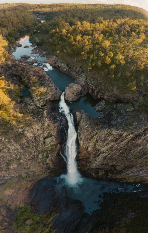
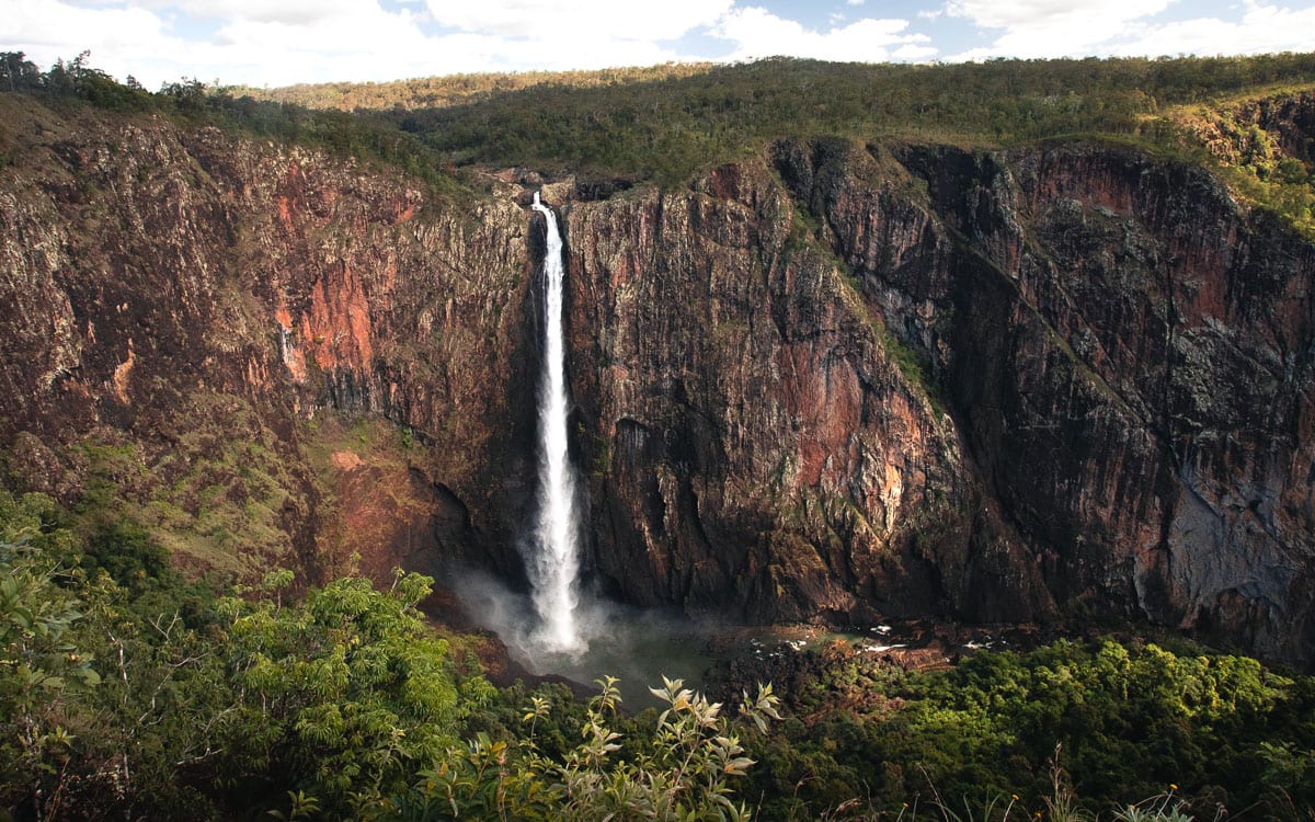
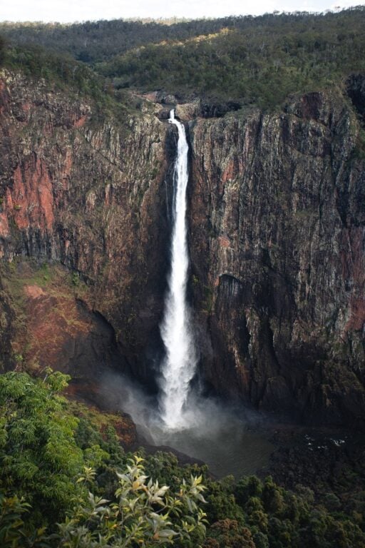
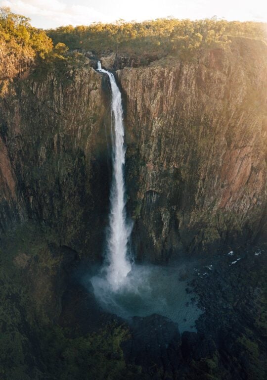
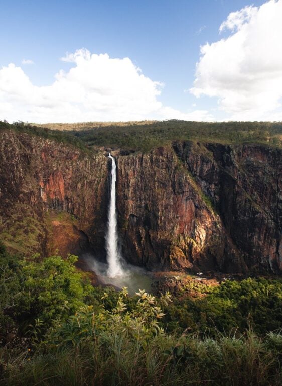
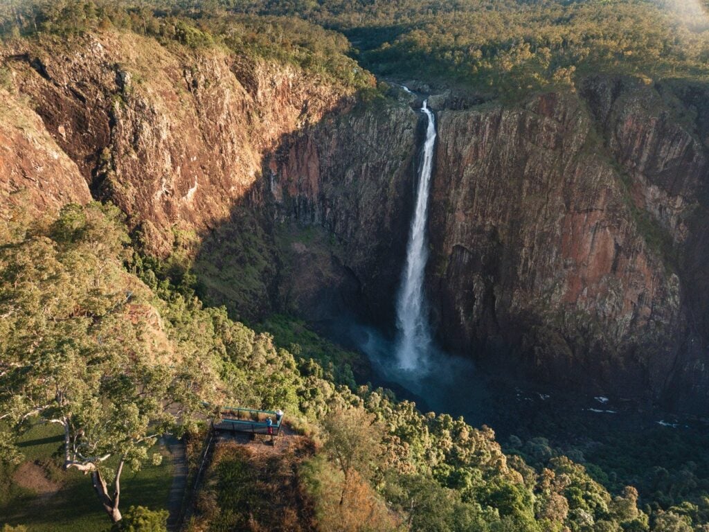
Wallaman Falls, the tallest waterfall in Australia, is located deep in the incredibly diverse Girringun National Park. The waterfall itself plunges down a sheer cliff into a deep pool at the base of the rainforest canyon.
- About Wallaman Falls and the Girringun National Park
- Visiting Girringun National Park
- How to Get to Wallaman Falls
- Detailed Directions To Wallamans Falls
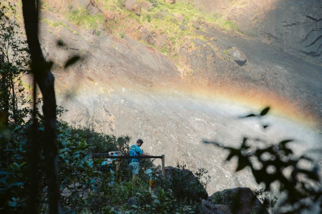
- Wallaman Falls Lookout
- The Wallaman Falls Hike – The Djyinda Track
- Swimming at Wallaman Falls
- Camping Near Wallamans Waterfall in Far North Queensland
- More Waterfalls and Adventures In Tropical North Queensland
- More Photos of Wallaman Falls Queensland
Wallaman Falls has been on my radar for a while now. After having explored most of the waterfalls around Cairns, Haylea and I were really keen to check out Australia's tallest waterfall! In fact, we were so excited that we departed on the 4-hour car trip from Cairns just to check it out.
In this blog post, I'll detail pretty much everything you'll need to visit Wallaman Falls. I'll also hope to answer all of the questions you might have about the waterfall and include some shots that I hope will inspire your visit.


About Wallaman Falls and the Girringun National Park
Wallaman Falls is part of the traditional lands of the Warrgamaygan Aboriginal people. 'Nginba Warrgamaygan Ngarji'.
The waterfall is in a designated section with the same name inside the Girringun National Park. This national park is part of the Wet Tropics Area, which has heritage listings under the national and world bodies.

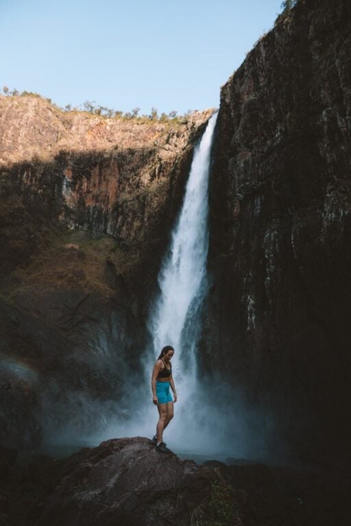
- Wallaman Falls Height: 268 metres
- Pool Depth: 20 metres
There are two viewing options for Wallaman Falls. The first is a dedicated viewing area where three platforms have been built. Here, you'll get great views of the waterfall from above, as well as the steep rainforest canopy and surrounding cliffs.
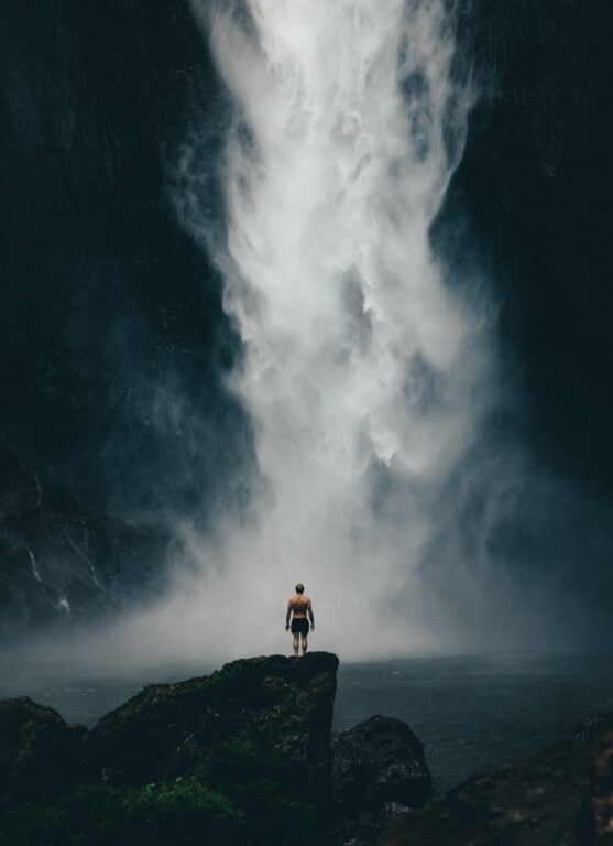
The second viewing option is from below the waterfall itself. You'll reach this by taking the Djyinda Track (more on this below).

Visiting Girringun National Park
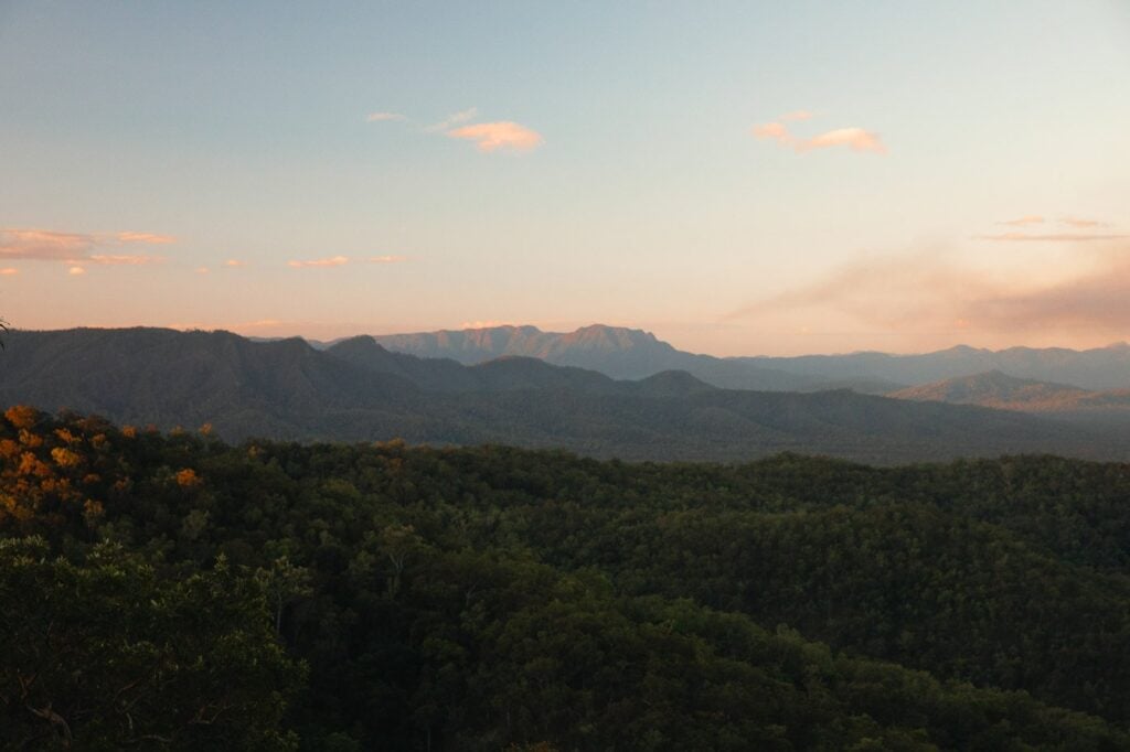
The Wallaman section of the park has deep gorges below vast plateaus. These flat, forest-covered plains fall steeply down sheer cliffs creating some pretty dramatic scenes.
I'm not sure what it was about this national park for me. But, I really felt like it was a great representation of "Australia". I think this is due to the diversity of plants here. The flora ranges from dense, tropical rainforest to sparse eucalypt forests as you make your way down the canyon.
Also, many uniquely Australian animals call the Wallaman section of the Girringun home. These include platypi, water dragons, rat kangaroos, cassowaries and turtles.

How to Get to Wallaman Falls
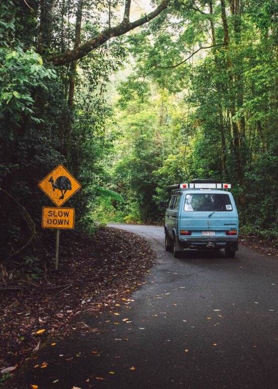
To get to Wallaman Falls, you are going to need a vehicle. The roads here are well-maintained and newly sealed for the entire stretch, so a regular sedan or hatchback will suffice. However, due to the relative remoteness of the falls, it requires a bit of a stretch to get here.
Tip: If you want some great photos of the waterfall, aim to get here by 3:30 pm. The setting sun falls quickly behind the canyon, blocking the light from hitting half of the waterfall.

Car Rentals in Far North Queensland
Cairns is one of the most popular travel destinations in Australia and car rentals quickly book out! I recommend booking well in advance. I always use RentalCars.com as they compare the widest range of rentals across dealerships in the Far North.
Detailed Directions To Wallamans Falls
The best advice is to head towards the small rural town of "Ingham" which is located approximately 235 KM south of Cairns and about 112 km north of Townsville. Ingham is a highway town on the Bruce Highway, so getting here is easy.
From Ingham, there are signs in town pointing the way to "Wallaman Falls - Australia's Tallest Waterfall". These lead you to Trebonne Road, just off the T-intersection at the centre of town.
Follow the signs to Wallaman Falls, continuing straight to Trebonne, then take the first right after crossing the creek. Continue on this road until you reach Venables Crossing (there's a waterfall sign here), then take a left on Lannercrost Exit Road and then a right on Wallaman Falls Road.
Wallaman Falls Road is 37 km long and gently climbs the rainforest hills of Lannercost State Forest and eventually into Girringun National Park. Again, the road is sealed. However, the first section of the road before the climb passes cattle land with loads of cows commonly blocking the road, so take it easy.
There are a few lookouts that you can park at on the way up to Wallaman Falls, if you've got the time, I recommend the stop.
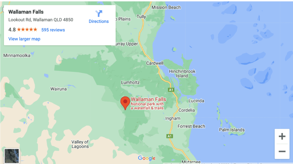
- Google Maps Pin: "Wallaman Falls"
Eventually, you'll arrive at a bend with a sign to "Lookout Road", leading to the well-established Wallaman Falls car park (pinned below). There is plenty of parking here and even a toilet. Instead, if you continue straight past Lookout Road for a few hundred metres, you'll arrive at Wallaman Falls campsite.

Wallaman Falls Lookout
After arriving at Wallaman Falls car park, you really can't miss the lookout. This is a small, grassy cleared area with three boardwalk-style viewing platforms stretching out over the canyon.
For a comprehensive view of Wallamans Falls and the National Park, this is as good as it gets. However, in my opinion, taking the short but rewarding hike down to the base of the falls is definitely worth it. Besides, you've come all this way to see it!


#1 Water Bottle Filter
Enter the Grayl GeoPress Water Filter & Purifier Bottle! I take this bottle on every hike and use it as my go-to source for filtering water all over the world. I've even used it to drink tap water in India!
// Compare how the GeoPress stacks up against the best water bottle filters on the market.
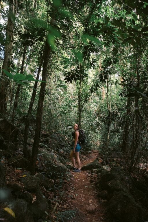
The Wallaman Falls Hike - The Djyinda Track
- Hike Distance: 1.6 im (3.2 km return)
- Duration: 1-2 hours
- Elevation: 270 m elevation gain (on the walk back up)
- Difficulty: Moderate (steep)
The Djyinda Track (pronounced 'Yin-Da') is the name given to the graded walking track down to the base of Wallaman Falls from the Wallaman Falls lookout. It's a relatively short track, yet steep in some sections. I'd say anyone with relatively good fitness will have absolutely no trouble with it. Though, since it's a fairly short walk, even those that usually struggle with steep climbs should just take their time and bring water.
The track begins as a sealed path before giving way to rocky and rooty, rainforest undergrowth. The Djyinda track snakes its way down the steep canyon through dense forest. You'll notice that the further you make your way down, the wetter it gets, with thick moss growing on rocks and tree trunks.

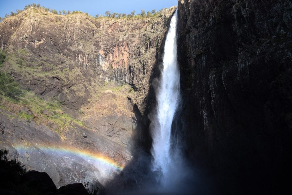
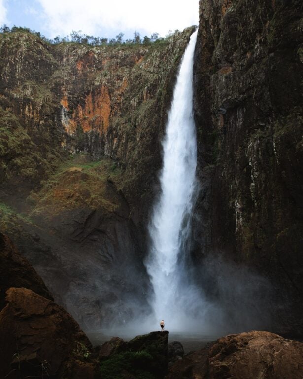
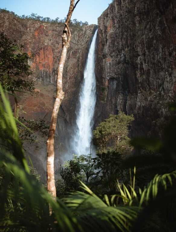
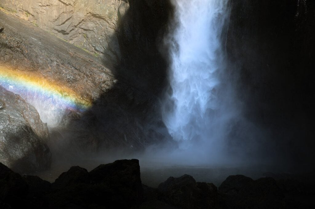
You won't have a view of Wallaman Falls until right at the end of the Djyinda Track. There is a fenced-off viewing platform at the end of the track. Here, you'll get great views of the Aussie colossal pounding into the deep pool, casting a shroud of rainbow vapour into the air.


50+ More Cairns Bucketlist Items
- Visit the Cairns Islands
- Kuranda Railway & Skyrail
- Rusty's Markets
- Day trip to Cape Tribulation
- ... +51 more things to do in Cairns!
Swimming at Wallaman Falls
It is possible to swim at Wallaman Falls if you're a strong swimmer.
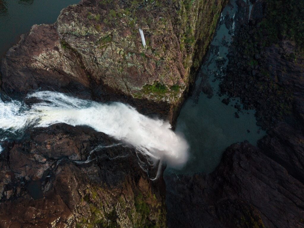
The pool is 20 metres deep and fairly wide. Furthermore, the creek flows gently out of the pool in normal conditions, so there is little risk (this can definitely change following downpours). Though, I certainly wouldn't want to swim too close to it. However, the force of the 268-metre giant is probably enough to push you back to the edges of the pool quite quickly.
Getting to the waterfall pool requires a bit of slippery rock scrambling. Don't underestimate just how slippery the rocks are!

Don't Miss: Dunk Island (Mission Beach)
Camping Near Wallamans Waterfall in Far North Queensland
There is a designated campsite just a few hundred metres further down Wallaman Falls Road, past the Lookout Road. Again, you can get here with a regular 2WD vehicle.
Unfortunately, Caravans aren't permitted as it's a tent-only site. A camping permit is required to stay here. You can find all the information about the Wallaman Falls campsite on the QLD Parks website.
More Waterfalls and Adventures In Tropical North Queensland
I hope that you enjoyed this complete guide to visiting Australia's largest waterfall; Wallaman Falls Queensland. If you have any questions or any updates or suggestions to improve this blog post, please let me know!
Otherwise, why not check out some more adventure travel guides for Far North Queensland? Below I've listed a few of my favourite adventures for those travelling in the region.
Enjoy!
More Photos of Wallaman Falls Queensland