
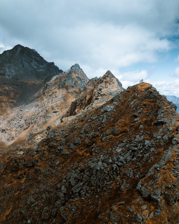
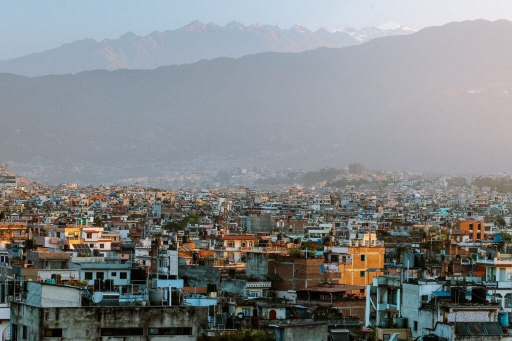
Everything you need to know about climbing Mera Peak, Nepal (6476 m). Includes several trekking itineraries & a detailed day-by-day breakdown of my experience on the climb.
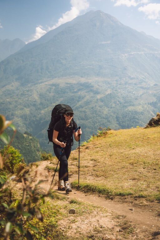
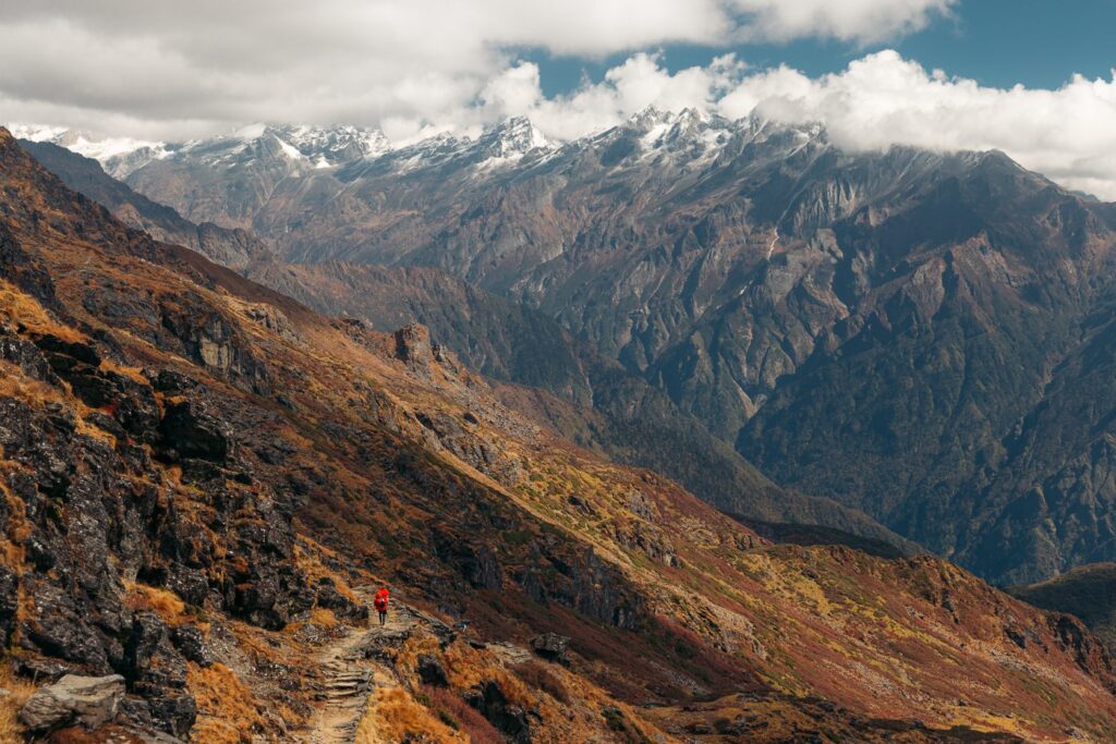
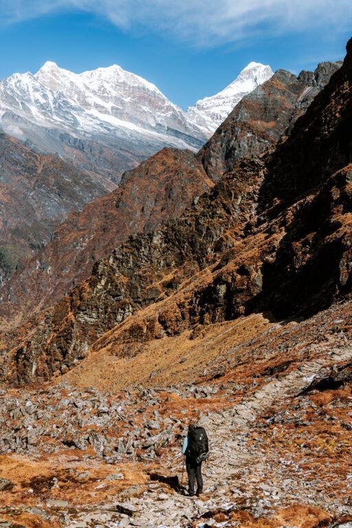
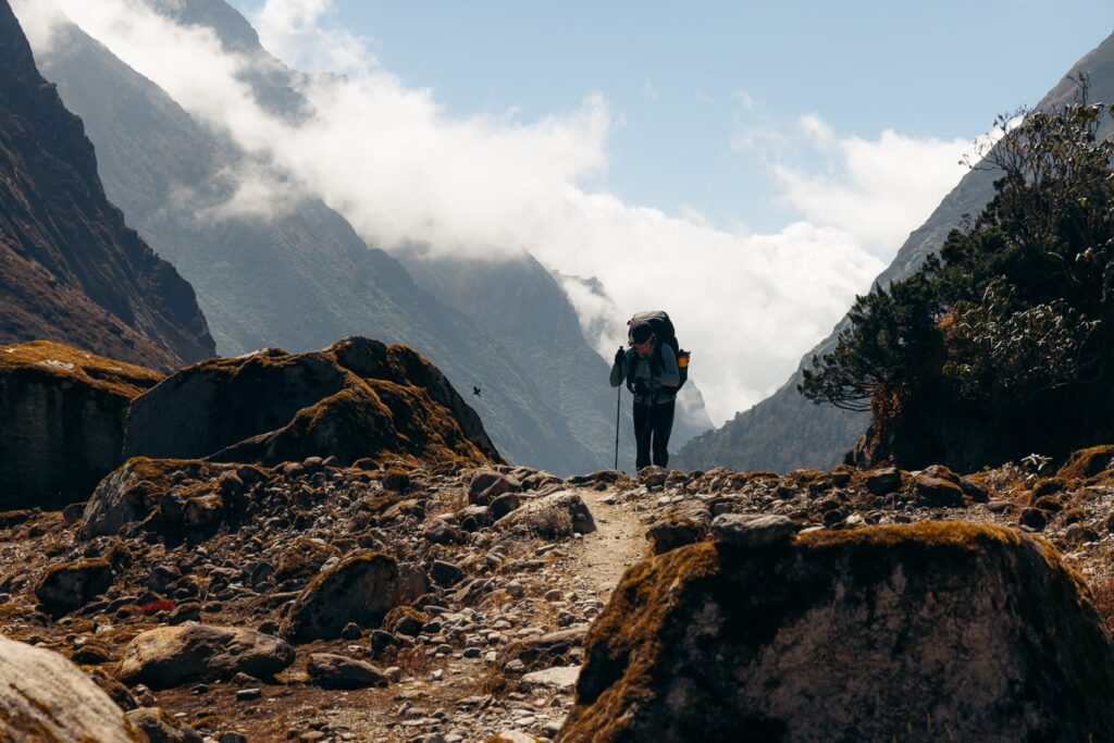
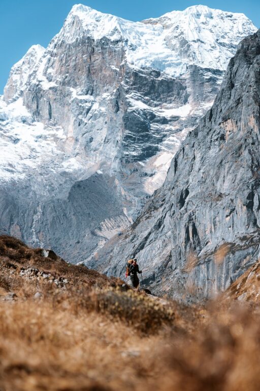
Many hikers are drawn to this remote part of the Khumbu Himalayas every season for a chance to stand on top of Nepal’s highest trekking peak at 6476 meters (21,247 ft).
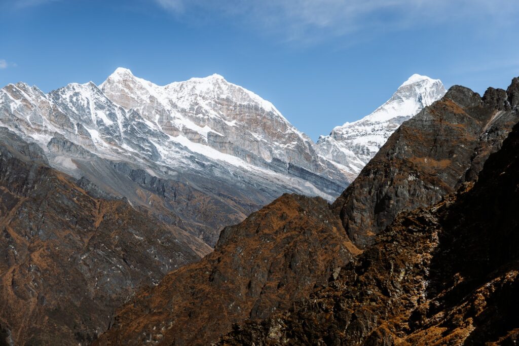
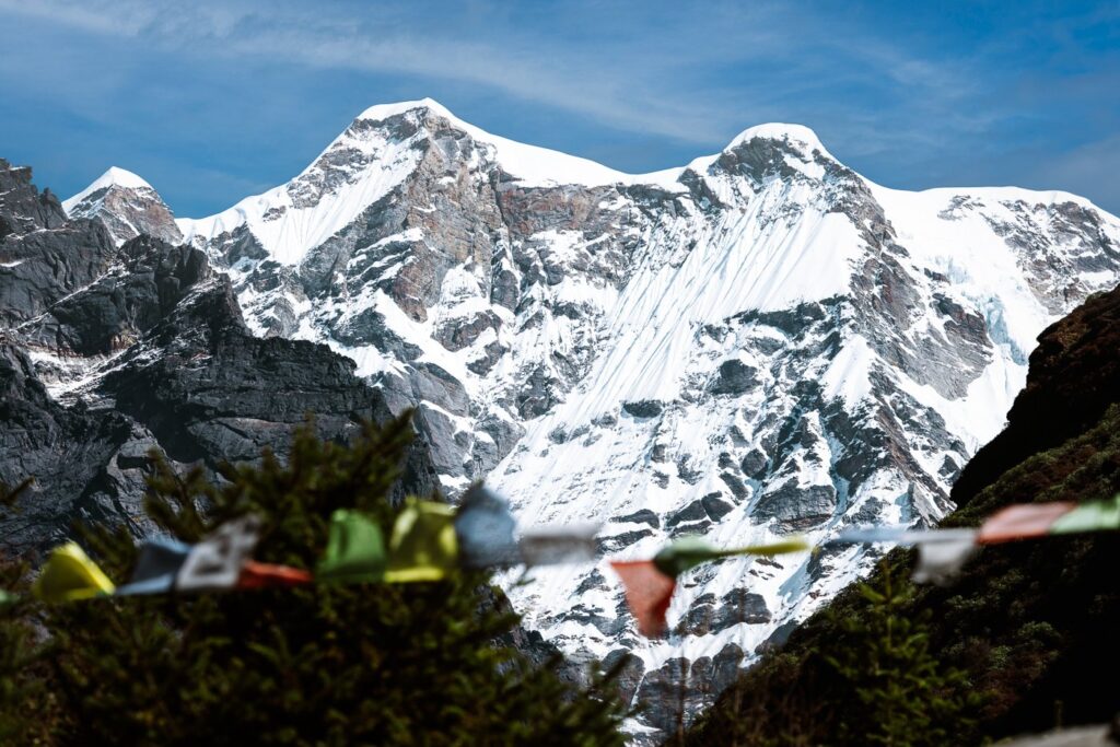
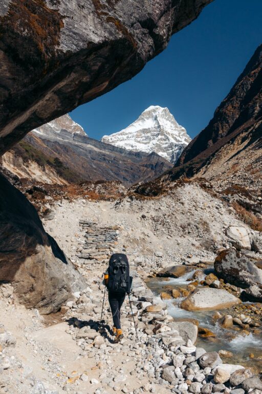
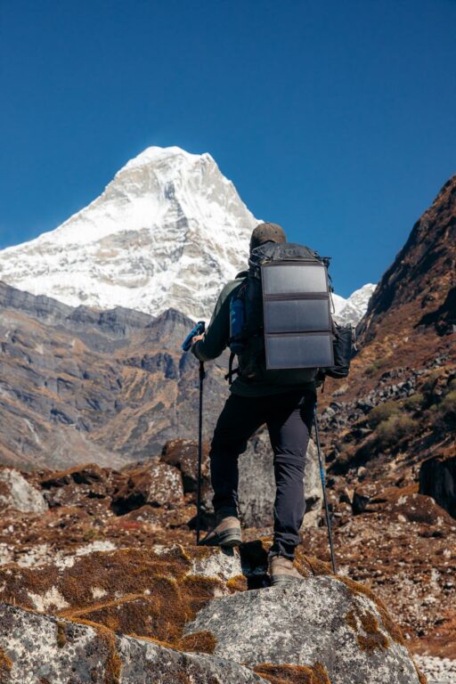
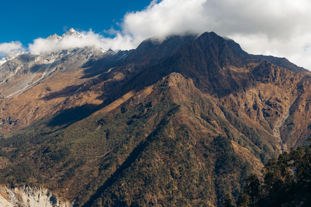
Mera Peak offers the perfect introduction to Himalayan high-altitude expeditions as it requires very little technical experience while providing exposure to glacial traverses, expedition camps, and of course, high altitude. At the Mera Peak summit and during the ascent, climbers are rewarded with incredible Himalayan views, including five of the world’s 8000-meter peaks in the Everest region and beyond; Lhotse (8516 m), Cho Oyu (8188 m), Kangchenjunga (8586 m), Makalu (8481 m), and Mount Everest (8848 m).

In this detailed guide, I’ll break down everything you need to know about trekking to and climbing Mera Peak (Mount Mera) from Kathmandu. I’ve included several itinerary options, tips on booking a guide, a packing list, and a personal day-by-day breakdown of our ascent with photos so you’ll know what to expect.
- About Mera Peak
- Itinerary Options to Khare (Mera Peak Base Camp)
- Booking a Guide for the Mera Peak Climb
- Facilities on the Mera Peak Trek
- My Day-By-Day Experience Climbing Mera Peak
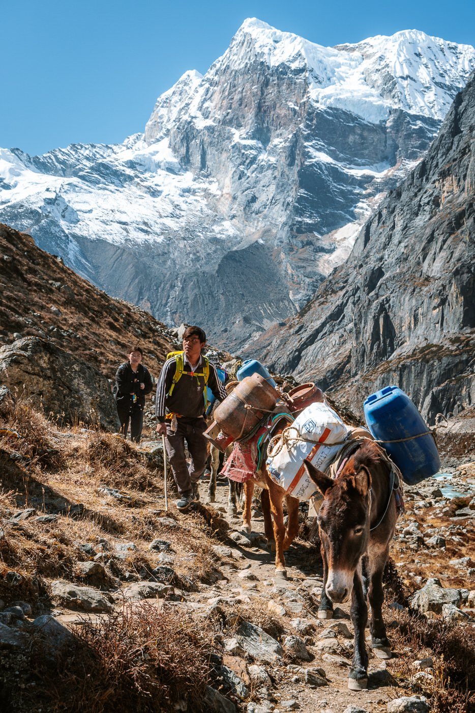
- Day 1: Jeep Journey from Kathmandu to Bung Mahakulung (1700 m)
- Day 2: Trek From Bung Mahakulung to Khiraule Gompa (2400 m)
- Day 3: Trek From Khiraule Gompa to Cholem (3450 m)
- Day 4: Rest Day at Cholem (3450 m)
- Day 5: Trek from Cholem to Panch Pokhari (4300 M)
- Day 6: Trek from Panch Pokhari to Kothe (3600 M)
- Day 7: Rest Day in Kothe (3600 M)
- Day 8: Trek from Kothe to Thangnag (4350 M)
- Day 9: Trek from Thangnag to Khare (4900 M)
- Day 10: Acclimatization Day – Hike & Training in Khare (4900 M)
- Day 11: Trek From Khare to Mera Peak High Camp (5800 M)
- Day 12: Mera Peak Summit (6476 M) to Khare (4900 M)
- Day 13: Trek From Khare to Kothe (3600 M)
- Day 14: Trek from Kothe to Thuli Kharka (4230 M)
- Day 15: Trek from Thuli Kharka to Lukla (2800 M) Via Zatrwa La (4610 M)
- Day 16: Fly to Ramechhap & MiniBus to Kathmandu
- Options to Continue on from Mera Peak (Mera Peak to Island Peak or Baruntse)
- Where to Stay in Kathmandu (Thamel) Before & After The Climb
- FAQs About Climbing Mera Peak
- More Himalayan Trekking & Climbing Posts


About Mera Peak
The Mera Massif is located in the Kumbu Region of the Nepal Himalaya and contains three summits. These are Mera North (6476 m), Mera Central (6461 m), and Mera South, (6065 m).
- Mera Peak Height: 6476 meters
- Duration: 14-18 days
- Difficulty: Relatively easy
- Climbing Season: April - May & September - November
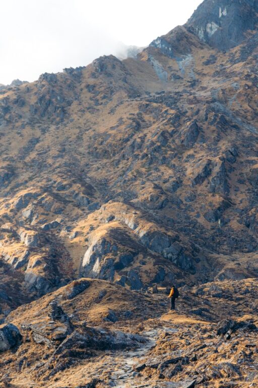
The standard trekking route to the summit begins at the nearby village of Khare and involves high-altitude glacier walking. This is usually covered in 2 or 3 days, opting to stay at Base Camp (5200 m) and Mera High Camp (5800 m), or directly from Khare to High Camp (what we did).
While crampons are required for the glacial traverse, an ice axe is optional and would only be useful for emergency self-arrest as the route to the summit is simply a long, steep walk on hard snow and ice. This means no crevasse crossings, rock or ice climbing, nor the need for fixed ropes or jumaring. In alpinism, this peak has an Alpine Grade F (Facile, or Easy).


Being an easy 6000er with incredible views makes it a popular peak during the main climbing seasons of Spring (April-May) and Autumn (September-November). Expect several expedition teams with a group size of 2-10 people to attempt the summit every day during these periods. Weather conditions in late Autumn are apparently much better, with less wind and cloud cover than in Spring. While this is the best time to climb, expect a very cold summit day.
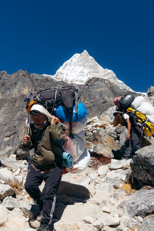
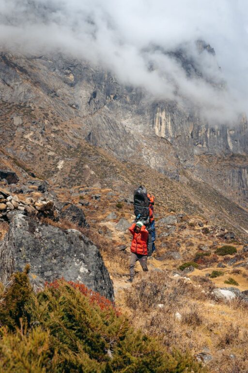
There are many expedition companies running programs to Mera Peak from Kathmandu via various trekking routes. Alternatively, it's also possible to trek to Khare independently and hire a guide at Khare (what we did). These routes usually take 7-10 days to reach Khare via Lukla or Bung Mahakulung. Below I'll go into more detail about trekking itinerary options to Khare.

Insurance for Trekking & Climbing in Nepal
Read the fine print– Most travel insurance companies void coverage as soon as you step over 5000 m. That's why I use and recommend Global Rescue, which offers yearly or expedition-based rescue coverage with no altitude caps.

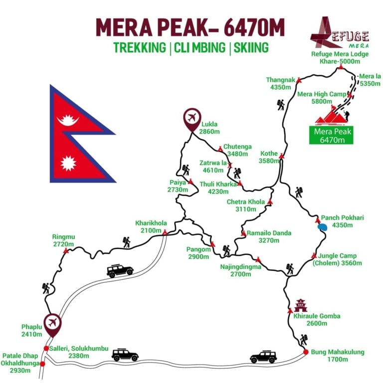
Itinerary Options to Khare (Mera Peak Base Camp)
There are three main trekking routes to reach Khare where you will begin the climb to Mera Peak. After the summit day, the best and quickest way to get back to Kathmandu is to trek to Lukla via the Zatrwa La.
The most popular itineraries to Khare include:
- Lukla to Khare via Paiya & Chutok La
- Lukla to Khare via Zatrwa La
- Bung Mahakulung to Khare
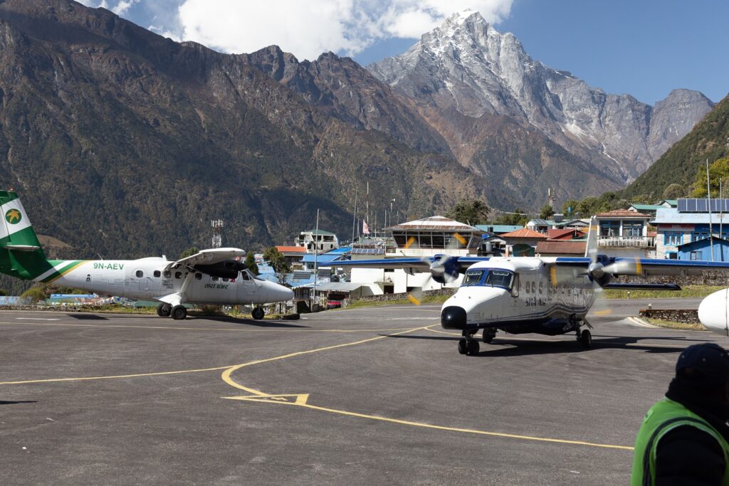
The majority of expedition companies and tour operators begin their Mera Peak programs by flying their clients from Kathmandu to Lukla (or now from Ramechhap as KTM-Lukla flights are halted).
However, if you're looking to trek to Khare independently, I highly recommend starting at Bung Mahakulung as we did. This is not the normal route but has a better acclimatization profile and passes through some beautiful small villages in the lower Himalayas. Here, locals are always happy and surprised to see trekking tourists. The track is also very easy to follow and superbly maintained. Additionally, you'll pass the beautiful alpine lakes of Panch Pokhari on the way and save some money as you will only need to purchase one Lukla flight (on the way down).
If you intend to hike to Khare from Lukla, then it's a good idea to take the longer Hinku Valley option via Paiya, Pangom, and Ramailo Danda. This is because flying to Lukla and trekking over the Zatrwa La in the first two days requires some serious elevation gain and is likely unsafe for anybody not acclimatized.
Below is a useful Mera Peak map showing the main trekking routes in this region with altitudes for each village. I've also included three sample itineraries below to help you plan your trip. Note that I've added one rest day into some of these. However, when planning make sure to add at least one extra day (contingency day) in case of bad weather.
Don't miss: Guide to Picking Trekking Travel Insurance (no altitude caps)

Lukla is a village with the only airport in the Solo Khumbu region (Tenzing-Hillary Airport). This is also the main starting point for some of the most popular treks in Nepal, including the Everest Base Camp Trek and the Three Passes Trek. Trekkers can purchase their Lukla flight in advance (best at least a week before) through Yeti Airlines (Tara Air), Summit Air, or Sita Air.
1. Lukla to Khare via Pangom
- Day 1: Fly to Lukla from Kathmandu (or minivan to Ramechhap then fly to Lukla) & trek to Paiya (2730 m) via Chutok La (2945 m)
- Day 2: Trek to Pangom (2900 m)
- Day 3: Trek to Ramailo Danda (3270 m)
- Day 4: Trek to Chetrwa Khola (3110 m)
- Day 5: Trek to Kothe (3580 m)
- Day 6: Rest day in Kothe (3600 m)
- Day 7: Trek to Thangnag (4350 m)
- Day 8: Trek to Khare (4900 m)
- Day 9: Acclimatization & training at Khare (4900 m)
- Day 10: Khare to Mera Peak High Camp (5800 m)
- Day 11: Summit Mera Peak (6476 m) and return to Khare (4900 m)
- Day 12: Trek to Kothe (3600 m)
- Day 13: Trek to Thuli Kharka (4230 m)
- Day 14: Trek to Lukla (2800 m) via Zatrwa La (4610 m)
- Day 15: Fly to Kathmandu (or via Ramechhap)

2. Lukla to Khare via the Zatrwa La
- Day 1: Fly to Lukla from Kathmandu (or minivan to Ramechhap then fly to Lukla) & trek to Chutenga (3480 m)
- Day 2: Trek to Thuli Kharka (4230 m) via Zatrwa La
- Day 3: Trek to Kothe (3600 m)
- Day 4: Rest day in Kothe (3600 m)
- Day 5: Trek to Thangnag (4350 m)
- Day 6: Trek to Khare (4900m)
- Day 7: Acclimatization & training at Khare (4900 m)
- Day 8: Khare to Mera Peak High Camp (5800 m)
- Day 9: Summit Mera Peak (6476 m) and return to Khare (4900 m)
- Day 10: Trek to Kothe (3600 m)
- Day 11: Trek to Thuli Kharka (4230 m)
- Day 12: Trek to Lukla (2800 m) via Zatrwa La (4610 m)
- Day 13: Fly to Kathmandu (or via Ramechhap

3. Bung Mahakulung to Khare
- Day 1: Jeep from Kathmandu to Bung Mahakulung (1700 m)
- Day 2: Trek to Khiraule Gompa (2600 m)
- Day 3: Trek to Cholem (3560 m)
- Day 4: Trek to Panch Pokhari (4350 m)
- Day 5: Trek to Kothe (3600 m)
- Day 6: Trek to Thangnag (4350 m)
- Day 7: Trek to Khare (4900 m)
- Day 8: Acclimatization & training at Khare (4900 m)
- Day 9: Khare to Mera Peak High Camp (5800 m)
- Day 10: Summit Mera Peak (6476 m) and return to Khare (4900 m)
- Day 11: Trek to Kothe (3600 m)
- Day 12: Trek to Thuli Kharka (4230 m)
- Day 13: Trek to Lukla (2800 m) via Zatrwa La (4610 m)
- Day 14: Fly to Kathmandu (or via Ramechhap)

Booking a Guide for the Mera Peak Climb
Climbing Mera Peak requires a guide from Khare as it is a mandatory part of getting a climbing permit from the Nepal Mountaineering Association (NMA). Furthermore, applying for this permit is difficult to do on your own unless you have a contact with an expedition agency in Nepal.
Luckily, it is possible to book a Sherpa guide from Khare, who can also arrange your permit. This means you can easily complete the trek to Khare (at the base of Mera Peak) independently and stay in tea houses along the way without any issues.
We planned our entire trek and climb with Refuge Lodge, the largest and best lodge in Khare. This is a small family-run business and the first family to offer guided Mera Peak climbing.
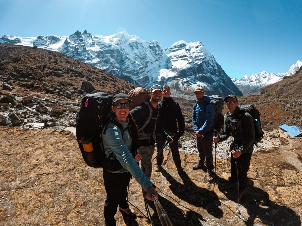
While we trekked to Khare on our own, Jangbu Sherpa from Refuge Lodge (he lives in Kathmandu) organized everything for us in person, including:
- Jeep ride from Kathmandu to Bung Mahakulung
- Mera Peak climbing permit
- Mera Peak High Camp - tents, mattress, pillows, camp cook, meals and tea, emergency oxygen
- Staff and Sherpa Insurance - mandatory for the NMA permit
- Included gear rental (once we reached Khare)
- Sherpa guide (from Khare)
- Free lodging at Refuge Lodge
He also went over our plan and gave us a better-recommended itinerary from Bung Mahakulung to Khare with the help of the above map. The cost for all of this was $450 USD, plus an additional 4000 Nepali rupees (shared between 5) for the jeep ride from Kathmandu to Bung Mahakulung. We were able to pay via bank transfer in Kathmandu before departing.
Alternatively, trekkers who would prefer to pay for a Kathmandu to Kathmandu expedition to Mera Peak will have dozens of trekking companies to choose from. Note that the price is obviously going to be much higher than simply booking a guide from Khare.

Mera Peak Expedition Cost
After contacting several expeditions and climbing companies prior to departing, I can confirm that the price for an all-inclusive Mera Peak expedition from Kathmandu to Kathmandu costs between $1800-$4735 USD depending on the company.
Conversely, here's my cost breakdown for trekking independently from Bung Mahakulung to Khare and returning to Kathmandu via Lukla over a 16-day trip. I recorded the costs and listed the average in the daily cost column.
| Item | Daily costs (USD) | Total Cost (USD) |
|---|---|---|
| Mera Peak climbing package from Refuge Lodge (Khare) | N/A | $450 |
| Jeep from Kathmandu to Bung Mahakulung | N/A | $311/5 pax = $62.20 |
| Flight from Lukla to Ramechhap | N/A | $151 |
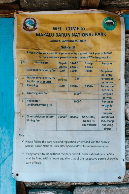
| Makalu-Barun National Park Permit (2000 rupees)** | N/A | $15.59 |
| Minivan from Ramechhap to Kathmandu | N/A | $15.59 |
| Tea house accommodation on the trek to Khare | $3.90 | $11.70* |
| Food & drink (3 meals per day at tea houses) | $13.64 | $218.24 |
| Optional rental gear at Khare (down jacket, gloves) | N/A | $31.19 |
| Total cost | $955.51 |
* The cost of tea house accommodation was very low because most of them offered us free lodging if we ate our meals there.
** You will buy the National Park permit in Kothe - Nepali rupees only

Tipping guides: It is also customary to tip Sherpa guides upon a successful summit.
Facilities on the Mera Peak Trek
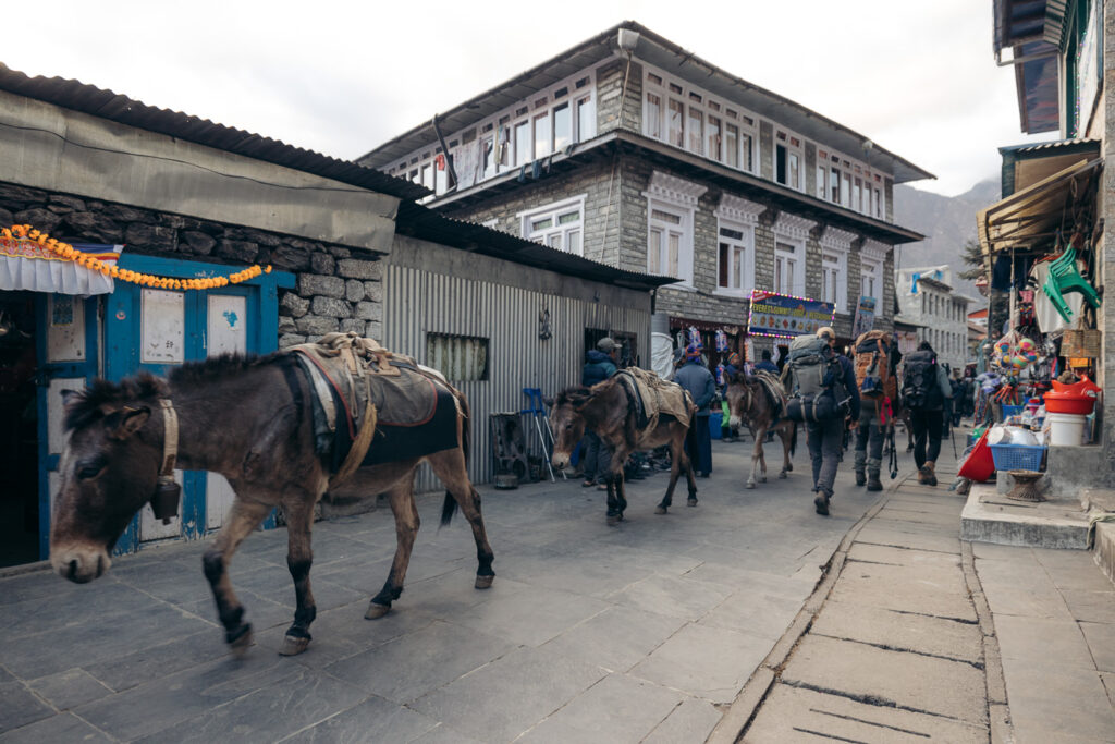
Nepal is one of the best destinations on earth for tea house trekking. However, unlike the more popular routes like the Everest Base Camp Trek or the Annapurna Circuit, the facilities in the remote regions you'll pass on the way to Mera Peak are much more limited.
You'll still have access to accommodation, hot food, simple packaged snacks, and sometimes even electricity and WiFi. However, the only villages where you can purchase equipment or clothing are Lukla and Khare.
Furthermore, Lukla is the only village with an ATM, yet they are not always working. Therefore, it's best to withdraw enough cash in Kathmandu prior to departing.
Tea House Lodging & Accommodation
On the trail, you will find small lodges and tea houses to sleep in. You do not need to book these in advance, simply show up and they will offer you a room. These are usually just large enough to fit two single beds or one double bed.
Most tea houses in the Khumbu are built from stone and rooms divided by basic plywood. You'll get a raised bed with a mattress (thickness varies greatly), and you must ask for a blanket (sometimes lodges do not have any spares). Tea houses usually have a common area that serves as a restaurant. If you're lucky, the lodge will light a fire to warm up the room.
The cost for tea house lodging on the Mera Peak routes is usually free if you eat your dinner and breakfast there. On some occasions in remote areas like Cholem and Panch Pokhari, the cost is 500 Nepali Rupees per night ($3.90 USD).
If you're trekking from Bung Mahakulung as I did, expect very basic lodging until you reach Kothe.
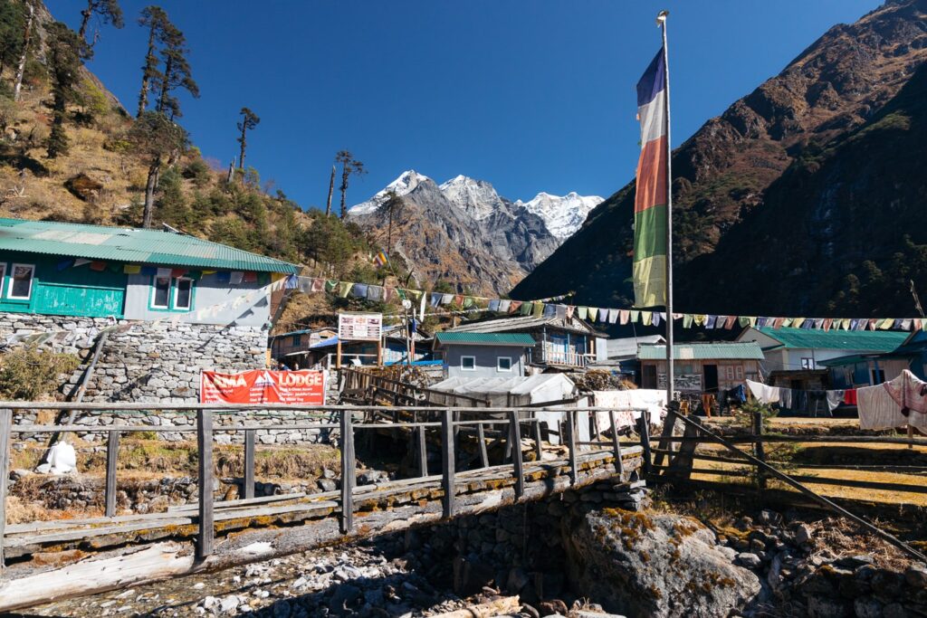
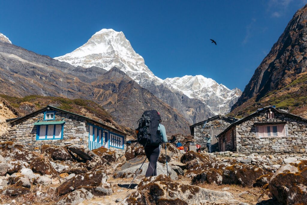
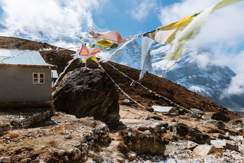
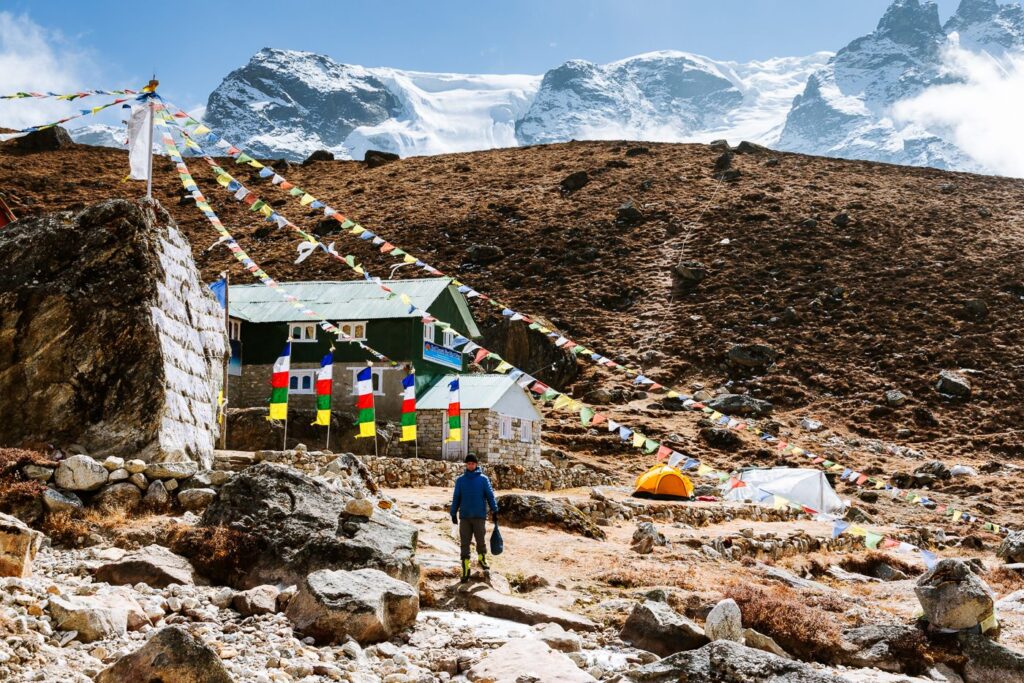
Khare, the village beneath Mera Peak, is the most developed village that I passed outside of Lukla. Here, you'll find very comfortable beds, a bakery, a large restaurant serving pizza and steak, and even an electric blanket!

Food & Snacks
Meals in the Himalayas are usually simple but always hearty. Most lodges will offer meals like fried potato and cheese, fried noodles, fried rice, and of course, dal bhat– the traditional meal of Nepal.
It is customary for hosts to offer second servings of dal bhat, which always leaves you full.
The cost of a hot, cooked meal at a tea house varies from 350 to 850 Nepali rupees ($2.70-$6.60 USD). Expect to pay upwards of 1200 rupees for exotic food like pizza and steak at the fancier lodges.
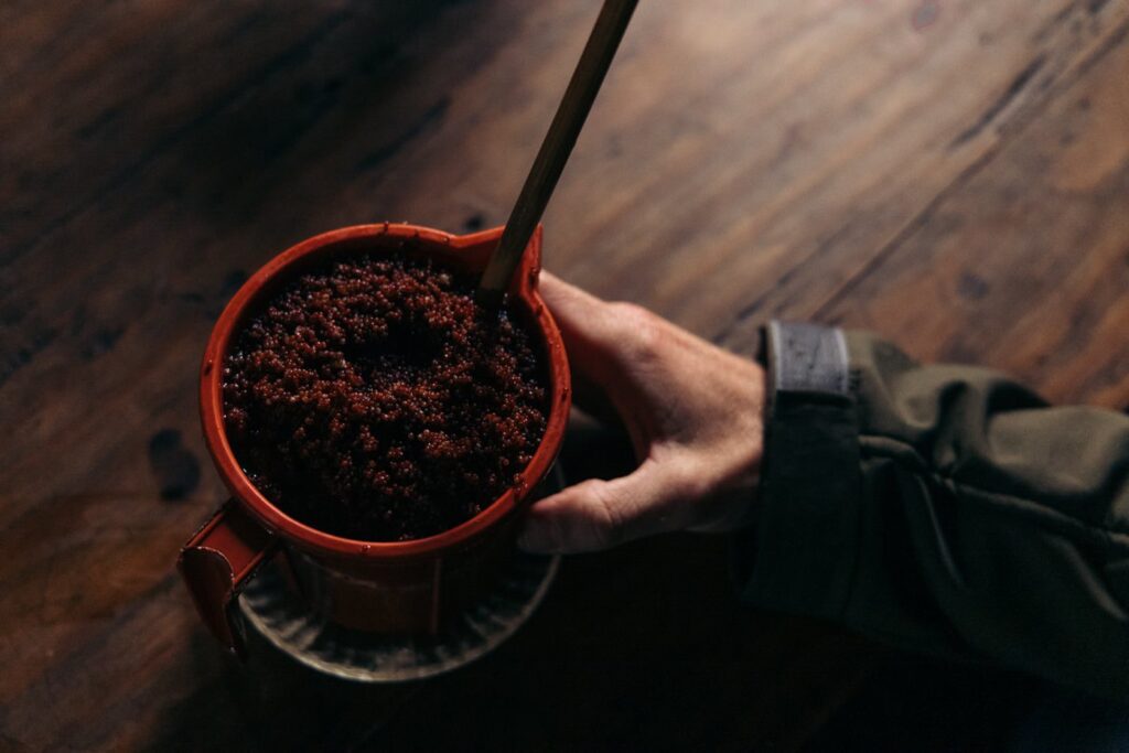
All lodges also offer a variety of different hot drinks including tea, coffee, and hot chocolate. Black tea will set you back 100 rupees ($0.80). Trekkers can also purchase packaged snacks like chocolate bars or packaged noodles at most tea houses.

Wifi & Electricity
Before you depart from Kathmandu, you can purchase a Nepal Telecom (NTC) sim card. Currently, this is the only Nepali telecommunications company offering service in this region. I had a Ncell sim and this did not work anywhere once we left Bung Mahakulung.
However, connectivity will be very limited even with NTC for the majority of the trek. You'll likely only be able to get enough coverage to get a message out every now and then.
Electricity is also very limited until you reach Kothe. From here, you'll be able to ask the lodge owners if you can charge your devices. However, the majority of these villages rely on solar and will likely charge you for the privilege.
The exception is Khare, where at Refuge Lodge they somehow have enough electricity to offer electric blankets in the rooms.
Tip: If you need to charge cameras or your phone, I recommend buying a lightweight solar panel. I used the 21W Anker Powerport which kept my camera, InReach, and kindle charged up for the whole trek.
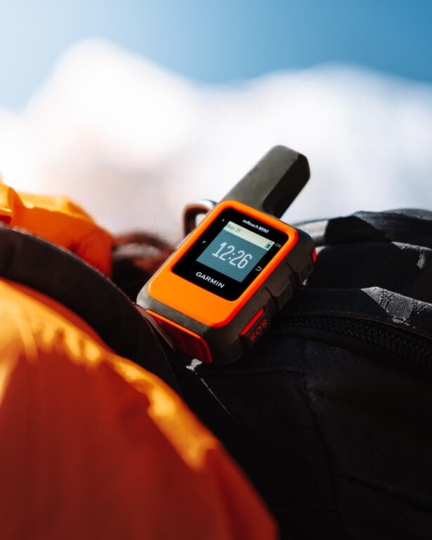

How I Stay Connected Off-Grid
I've been using the Garmin InReach Mini satellite communicator for all serious treks and expeditions since 2020. It lets me send unlimited SMS anywhere on earth and has an emergency SOS feature that could save your life.
My Day-By-Day Experience Climbing Mera Peak
With all of the logistics out of the way, here is my detailed day-to-day Mera Peak itinerary.
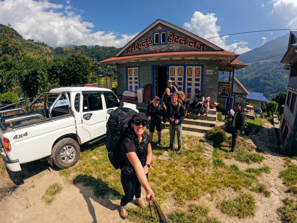
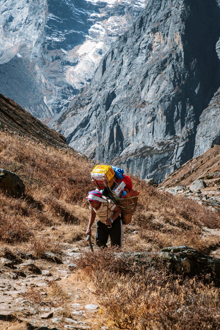
Day 1: Jeep Journey from Kathmandu to Bung Mahakulung (1700 m)
We were told the jeep ride from Kathmandu to Mahakulung would be long, bumpy, and would feature a few nail-biting sections. However, no warnings could prepare us for what was to come.
Starting at 3 am, our driver arrived at our pickup point, strapped our trekking backpacks to the roof, and hit the road.
Initially, we were skeptical about the need for such an early start. However, after seeing the conditions of some stretches of these Nepalese mountain roads, we knew it would be a long one.
The first 8 hours alternated between stretches of decent tarred road and off-road, unsealed tracks. As we climbed, the weather blessed us with clear, uninterrupted views of several Himalayan peaks.
After this time, we had officially passed the end of the documented road, and we were en route to Mahakulung via a network of local dirt tracks that would excite any 4x4 off-road fan.
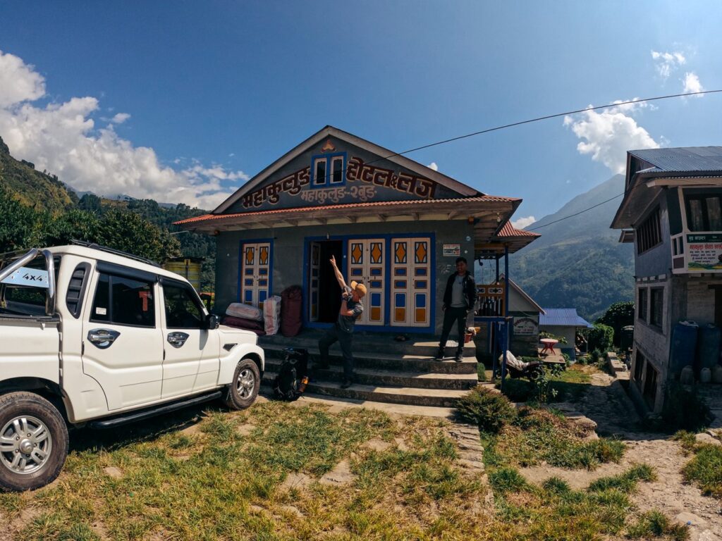
Finally, as the sun had just set, we pulled up to Bung Mahakulung, a small mountain village with a single tea house lodge. A friendly man greeted us and welcomed us to our rooms, which were very clean, comfortable, and warm.
Safe to say we had a pleasant first night’s sleep, with a belly full of dal bhat and a mind full of thoughts of the trail and summit ahead.


Day 2: Trek From Bung Mahakulung to Khiraule Gompa (2400 m)
- Duration: 2-3 hours
- Total ascent: 700 m
- Total descent: 0 m
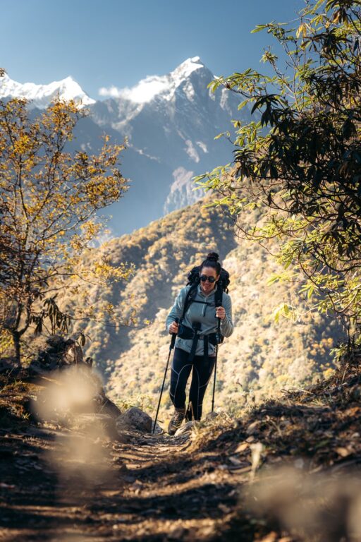
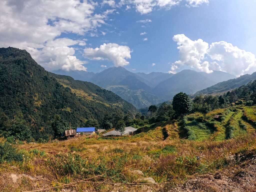
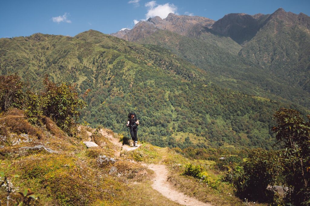
The first day of trekking would be an easy one, with just a few short kilometers climbing from 1700 m to 2400 m via a wide and gentle inclining trail, ducking in and out of the jungle.

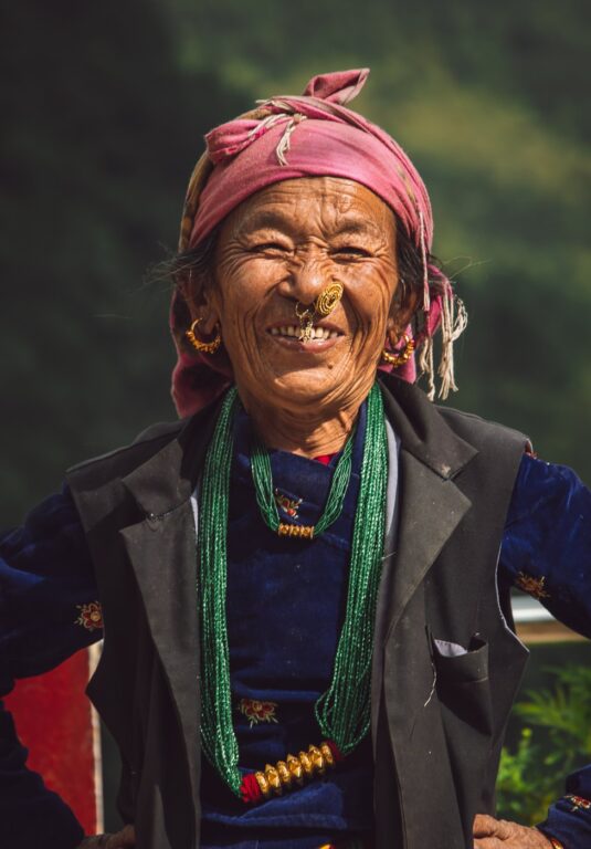
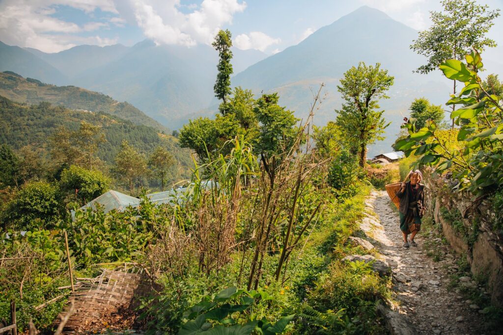
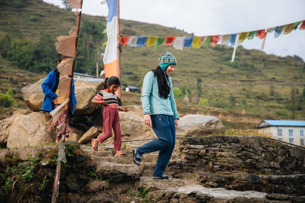
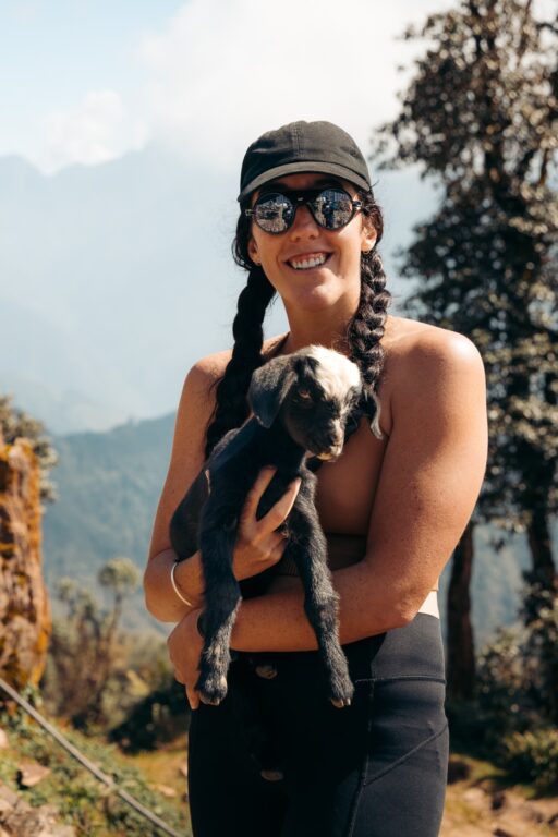
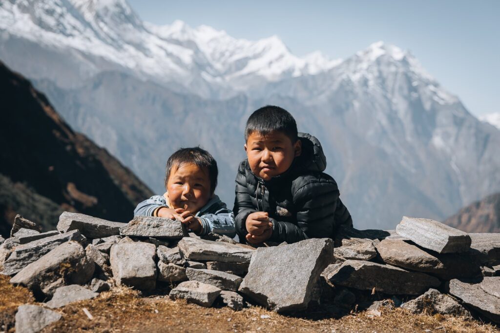
We passed several local families harvesting corn and tending to their buffalo. Each greeted us with warm smiles and a friendly, excited welcome. It was immediately clear that this was a region that not a lot of tourists had the privilege of visiting.


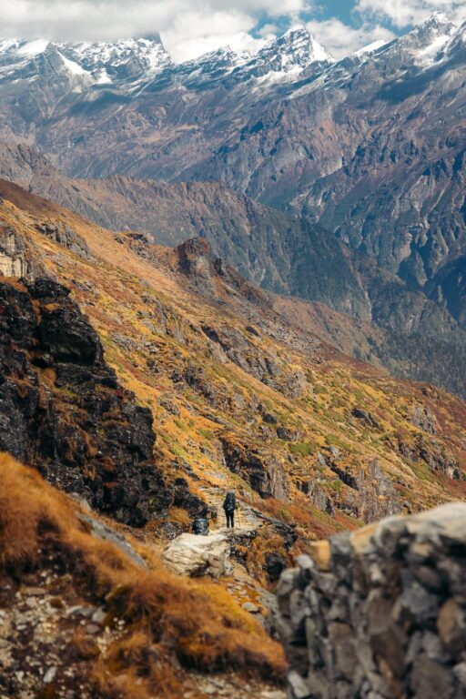
This trail was utterly beautiful and offered us magical views of the sweeping valley and the surrounding Himalayan foothills.


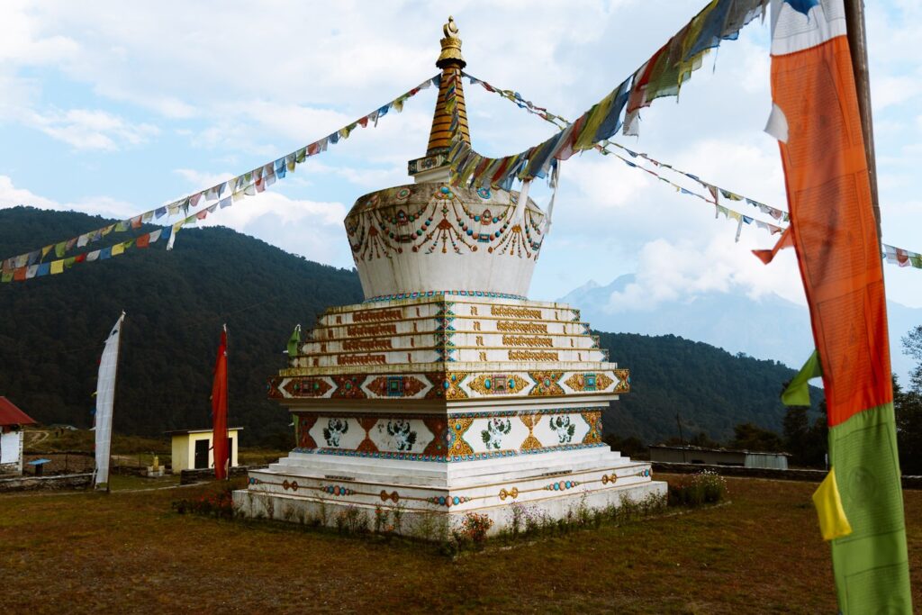
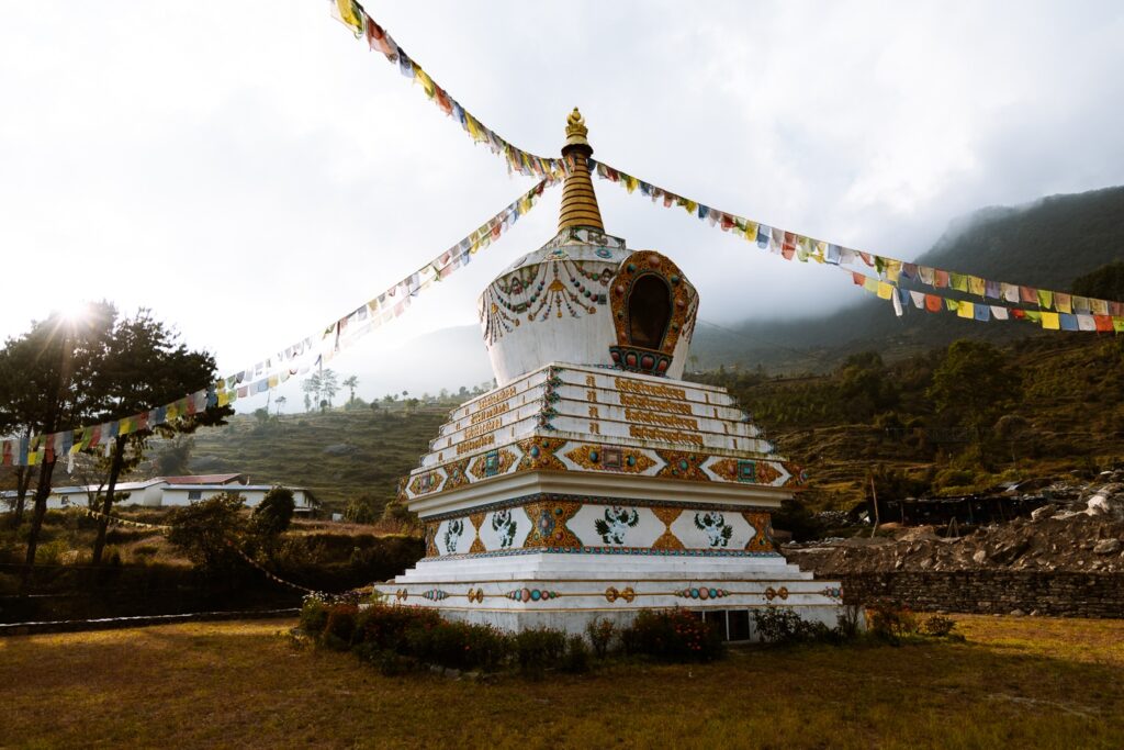
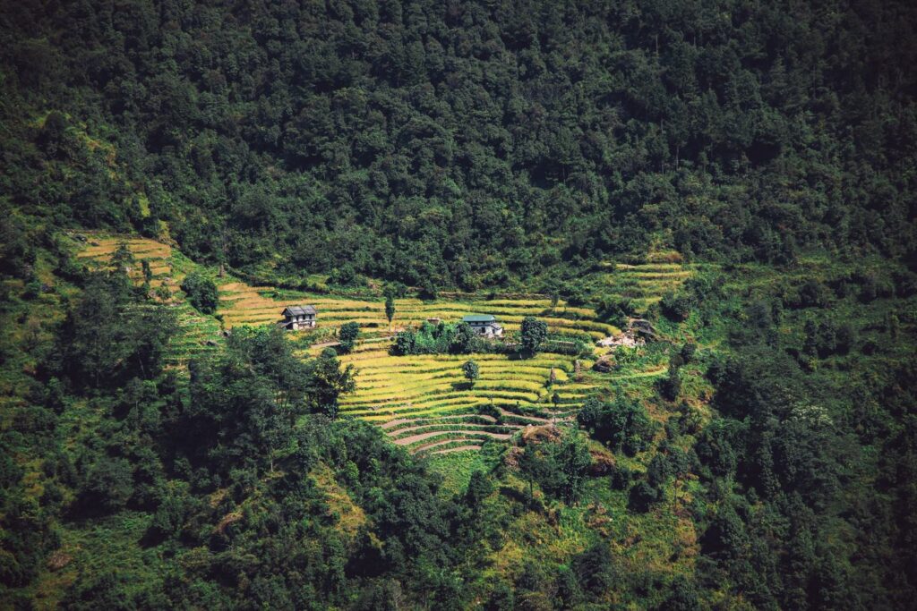
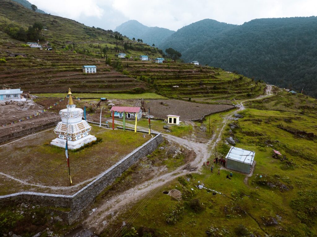
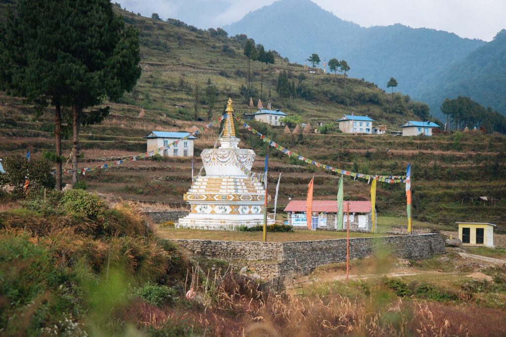
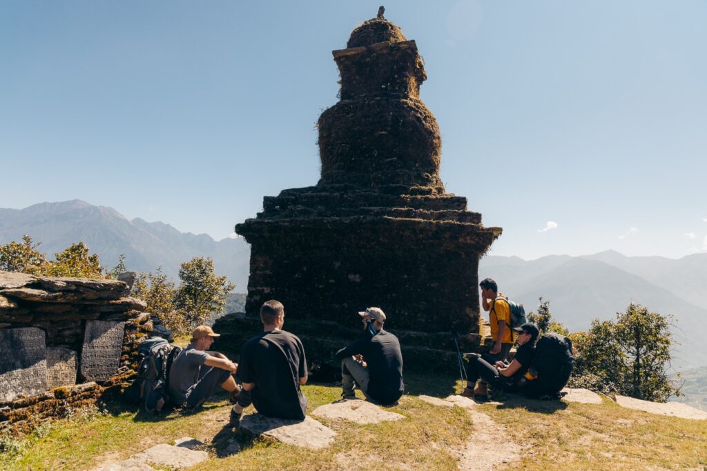
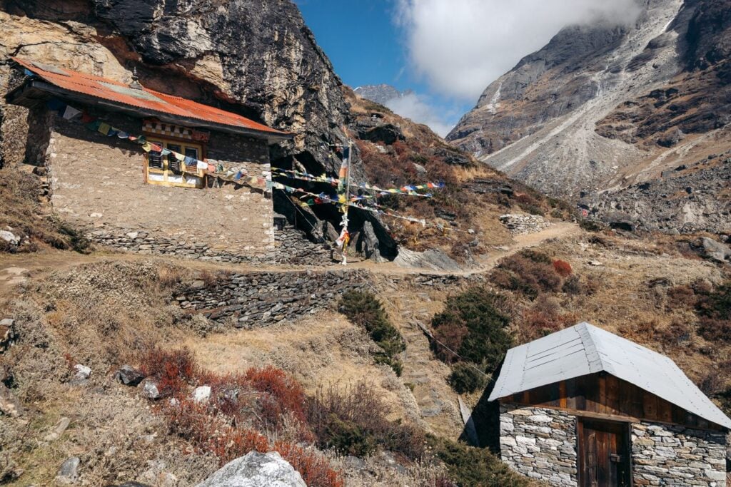
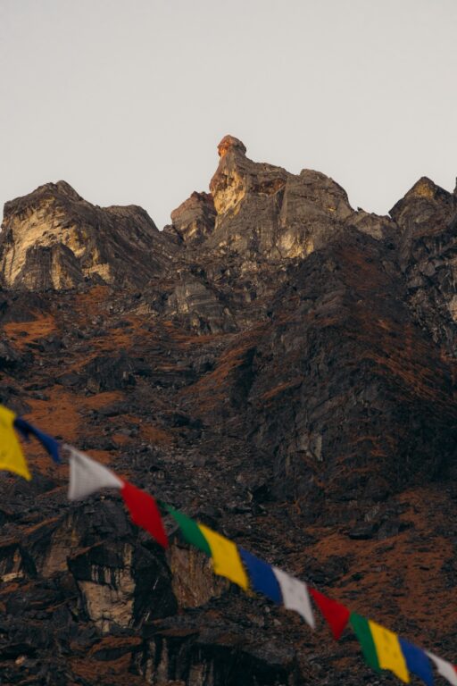
After just 3 hours of easy hiking with several stops for photos, we had already arrived in Khiraule Gompa, a picturesque hillside village with a large, prayer flag-draped stupa in its center.


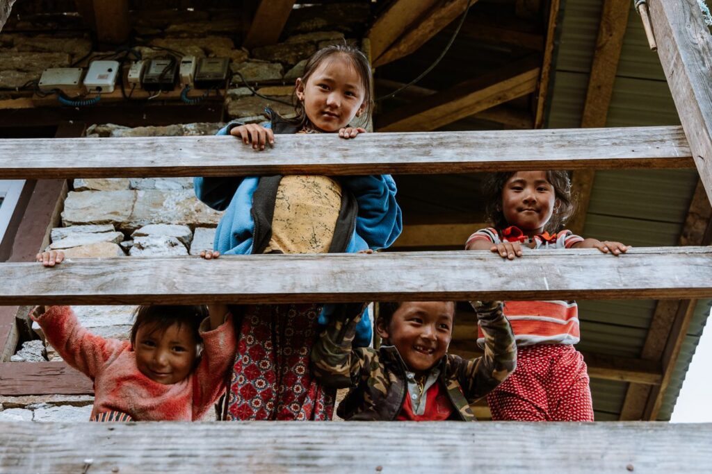
Shortly after dropping our bags at the “Yangjum Hotel” lodge, the village kids ran to us and watched us with a look of confusion. After returning their curiosity with a smile and some childish banter, they obsessively followed us around the village, belly-laughing and skipping through the worn, dusty trails.


We spent the rest of the afternoon relaxing at the lodge, drinking tea, and trying our first thongba- a traditional alcoholic beverage native to the Himalayan villages of Eastern Nepal.


Just as the night prior, we downed a big portion of dal bhat and hit the sack, ready for a slightly longer trek the following day. Unfortunately, I began developing a fever on the jeep ride the previous day which progressively worsened in the coming days and resulted in a couple of extra rest days on the way to Mera Peak.


Day 3: Trek From Khiraule Gompa to Cholem (3450 m)
- Duration: 3-4 hours
- Total ascent: 1175 m
- Total descent: 125 m
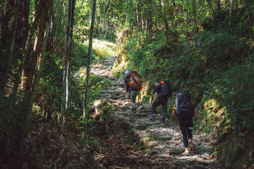
Following a lazy start topped off by a hearty serving of tsampa porridge, we departed Khiraule Gomba towards Cholem.

The first section climbed the hillside directly above Khiraule Gompa before meeting up with a dirt road, which we then followed for a short section. After roughly 100 meters of incline, we arrived at a nice lodge called the Himalayan Hotel, surrounded by beautiful pine trees.

Here, we met Pasang Sherpa, the father of Jangbu, who helped us to arrange the climb from Refuge Lodge. We found out that Jangbu had wished that we had stayed at his hotel, but due to a bit of confusion simply checked into the first tea house in Khiraule Gomba instead. Pasang Sherpa was not bothered by this and even offered to show us the way to Jungle Camp (Cholem), where he also owned a lodge.
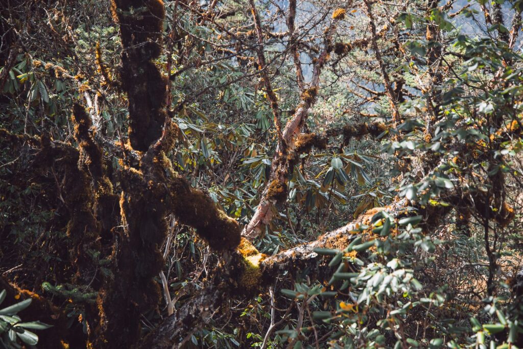
So, we continued up the hillside, climbing endlessly through varying sections of meadow-like fields and moist rhododendron forests. We stopped for lunch approximately halfway at a small lodge, which apparently was owned by Pasang Sherpa's sister. Then, we continued to climb the forested hills. At this stage, my fever was pretty awful but I tried to push the symptoms to the back of my mind and muster the energy to enjoy the beauty of this magical place.


The final section of this trail was quite steep but the trail is immaculately kept. Overall, there was very little decline for the entire day and the incline only broke briefly for short sections of flat ground.

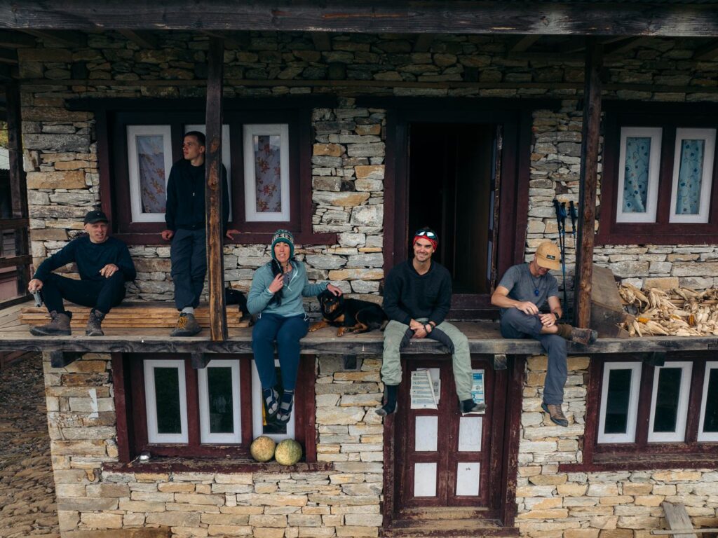
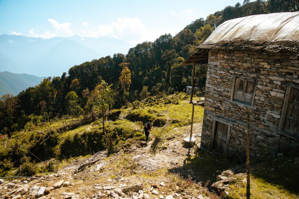
Jungle Camp (Cholem) is a picturesque little village comprising three stone buildings. The larger of which is a tea house owned by Pasang Sherpa. After passing us on the trail, he had prepared our rooms and welcomed us.
We wrapped up the night with a heaping serving of dal bhat and went to sleep at around 7:30 pm.

Day 4: Rest Day at Cholem (3450 m)
Unfortunately, the bug I'd picked up wasn't showing any signs of giving up. I thought that the two long days of hiking with a heavy backpack probably weren't helping my situation. So, in hopes of kicking it for good, we decided to have a rest day in Cholem before continuing to higher altitudes.
This would also have an acclimatization benefit. I sat enjoying the sun with a book and tea for the majority of the day while a few members of our party climbed the pass behind the camp for a better view and to help with acclimatization.


Day 5: Trek from Cholem to Panch Pokhari (4300 M)
- Duration: 4-5 hours
- Total ascent: 945 m
- Total descent: 95 m
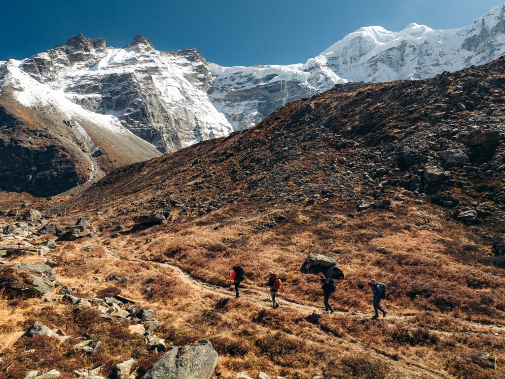
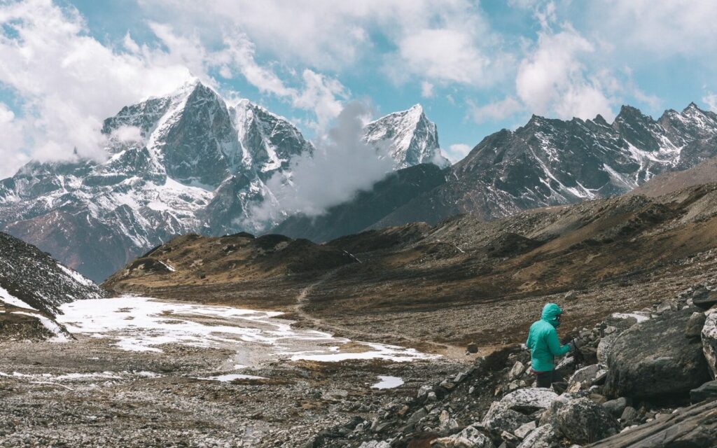
Feeling rested, we began the immediate climb up the bare hillside to the looming pass directly visible above Cholem. This climb is quite steep, climbing 750 meters over 1.5 kilometers to an altitude of roughly 4200 m. Since we left early, we were lucky enough to have a clear view of the snow-capped peaks hiding on the other side, as well as the imposing Indian peak of Kangchenjunga (8586 m) far in the distance.


Next, the path wraps around another bare hillside before climbing yet again to another pass at 4500 m.

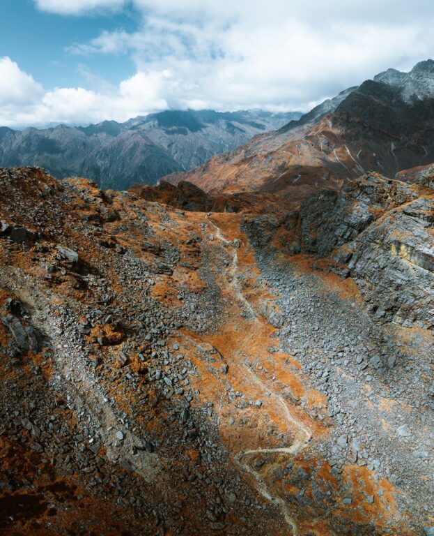

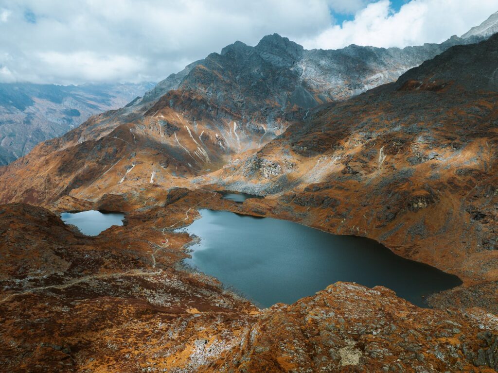
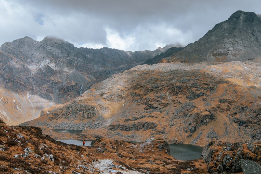
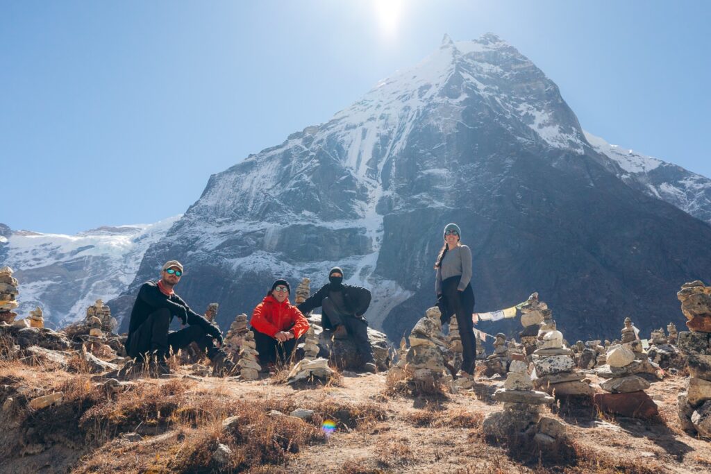
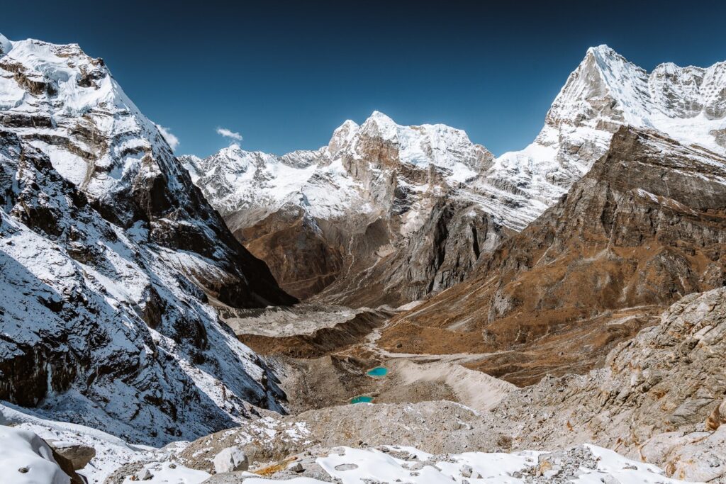
From this pass, the five beautiful alpine lakes of Panch Pukari reveal themselves beneath black, rocky peaks. We sat for a while admiring the view before descending gently toward the lakes. Apparently, these lakes are very holy and attract hundreds of pilgrims every year during the full moon festival in August.


A few of our team decided to climb the adjacent rocky ridge before descending. Once we'd descended to the lakes, we were in for another short descent down to the minuscule village.


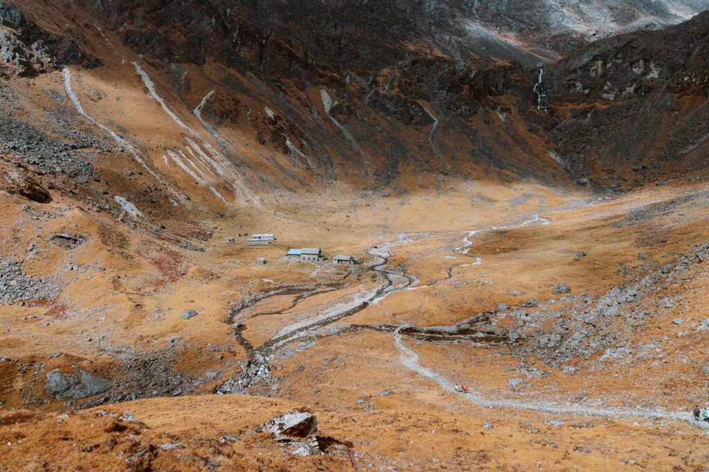
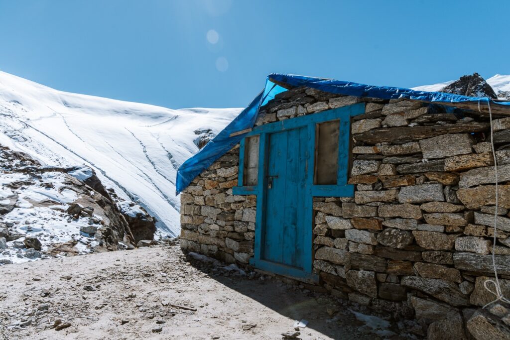
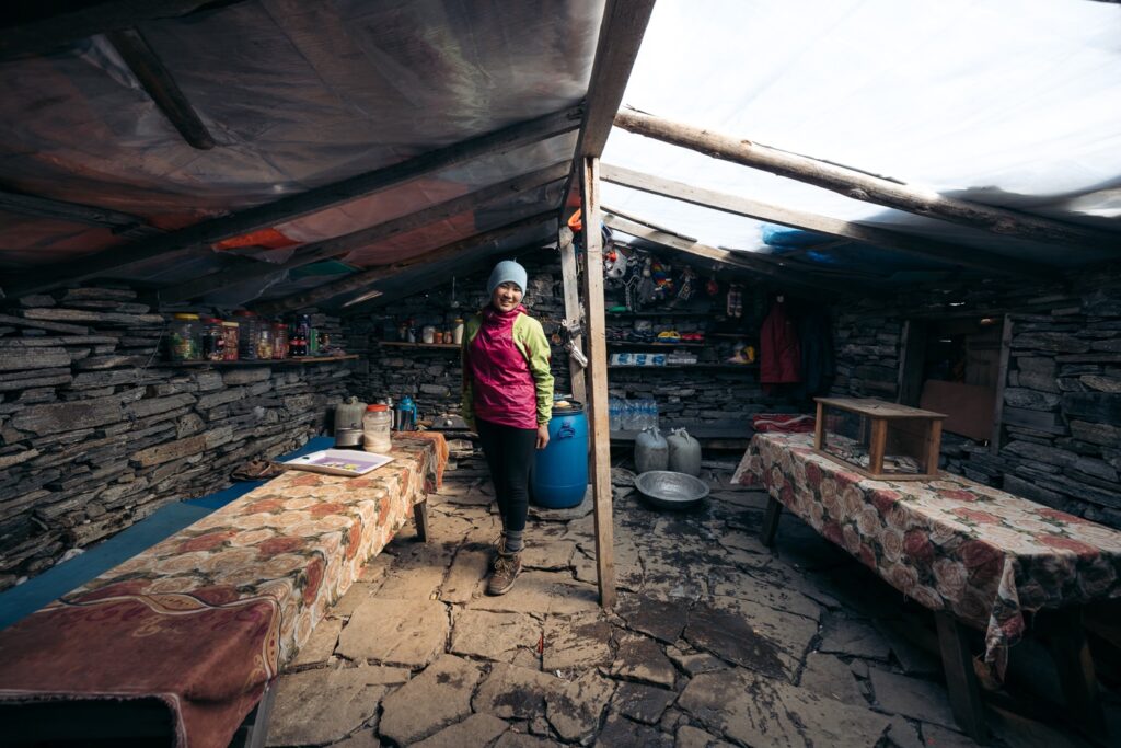
Panch Pukari consists of three dung-laden, stone huts sitting in a gorgeous bowled meadow beneath a towering waterfall. The only lodge is called Mera Lodge and Hotel, and the remoteness of this Himalayan homestead is apparent as soon as you step inside.
Nevertheless, our host whipped up a delicious lunch and dinner and kept us warm with tea. Unfortunately, after a big day of altitude gain, I was feeling terrible and crashed into bed almost immediately when I arrived. I downed two portions of extra strong Tibetan garlic tea and held my fingers that I'd begin feeling better soon.


Day 6: Trek from Panch Pokhari to Kothe (3600 M)
- Duration: 5-6 hours
- Total ascent: 385 m
- Total descent: 1085 m
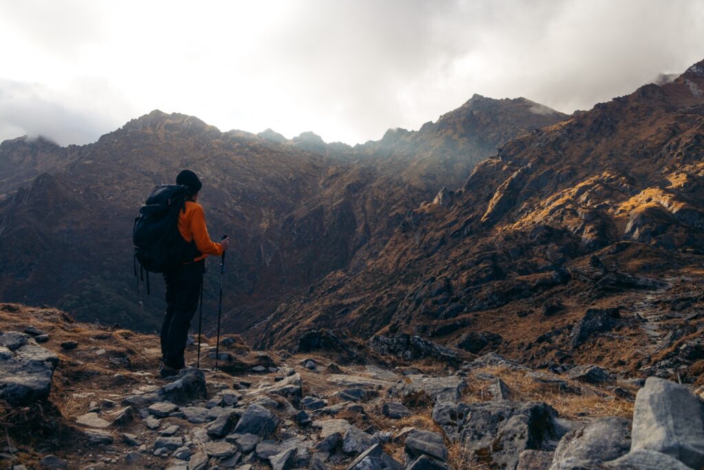
While the majority of the path from Panch Pokhari to Kothe is downhill, it begins by climbing up the side of a small ridge for roughly 200 vertical meters.
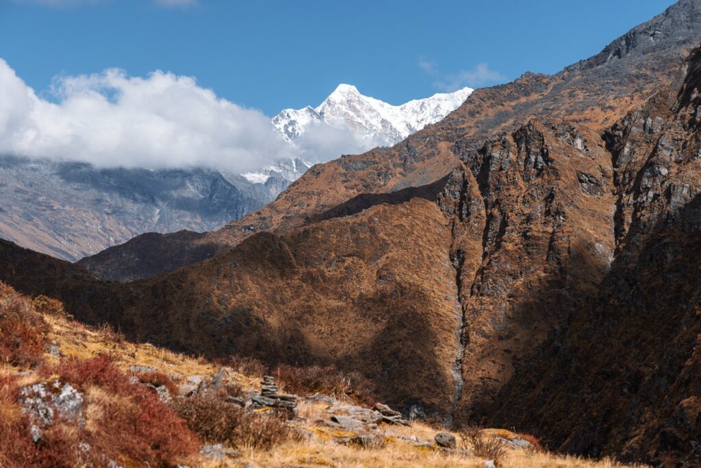
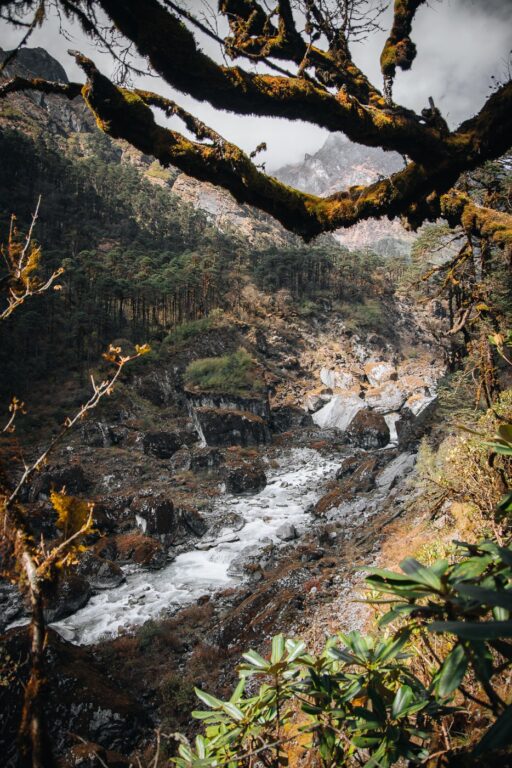
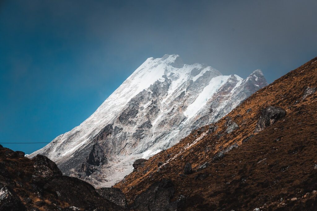
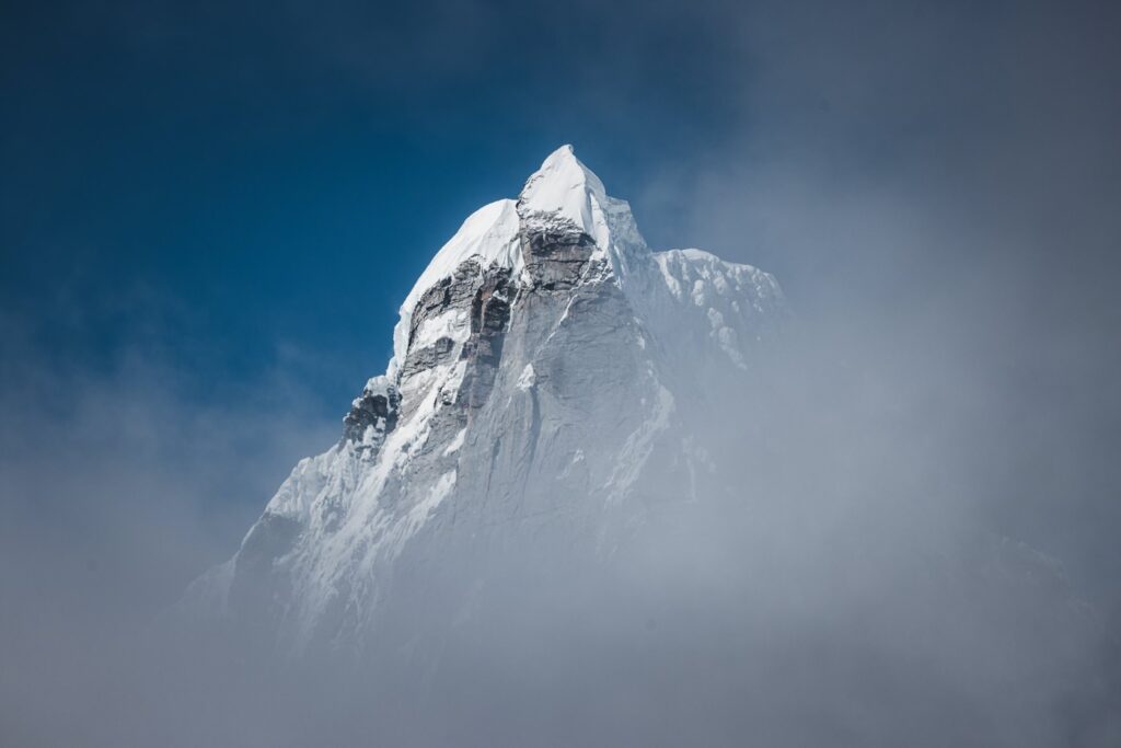
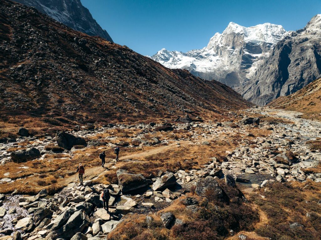
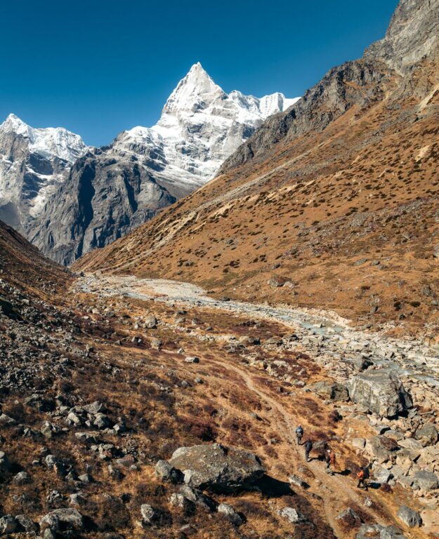
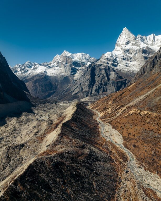
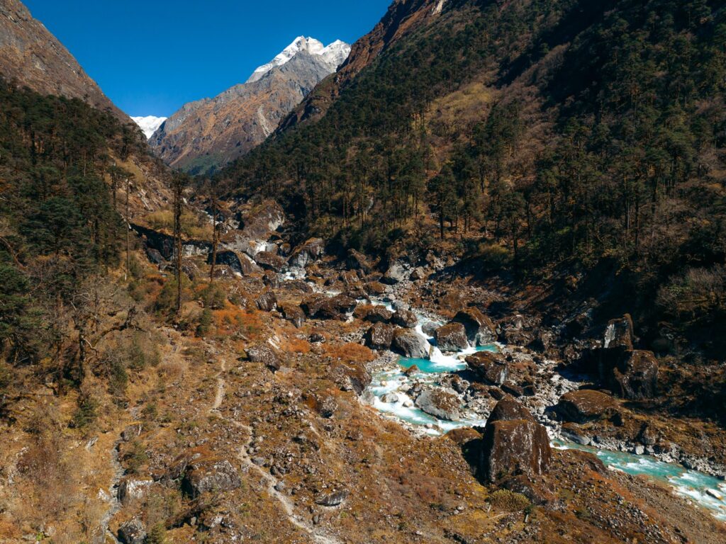
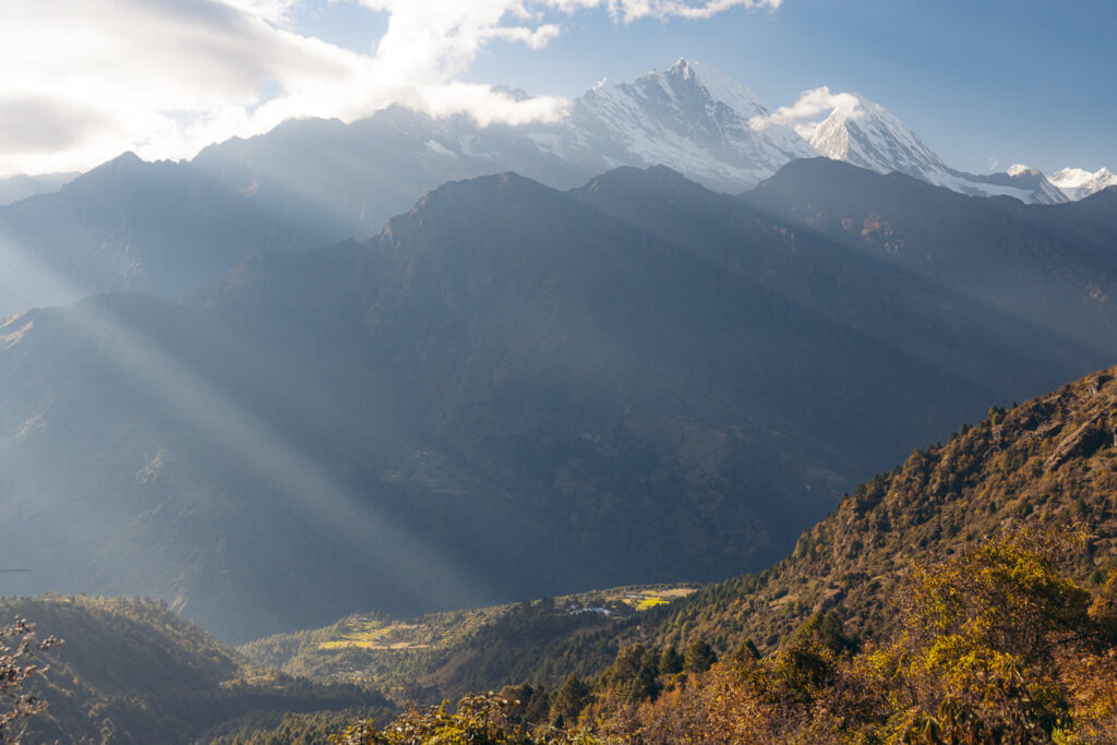
Then, the trail snakes around endless bends and drops sharply back into the tree line with snow-capped giants of Kyashar (6769 m) and Kusum Kangru (6367 m) revealing more of their might around each corner.


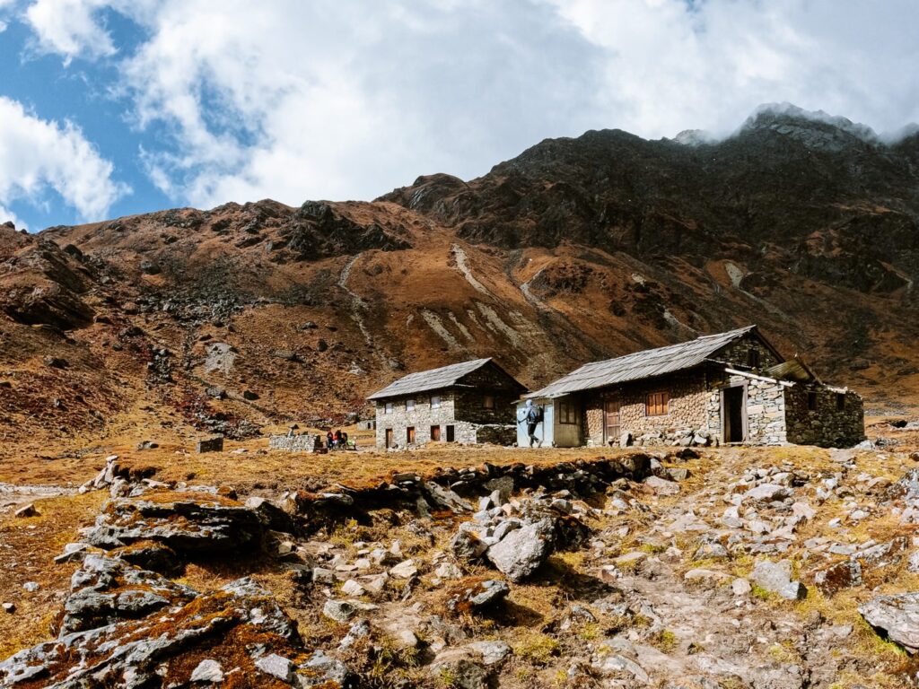
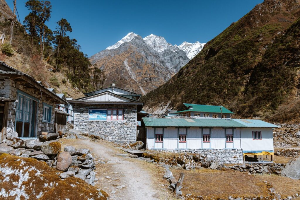
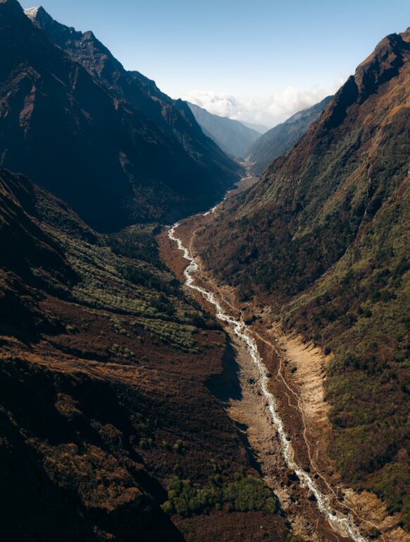
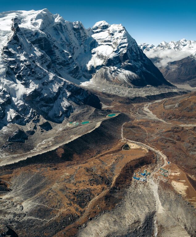
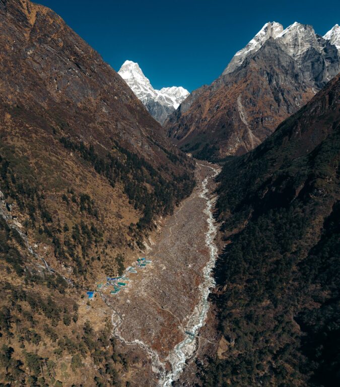
The final two hours lead trekkers through beautiful, dense forests while dropping gradually into the Hinku glacial valley before climbing another small hill further up the valley. Shortly after we arrived at Kothe (3600 m), a beautiful sunny crossroads village with plenty of options for lodging.


We decided to stay at the Mera Lodge and Restaurant, run by a very friendly old Sherpa man and his daughter.
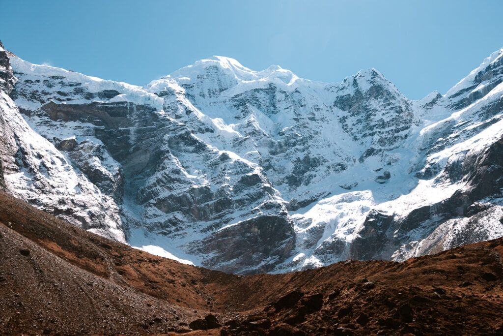
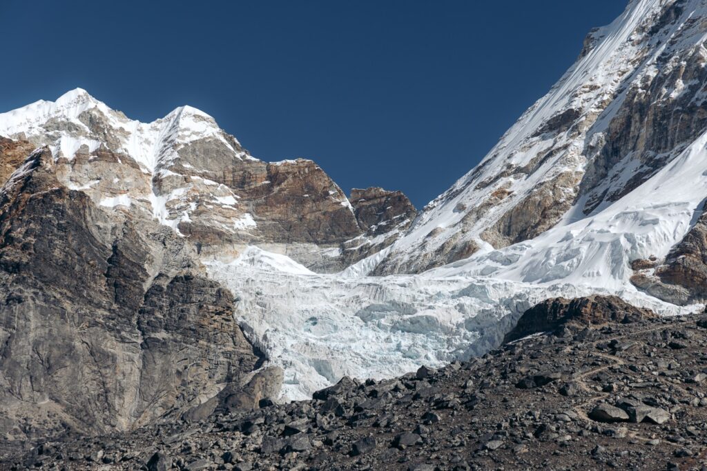
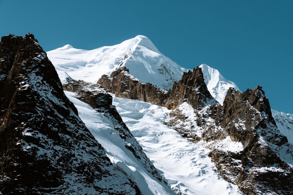
Directly behind the village, Mera Peak was now in full view for the first time. From its southern face, it looked formidable, but we knew that as a popular trekking peak, its other side would be much more welcoming.
We spent the afternoon enjoying the sun, washing clothes in the river, and playing cards by the fire.


Day 7: Rest Day in Kothe (3600 M)
Unfortunately, I was unable to shake the bug I'd been carrying as I was still lethargic and slightly feverish.
As a last-ditch effort to heal up, we decided to take advantage of the lower altitude in Kothe and take another rest here.
It was a beautiful day, and we sat outside for the majority of the day enjoying the warm weather and trying to soak in as much vitamin D as possible. I ordered a big pot of honey lemon ginger tea for 800 rupees and relaxed around Mera Lodge.

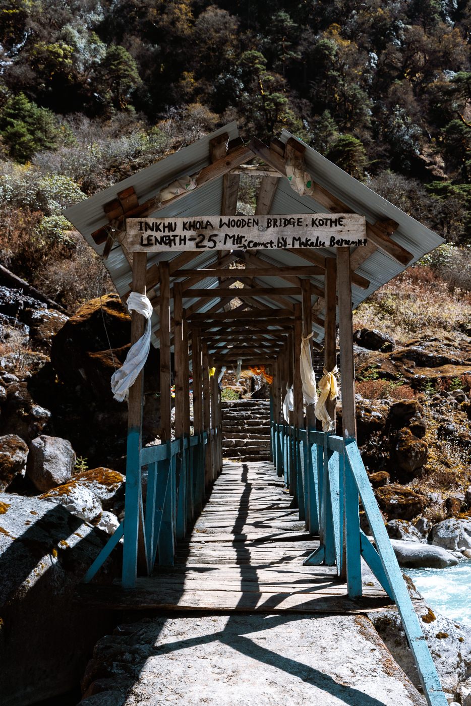
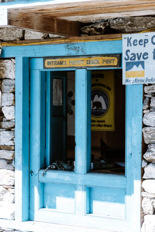
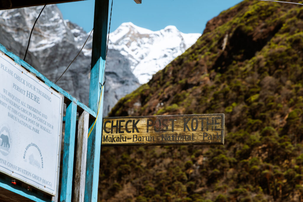
Kothe is also the village where trekkers will need to pick up the Makulu-Barun National Park Permit (2000 rupees). To save time, we walked down to the National Park office at the end of the village and purchased our permit here in advance. The official also requested to see our Mera Peak climbing permit, which Jangbu had sent me a digital copy of prior to departing Kathmandu.


Day 8: Trek from Kothe to Thangnag (4350 M)
- Duration: 4-5 hours
- Total ascent: 750 m
- Total descent: 0 m
Feeling refreshed, and for the first time in a week, not reading a fever when I woke up, we quickly downed some peanut butter and honey pancakes at the lodge dining area, packed our bags, and set off up the beautiful Hinku Valley towards the delightful mountain town of Thangnag.
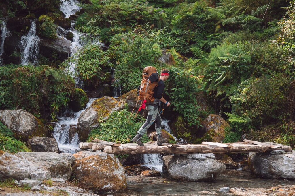
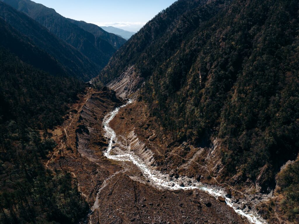
The trail begins at the northern end of the town, just after the National Park office. Immediately, it crosses a small boulder field before lining up with the Inkhu River, which we followed upstream until we reached Thangnag.
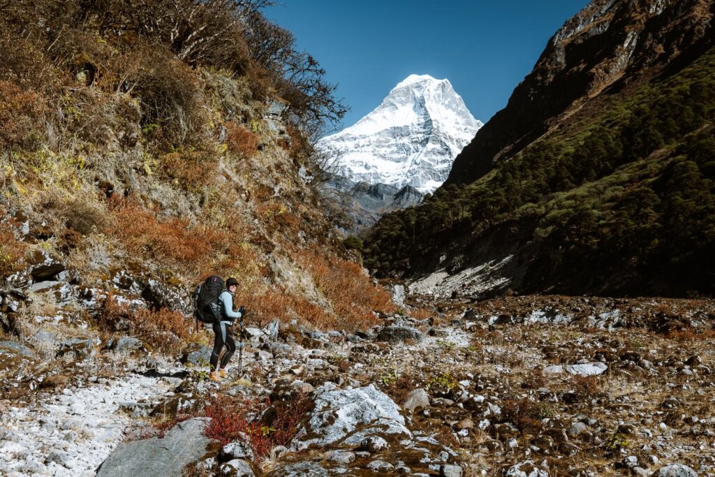

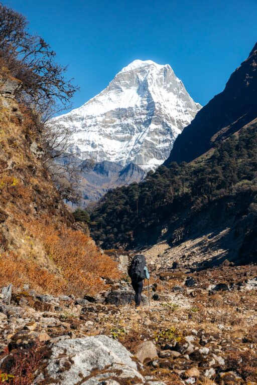

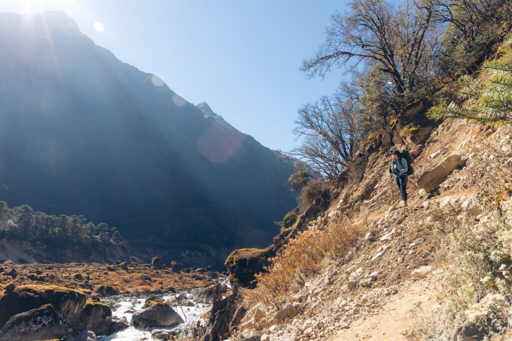

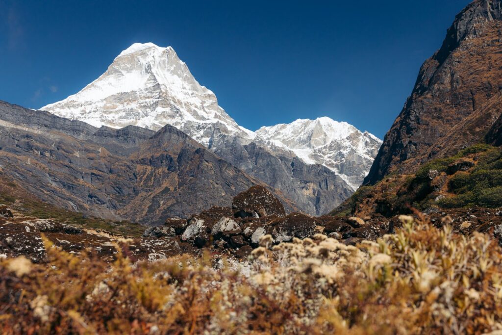


This was a clear highlight for me so far. Not only was I feeling much better, but the mountain views in the valley were phenomenal, with majestic, white peaks on all sides. As we rounded the Mera massif on its western face, its summit disappeared behind the smaller yet almost vertical Mahakulung Peak.


The trail was also very comfortable with such a gentle incline that we hardly noticed the altitude gain.

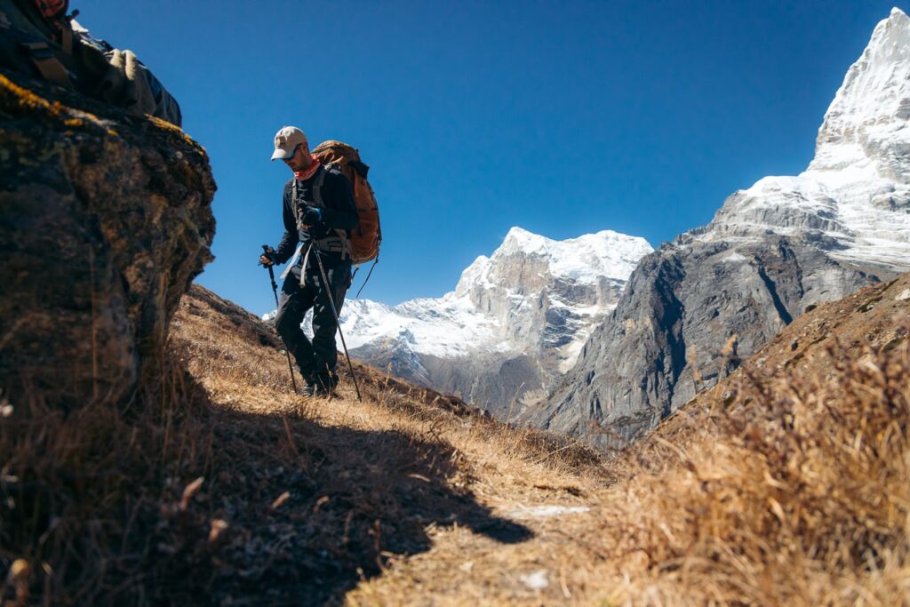
What we did notice, however, was that the trail from Kothe to Thangnag was much busier than the remote, off-the-beaten-path regions we'd come from so far. We passed about a dozen trekking companies returning from their Mera Peak climb in the short 4-hour walk! A stark contrast from meeting perhaps one or two groups per day.

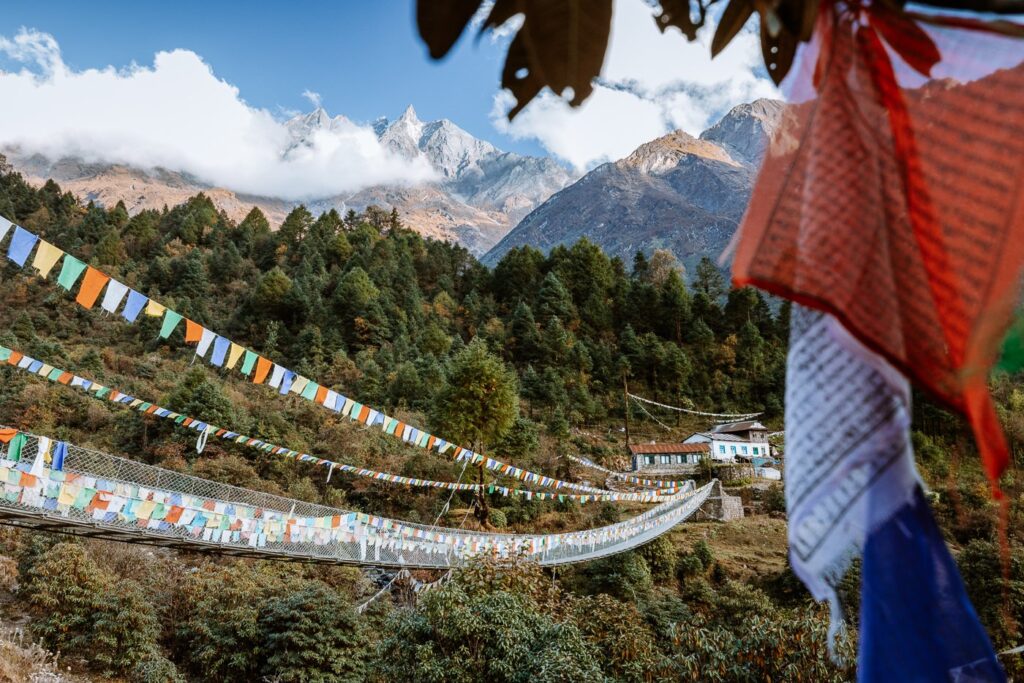
As we neared the village, we passed a small Tibetan monastery dug into the cliffside. Soon after, we could see Thangnag sheltered beneath the imposing south pillar of Kyashar, and Kusum Kangru's three peaks.

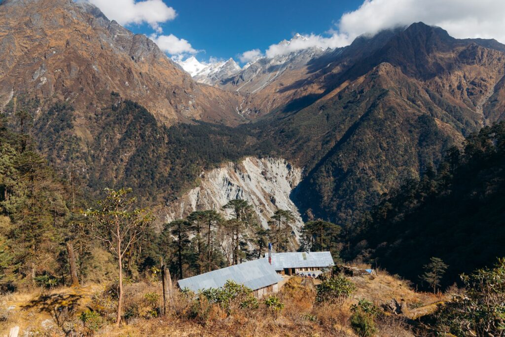
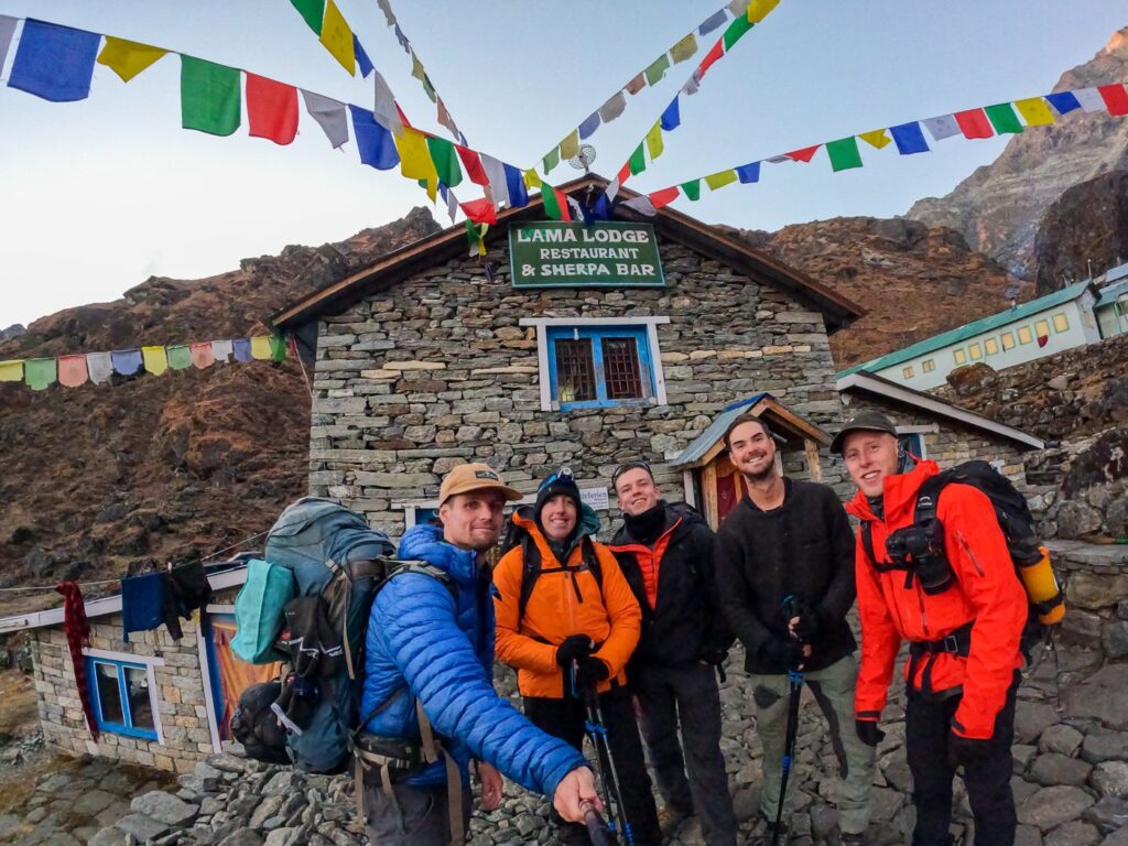
Jangbu's sister runs a lodge in Thangnag called Oxygen Lodge, so we decided to stay there. This was easily the best lodge in town and offered very clean, comfortable rooms and excellent food at great prices.


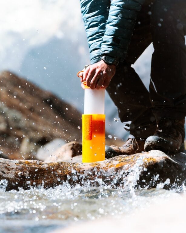

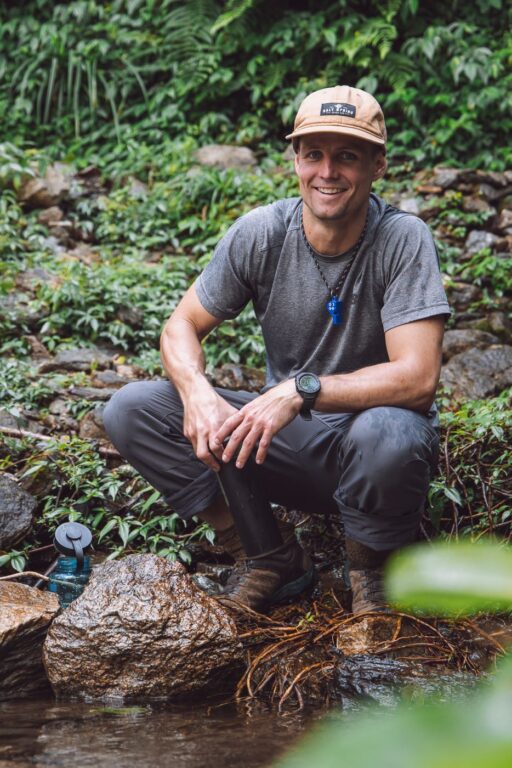
Get Safe Drinking Water Anywhere!
Enter the Grayl GeoPress Water Filter & Purifier Bottle! I take this bottle on every hike and use it as my go-to source for filtering water all over the world. I've even used it to drink tap water in India!
// Compare how the GeoPress stacks up against the best water bottle filters on the market.
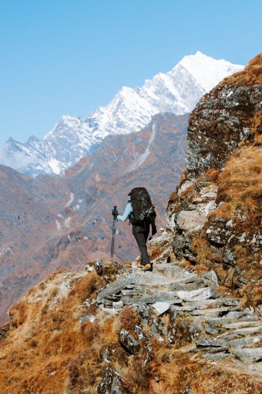
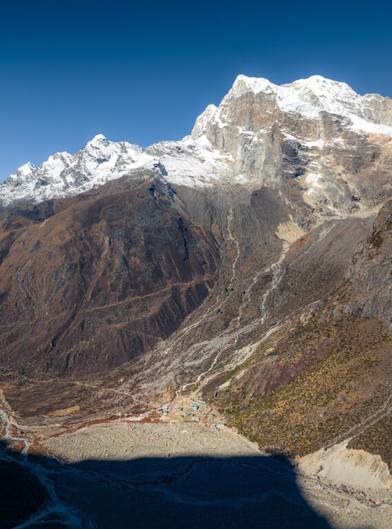
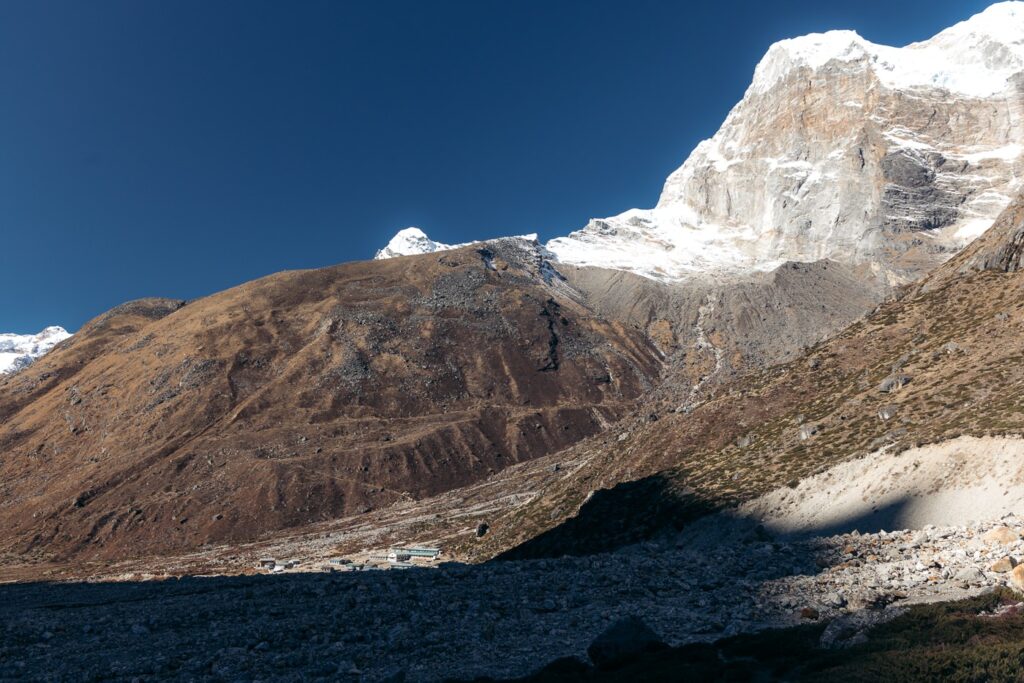
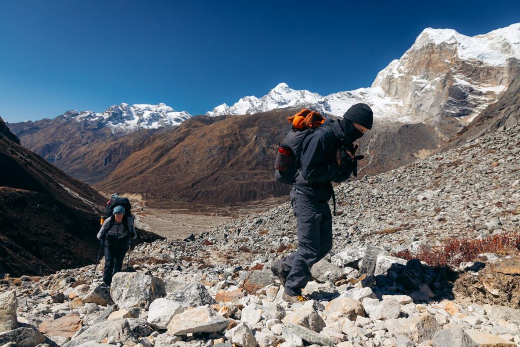
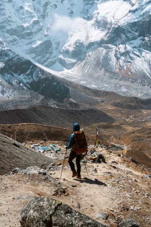
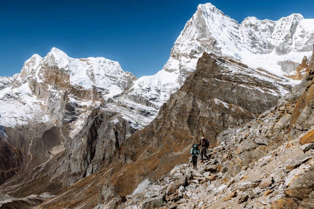
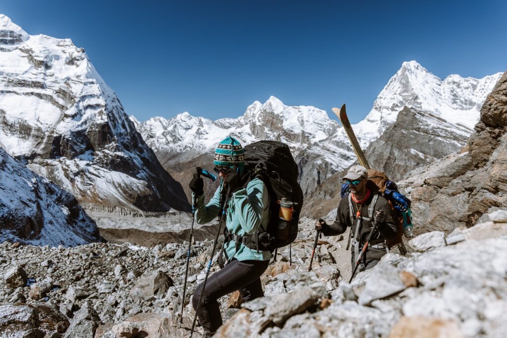
Day 9: Trek from Thangnag to Khare (4900 M)
- Duration: 4 hours
- Total ascent: 610 m
- Total descent: 60 m
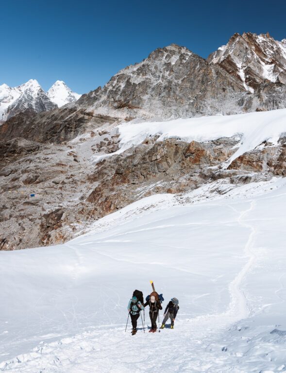
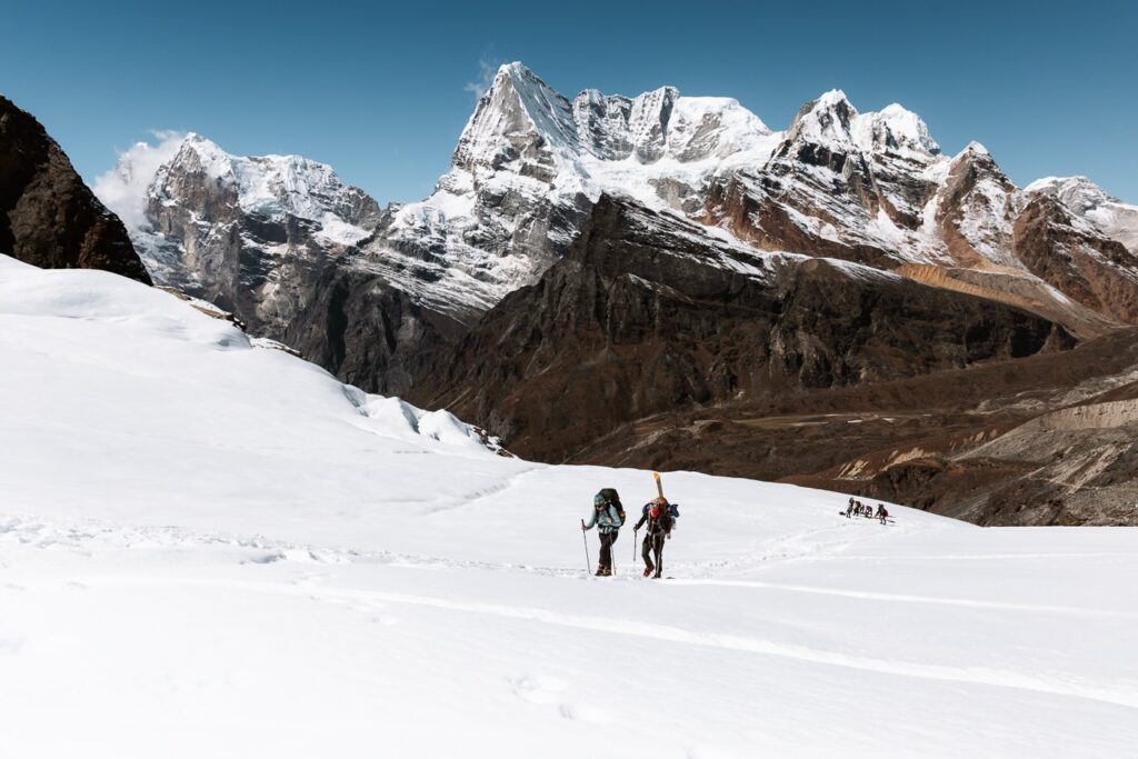
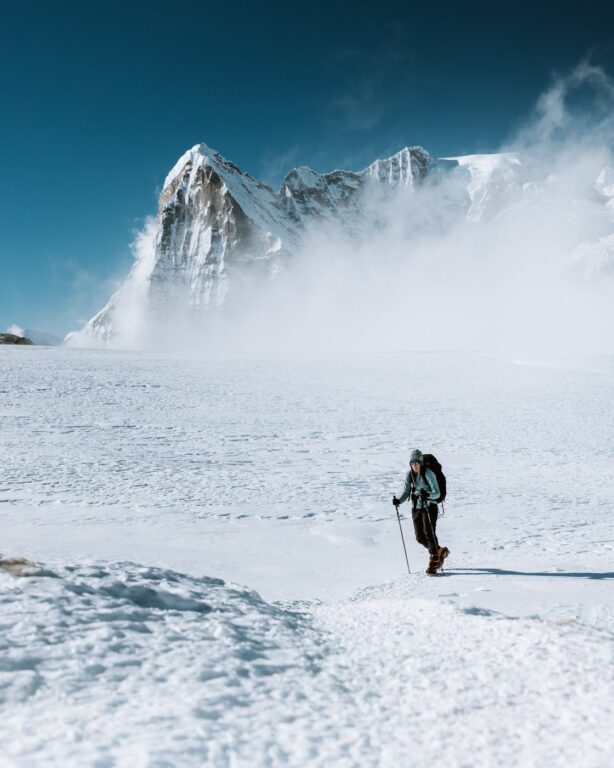
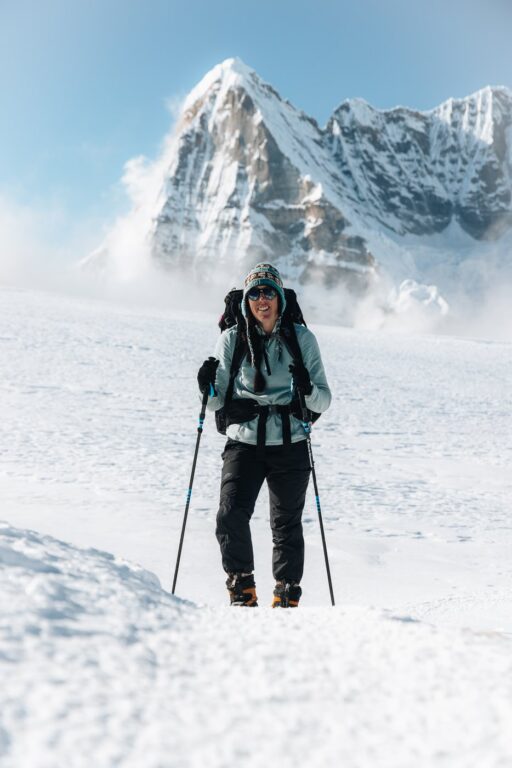
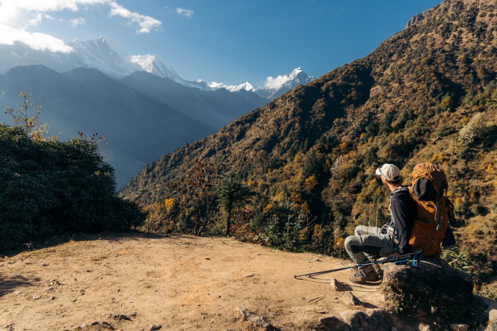
Finally feeling much better, we were in for another excellent day of trekking, in my opinion, the most scenic day of the trip.

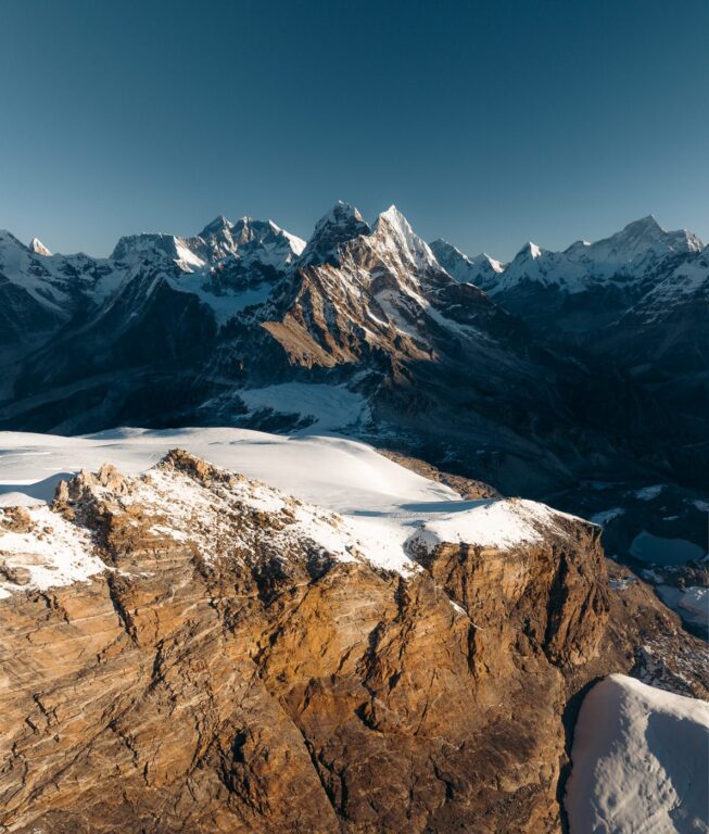
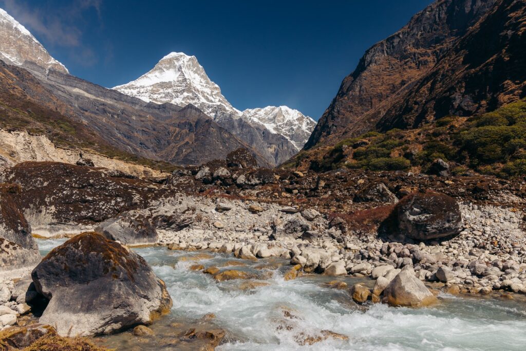
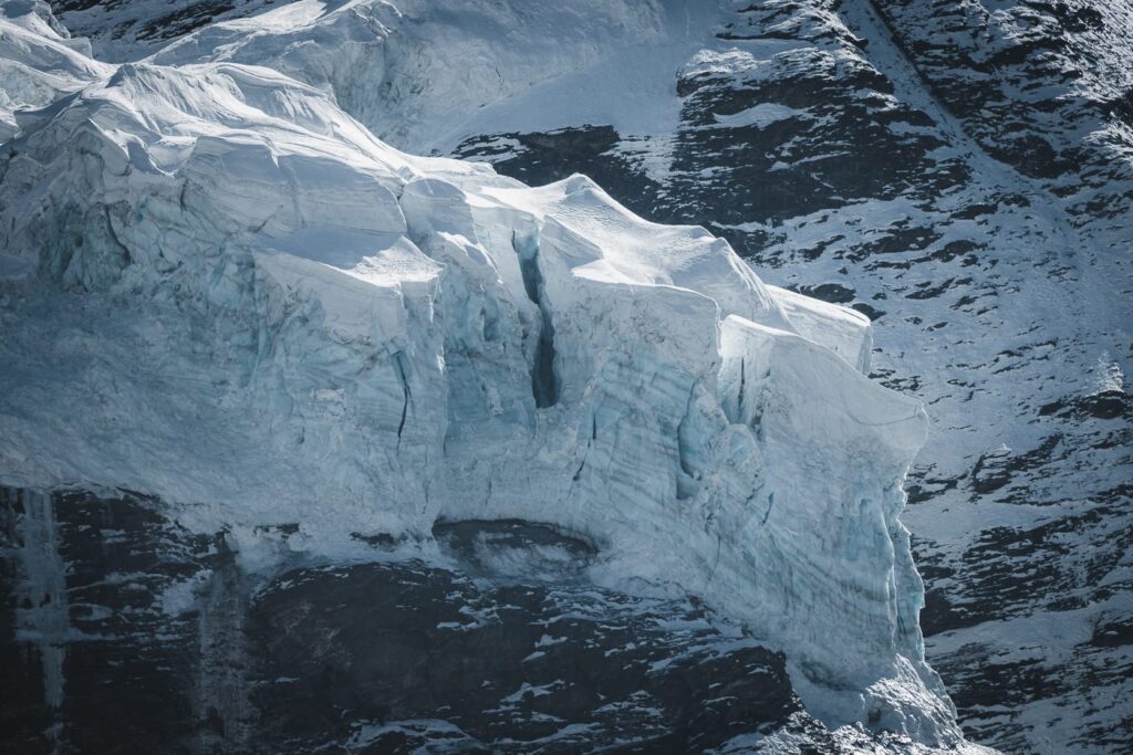
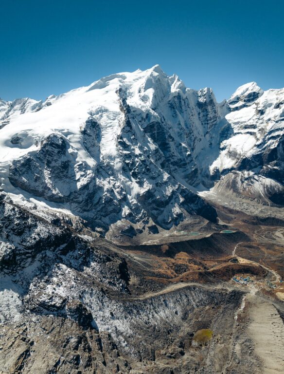
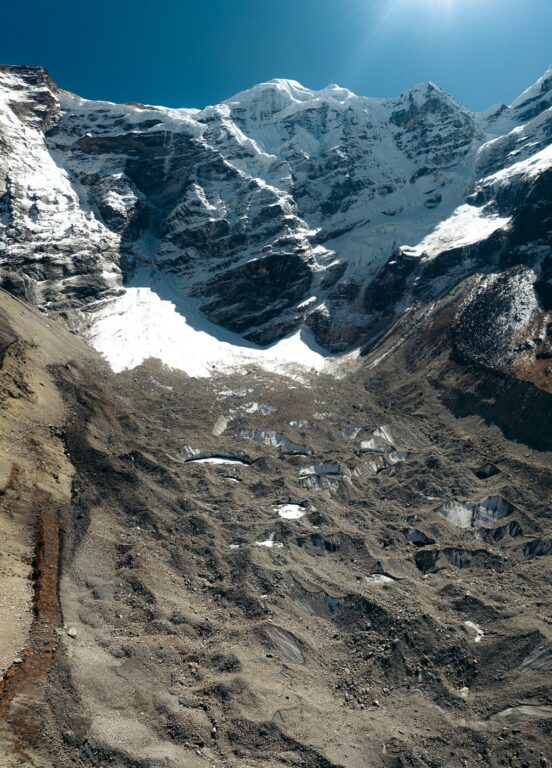
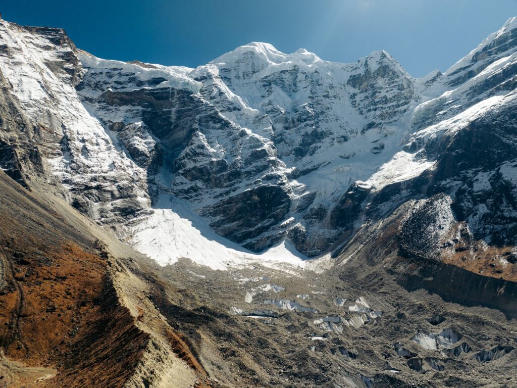
The trail from Thangnag to Khare begins directly east of the village by following a set of cairns through the large boulder field. Shortly after, we climbed the grassy hillside where we took a short detour overlooking the beautiful Sabai Tsho glacial lake. We sat here for a few moments taking in the view and snapping some photographs.
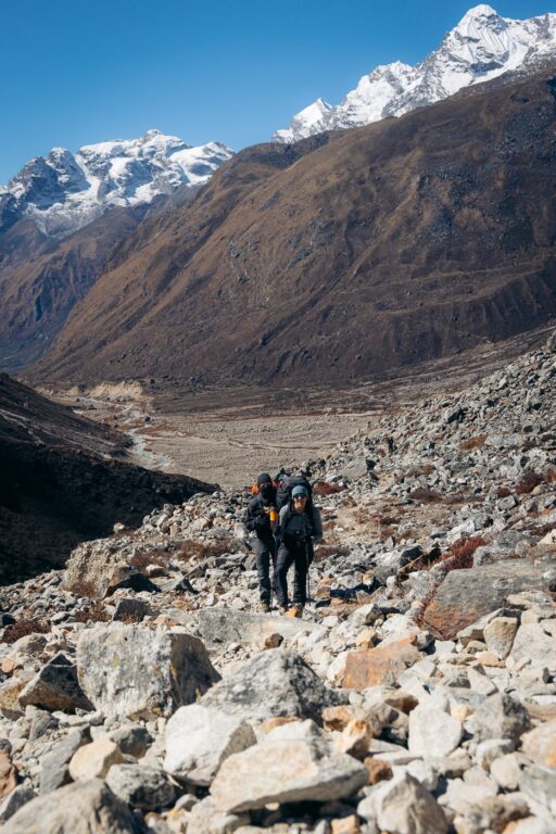


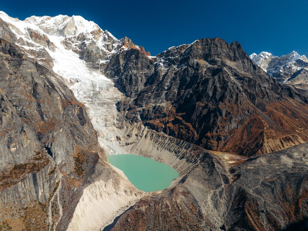

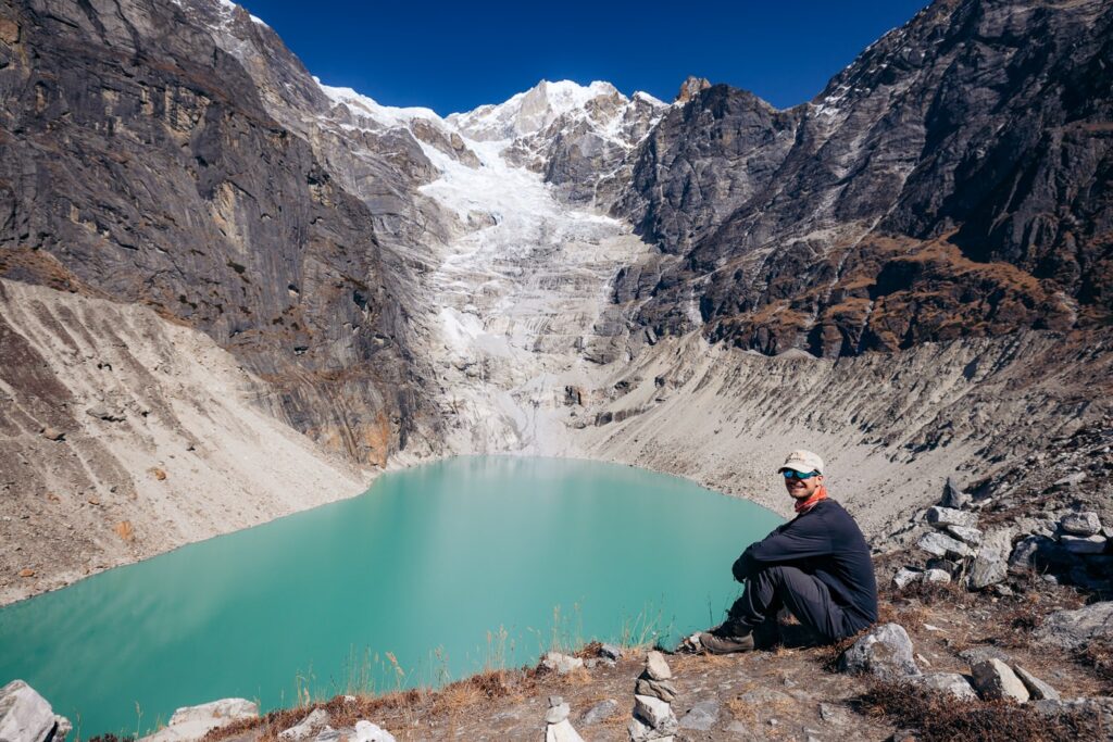

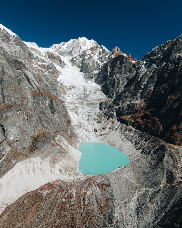


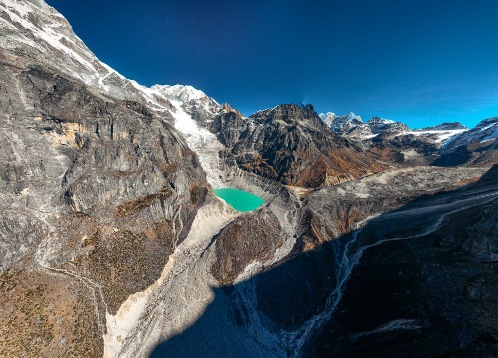

Right about at this stage, we were beginning to round the Mera massif towards its northern side, where we'd finally get a clear view of its North and Center summits.

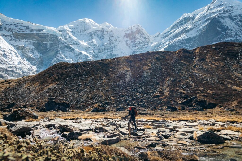


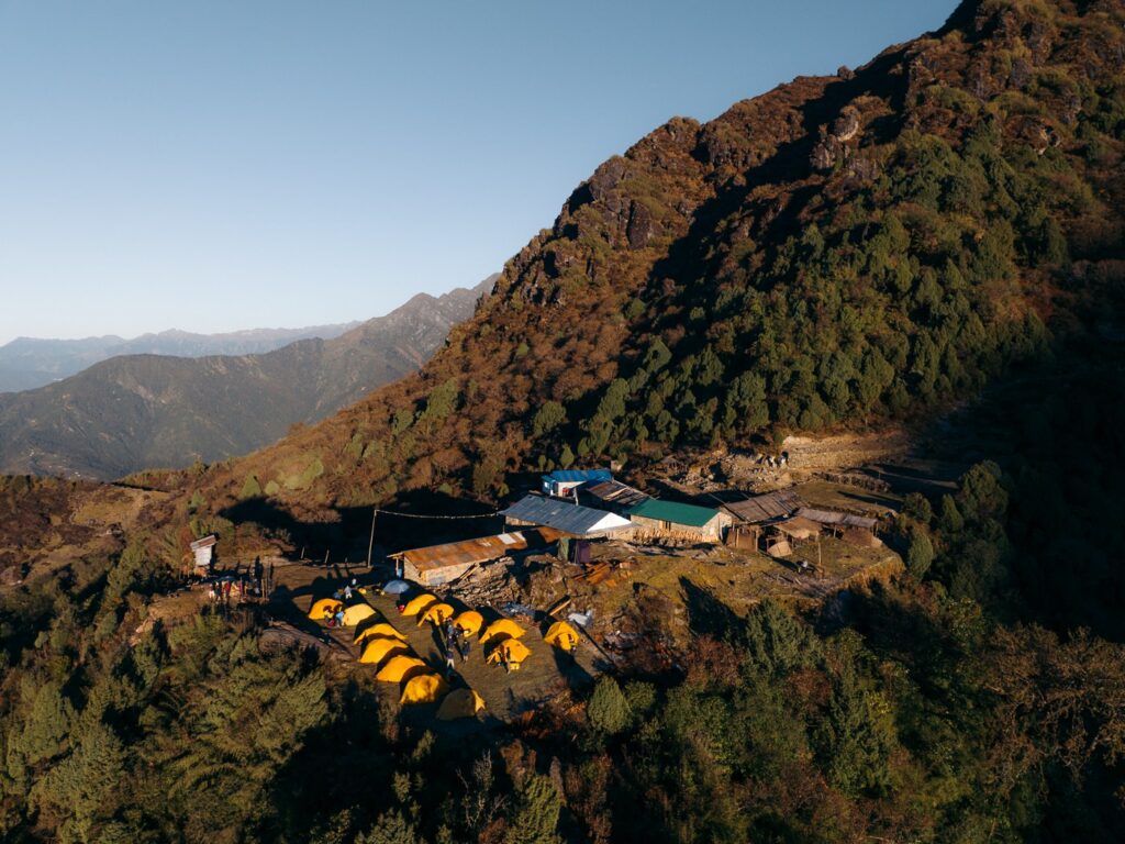
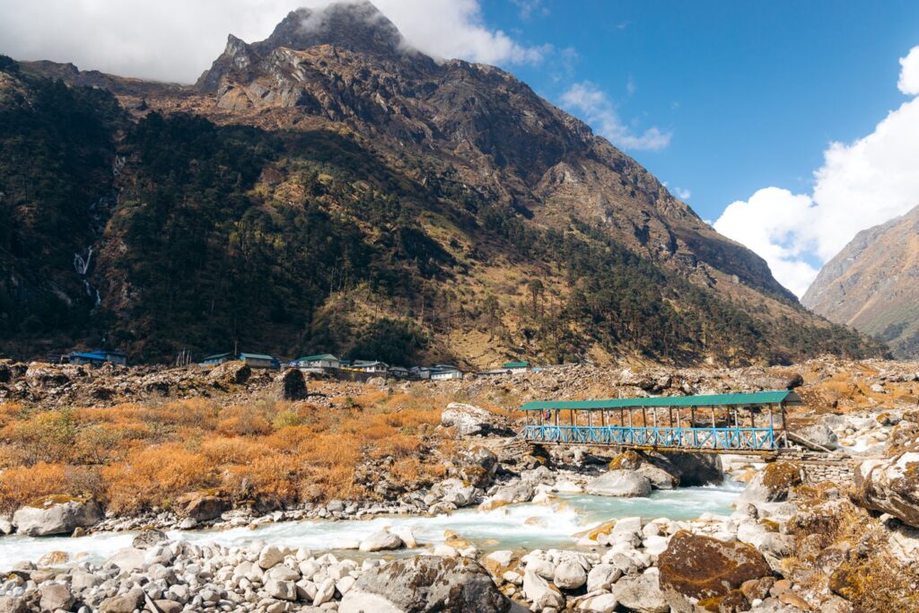
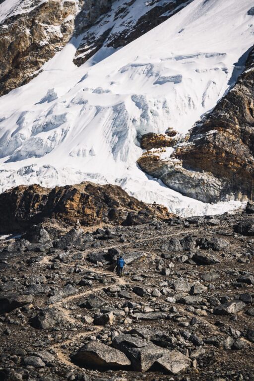
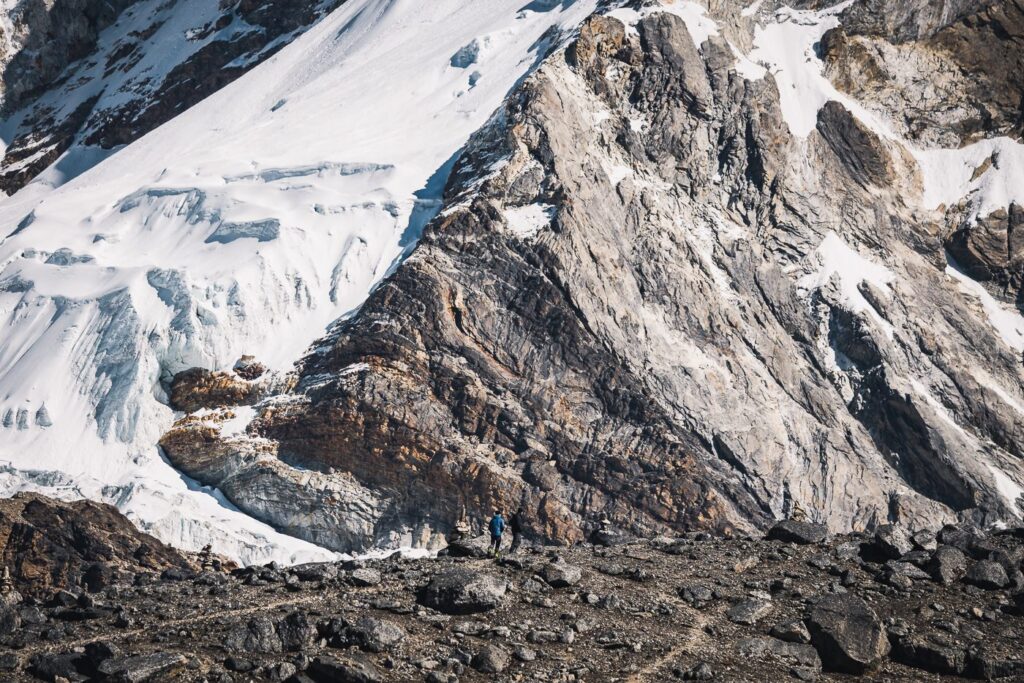
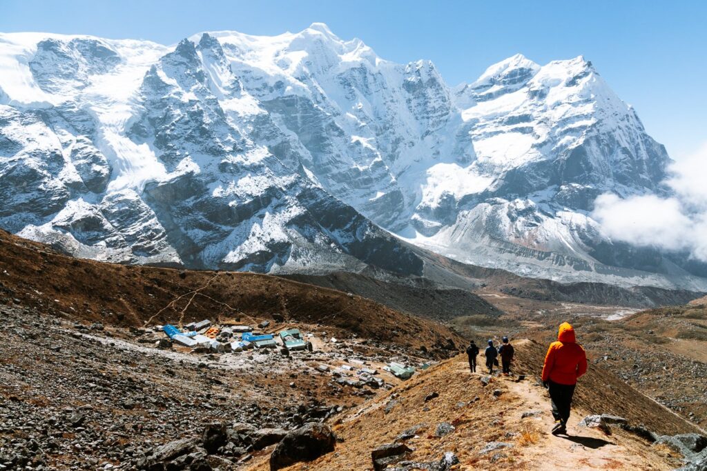
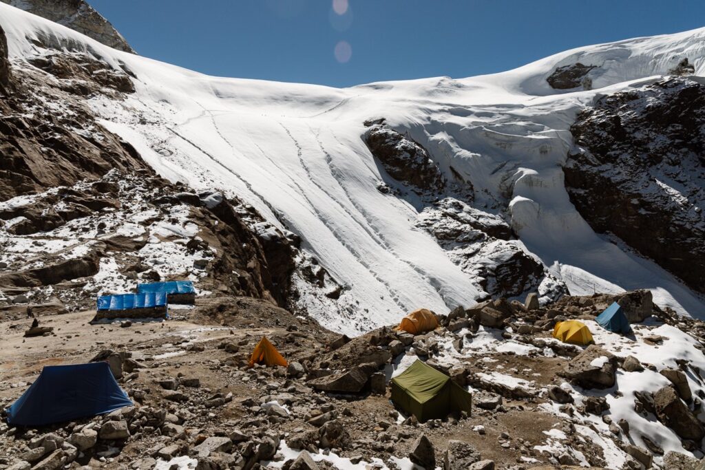
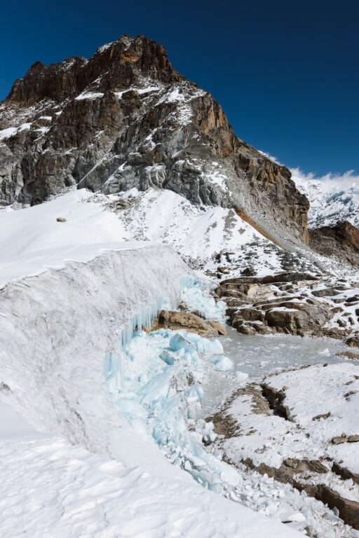
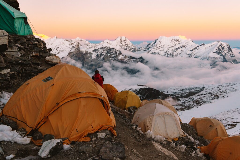
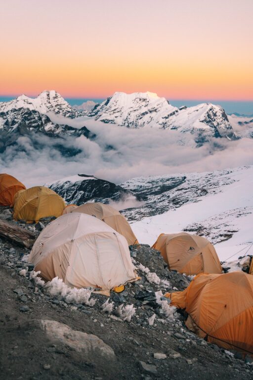
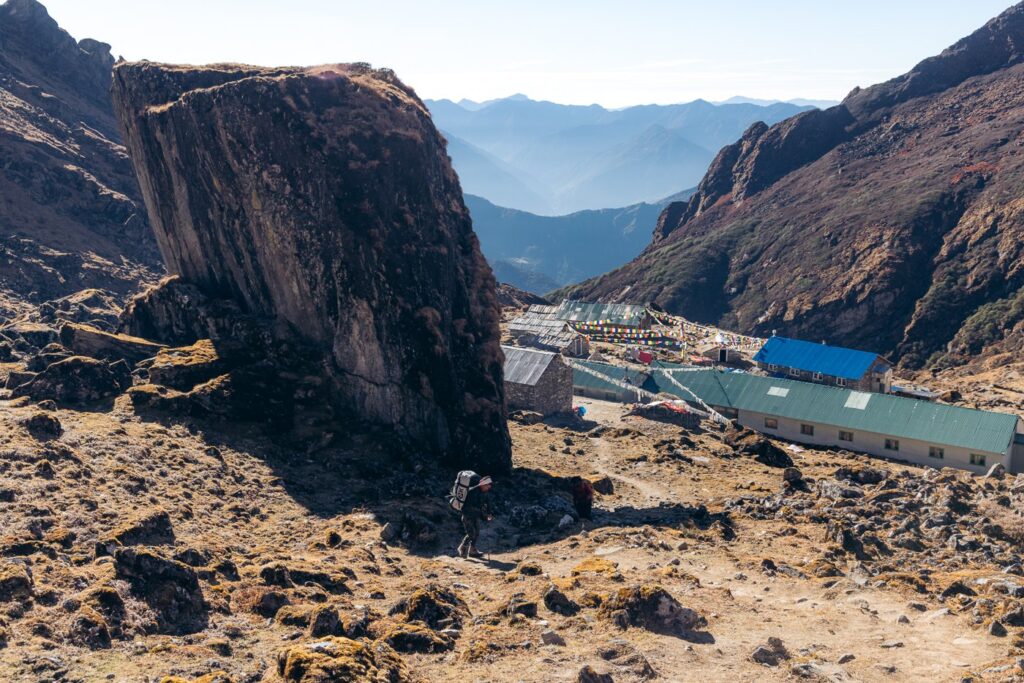
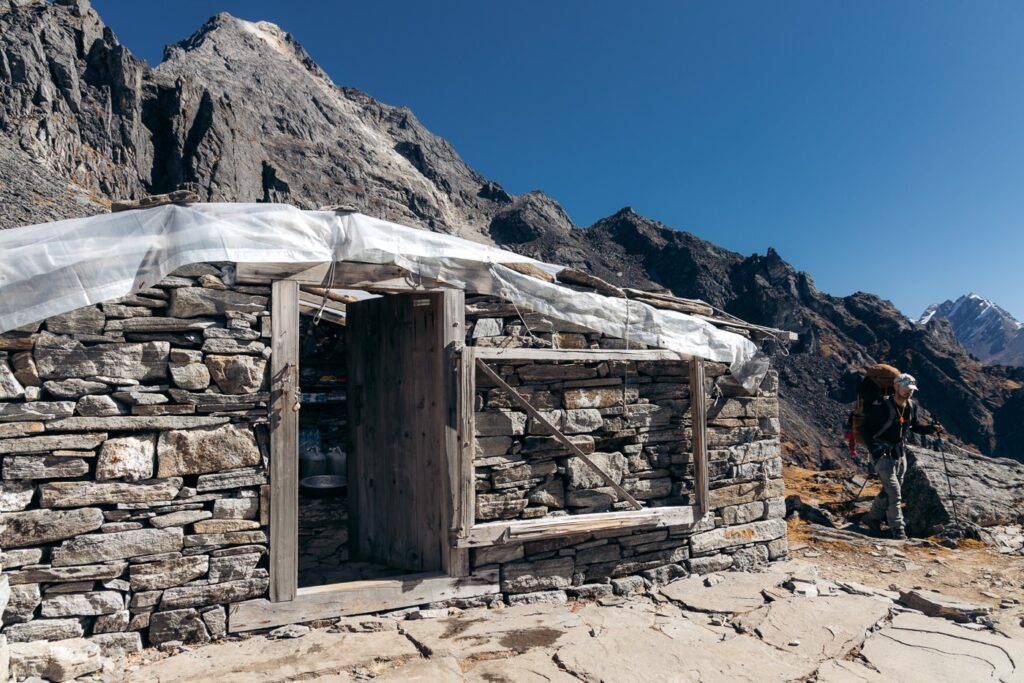
Next, we continued the gentle incline up the glacial valley following a magnificent trail beside the river and steep moraine. Soon, we came to a small hut where some locals were selling snacks. We sat here and enjoyed a chocolate bar and then made the final ascent into Khare by climbing a golden-grassed rolling bluff.
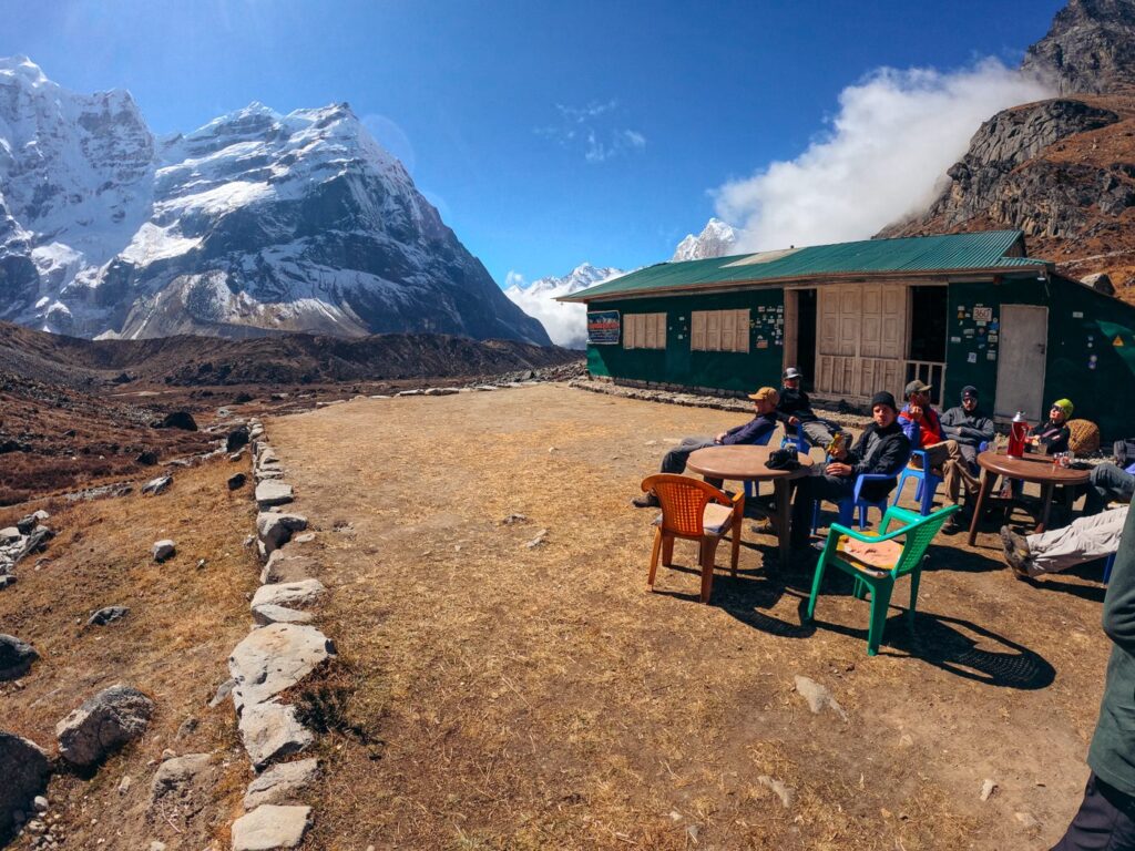


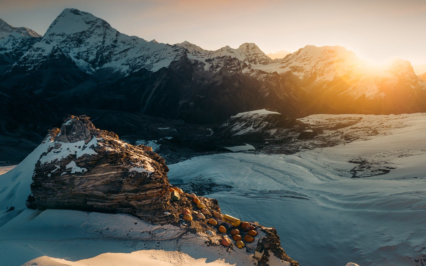
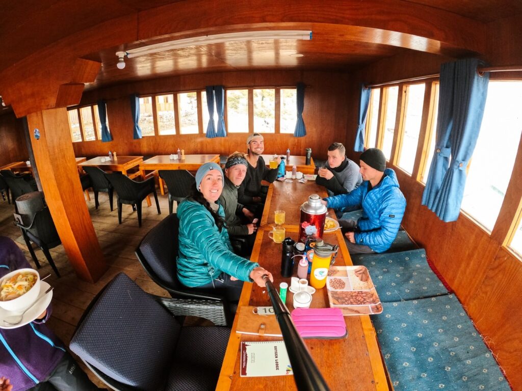
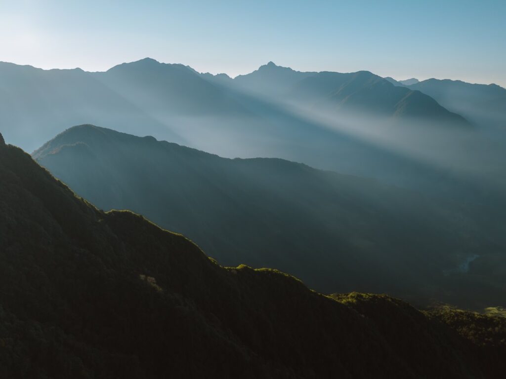
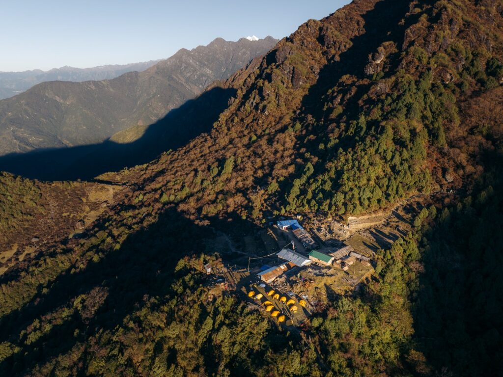
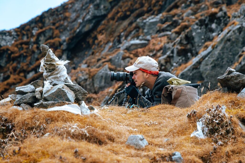
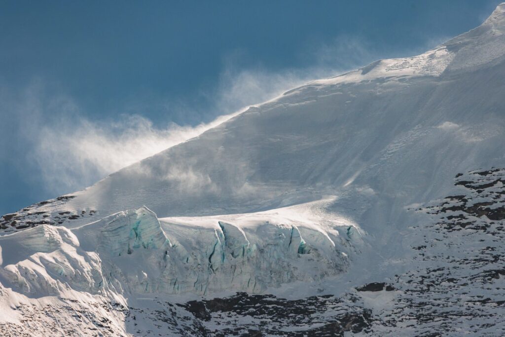
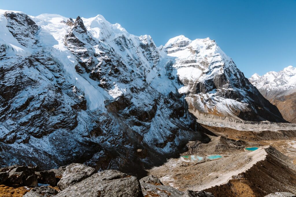
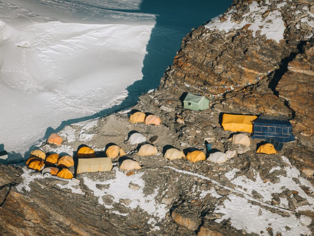
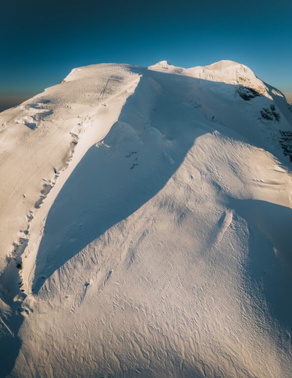
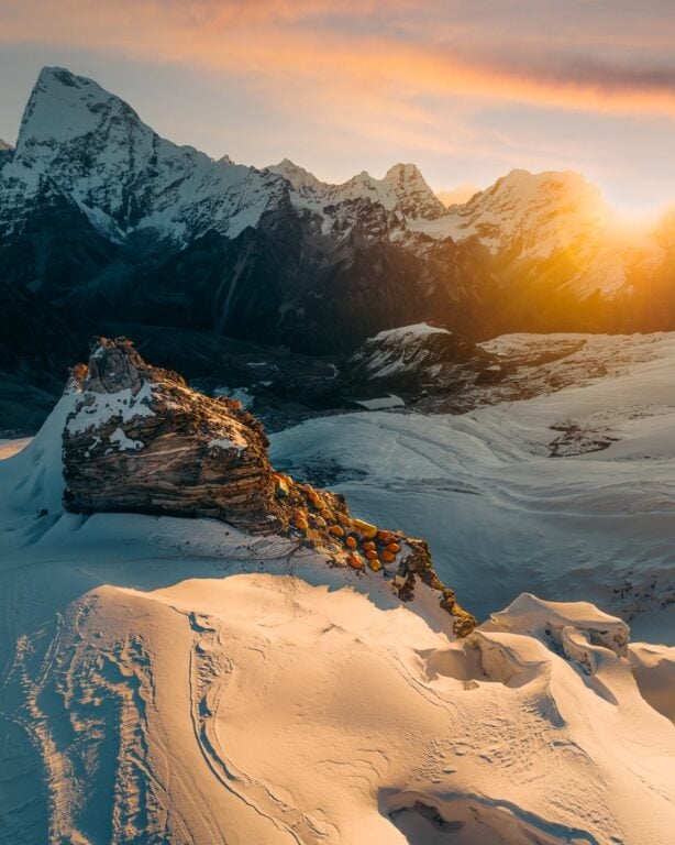
Arriving at Refuge Lodge in Khare was a strange feeling. We knew just how remote this region of Nepal was, yet this lodge looked and felt like it belonged in Chamonix! Yet, we were certainly not complaining. That evening, we got a beautiful sunset view of the back side of the Mera Peak massif. Below are some shots that I captured with my Canon 100-500mm lens.


To wind down, we ate a delicious gourmet cheese sandwich for dinner and played too many card games until late in the evening.

Day 10: Acclimatization Day - Hike & Training in Khare (4900 M)
- Duration: 1 hour
- Total ascent: 300 m
- Total descent: 300 m
Nearing 5000 meters, we were really starting to notice the cold. We woke up with our drink bottles almost completely frozen and many of our batteries drained. Luckily, I was able to charge my camera and drone batteries at the restaurant free of charge.
Today we met our guide, Phur Gyalje Sherpa (Gyalje), who would take us up the Mera Glacier to the Mera Peak summit. Apparently, he was Jangbu's cousin.
He instructed us regarding the breakdown of the coming summit attempt, which would involve an acclimatization hike today, followed by a short training session. Then, the next day we would depart directly for Mera Peak High Camp (5800 m), followed by a 2 am summit push the next morning.
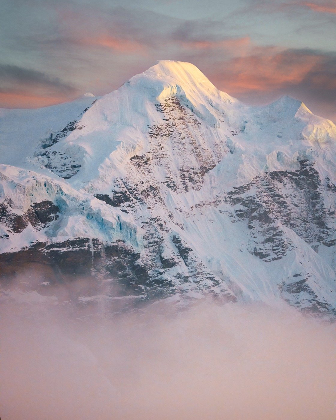
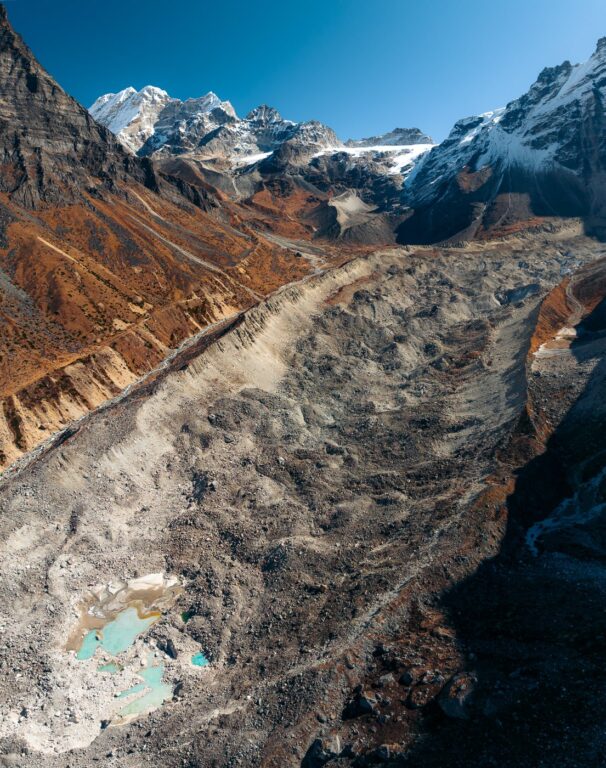
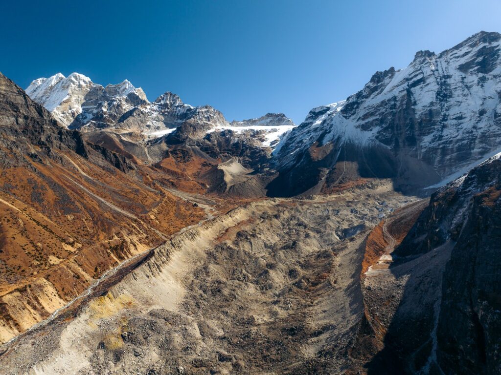
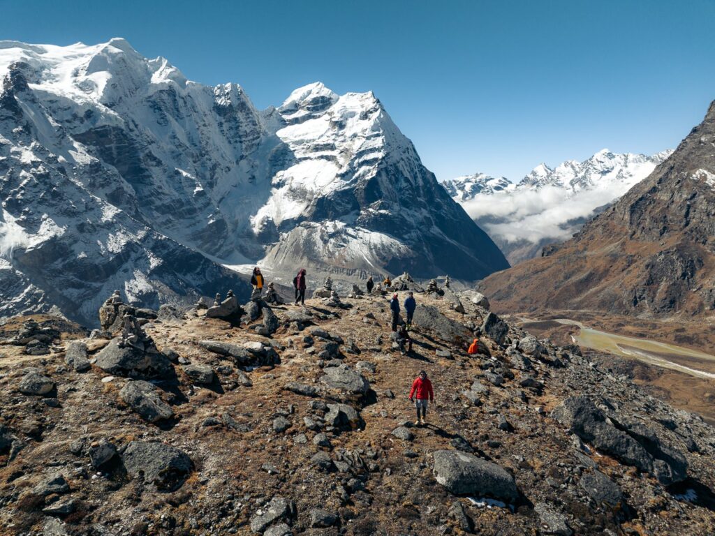
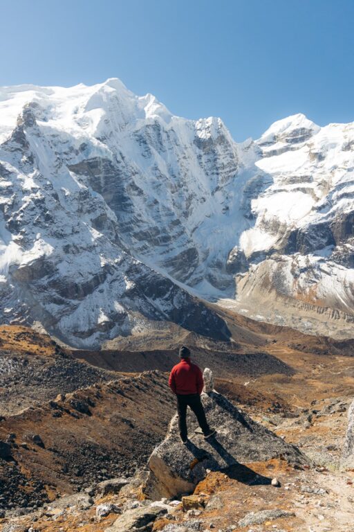
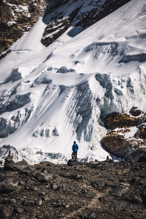
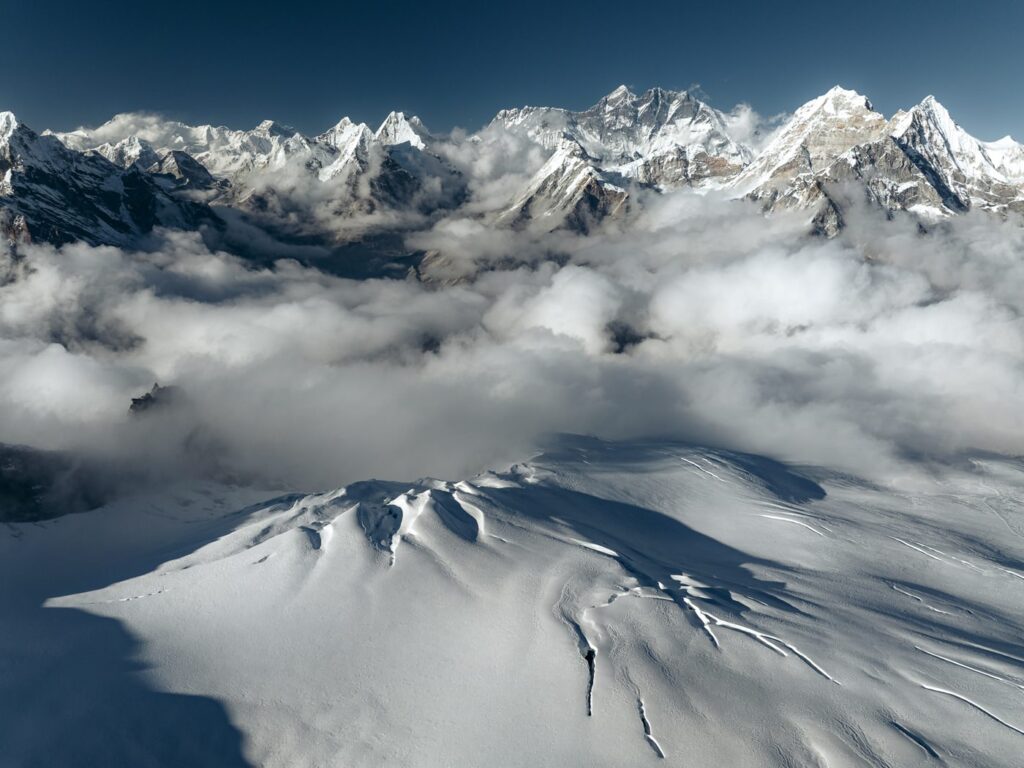
Excited, we began the planned acclimatization hike to the small hill beside Khare (Khare Ri) without our backpacks. It took us roughly one hour to reach the top, where we sat and then explored a little further on, trying to spend as much time as possible at the elevated altitude. I took the opportunity to photograph some of the nearby glaciers with my telephoto lens.


After the descent, Gyalje took us for a brief training session involving the basic use of jumar for ascending and a figure eight descender on a fixed rope. Having just completed the basic mountaineering course at HMI Darjeeling a couple of weeks prior, this wasn't really necessary for most of us. However, this was Haylea's first time even wearing crampons and she did not have much previous experience in mountaineering– so, the training was very useful for her.
We spent the rest of the afternoon packing our bags for the summit trek and then relaxing and fueling up with a big feed at Refuge Lodge. The lodge allowed us to leave all of the non-necessary climbing gear and clothes in a luggage area, which meant we could climb with a much lighter load.


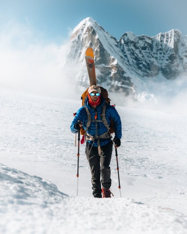
Day 11: Trek From Khare to Mera Peak High Camp (5800 M)
- Duration: 5-7 hours
- Total ascent: 920 m
- Total descent: 20 m
While it is possible and probably better for acclimatization, to summit Mera Peak in three days from Khare, we decided to skip the lower Mera Peak Base Camp (5200 m) and head straight up to Mera Peak High Camp.

Apparently, this is the more popular itinerary and worked well for me. However, as you'll read about further below, Haylea did not get enough time to acclimatize to this schedule and suffered altitude sickness just below the summit and had to turn back.
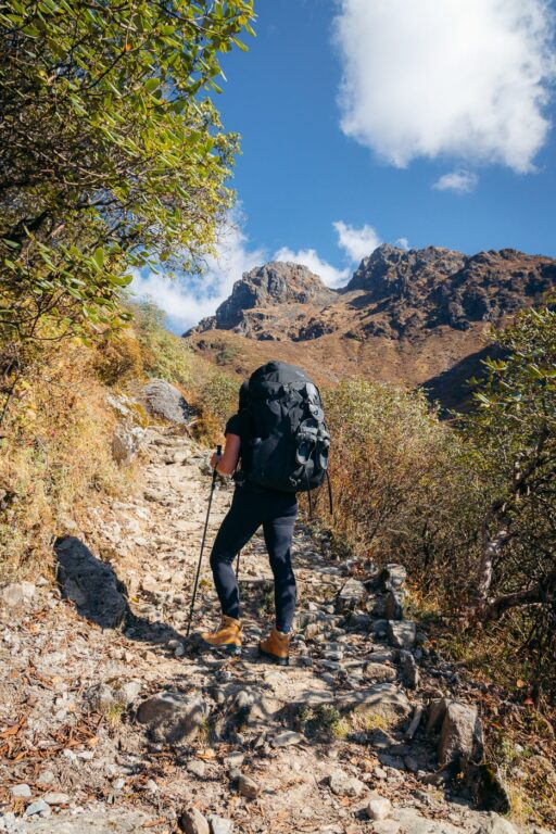
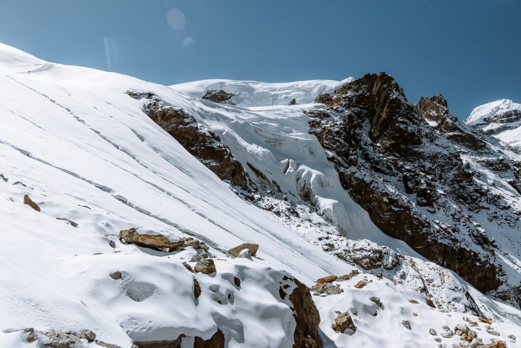
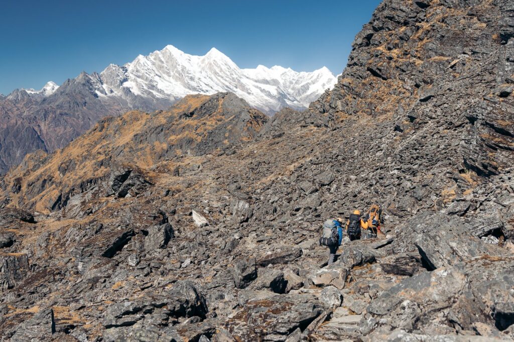
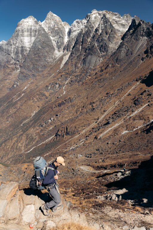
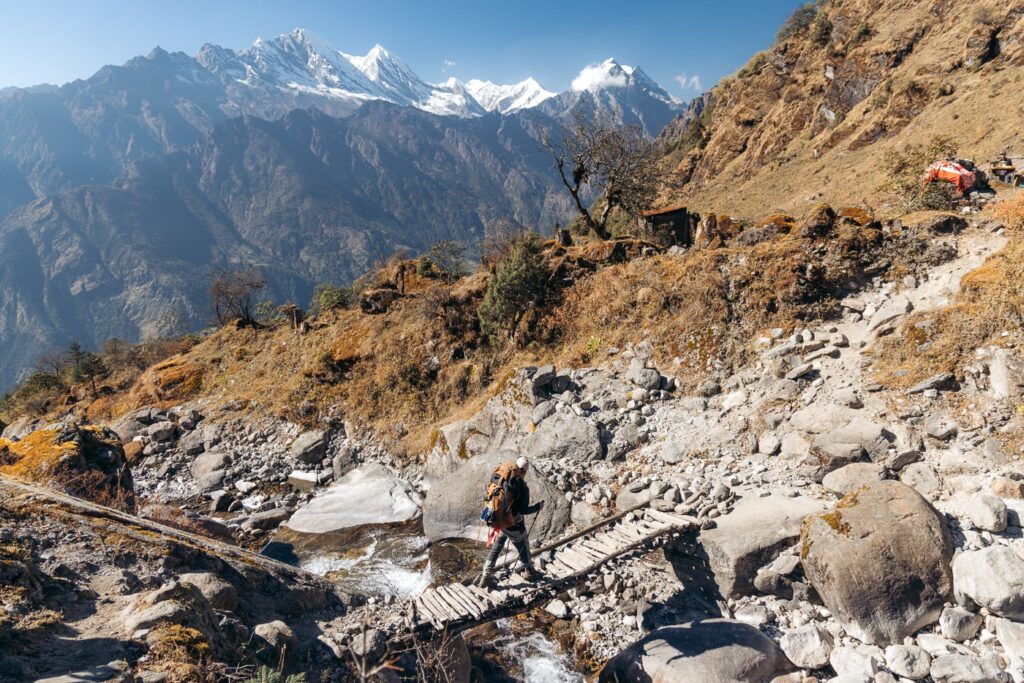
The trail to Mera Base Camp from Khare begins by climbing the small hillside to the east of the village. Soon, it begins climbing the edge of a steep ridge, crossing eroded sections of scree and large boulders. After roughly 1.5 hours, we arrived at Mera Peak Base Camp, which sits just above the crampon point 10 minutes further on (beginning of the glacial traverse).


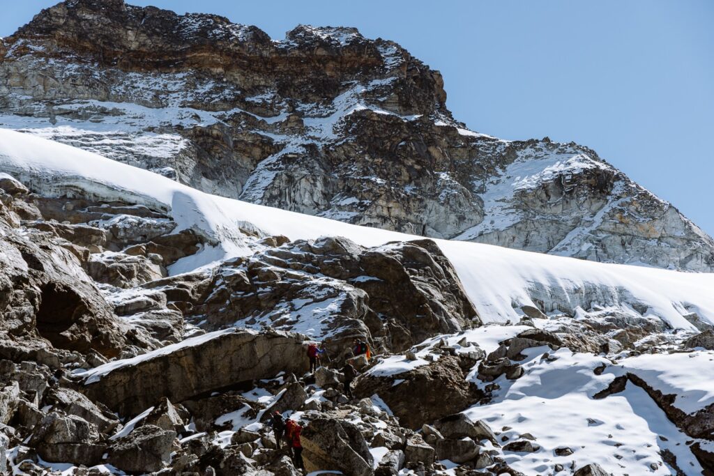

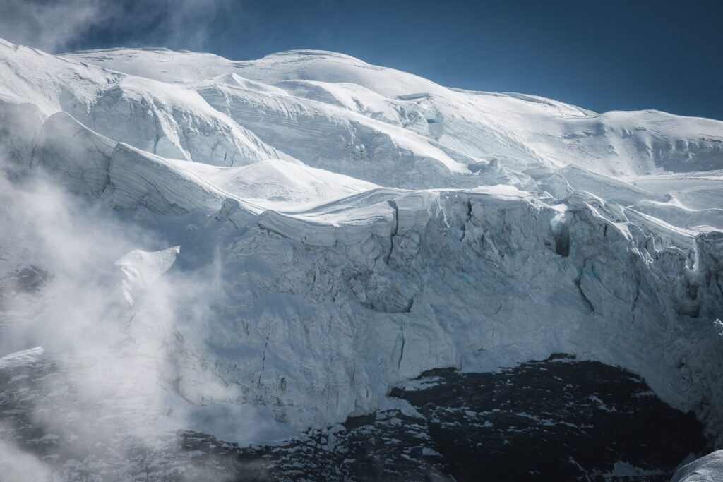
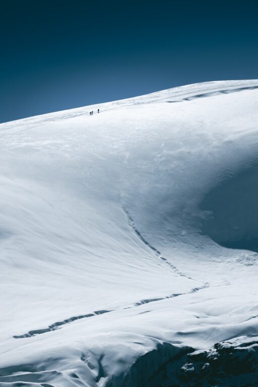
Here, we attached our crampons and began the steep climb toward High Camp via the Mera La. The snow conditions were quite hard and compact, making the ascent technically easy yet physically demanding due to the steepness and high altitude.


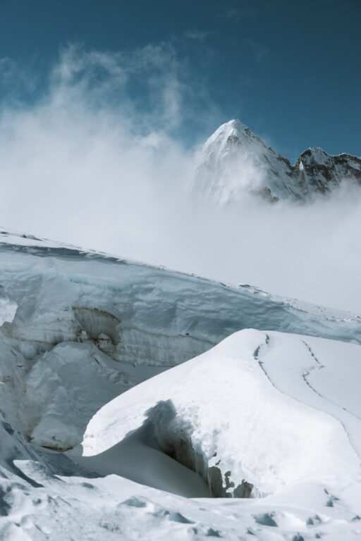

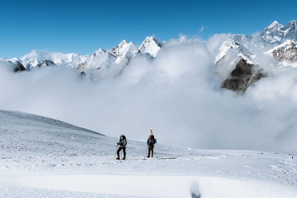
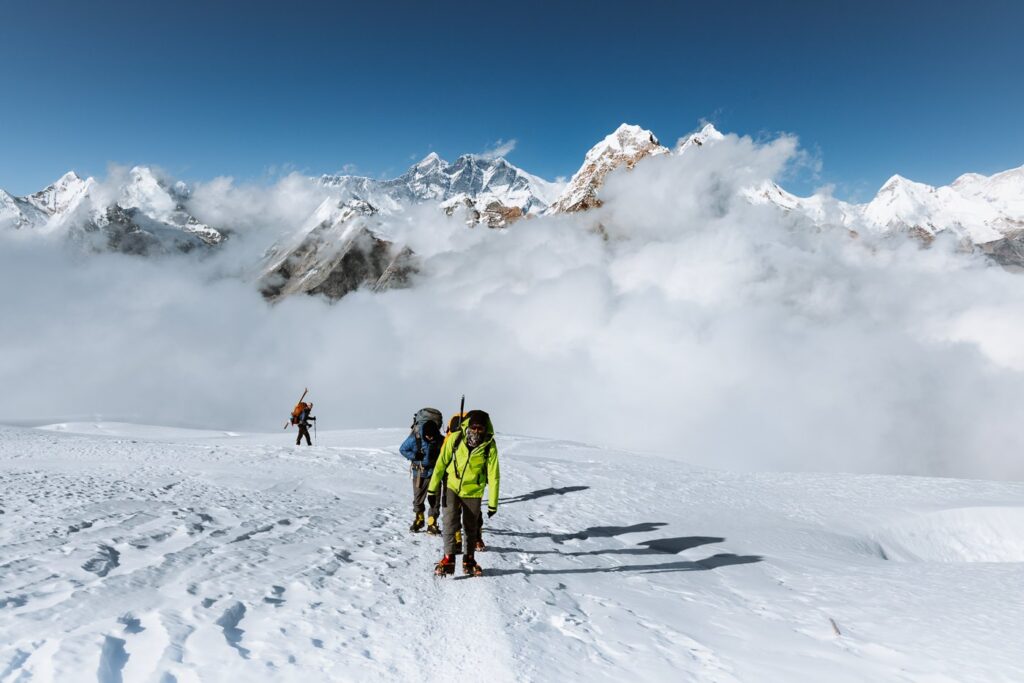
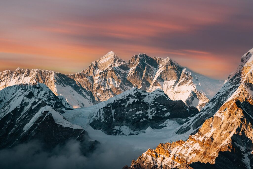
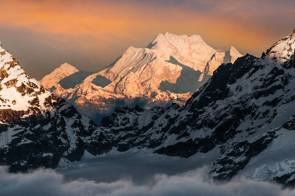
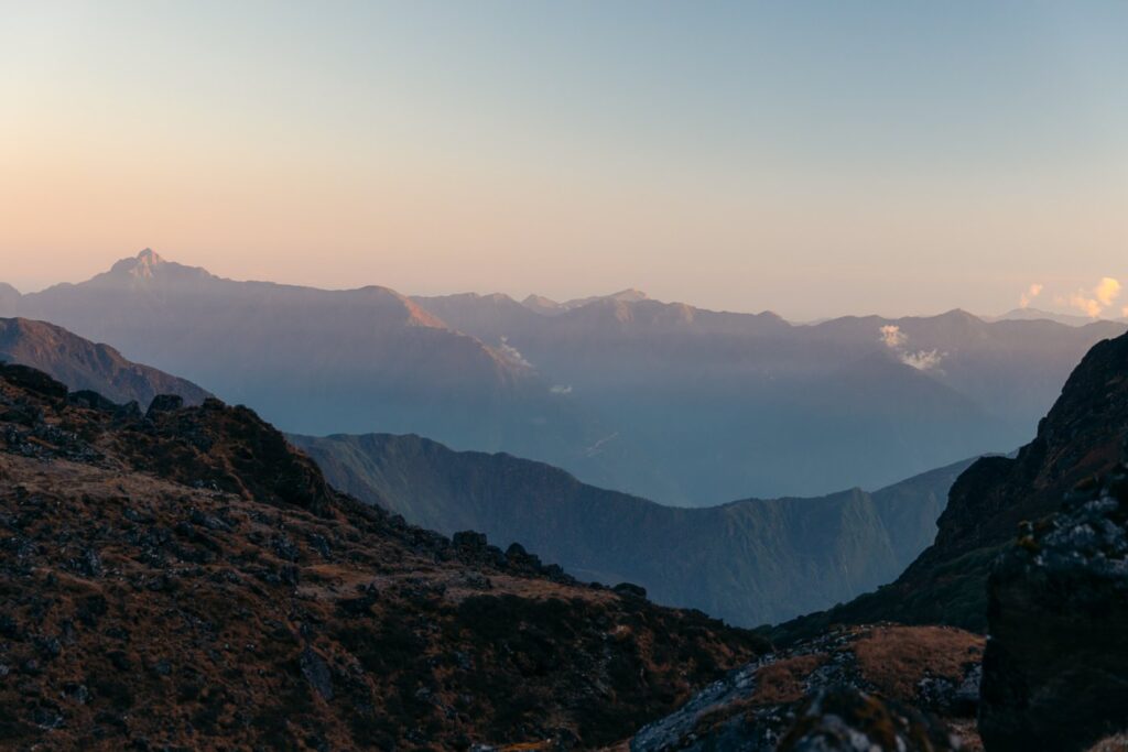
We had a short lunch break upon reaching the Mera La, where we admired the turquoise-blue glacier below us. Shortly after, we began the final push toward Mera Peak High Camp. At roughly 5500 meters, we turned around and noticed that we had our first view of Mount Everest, Lhotse, Makalu, and Cho Oyu.


The final push to camp was steeper than the first section and after a total of 6 hours of walking, we arrived.


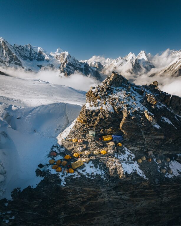

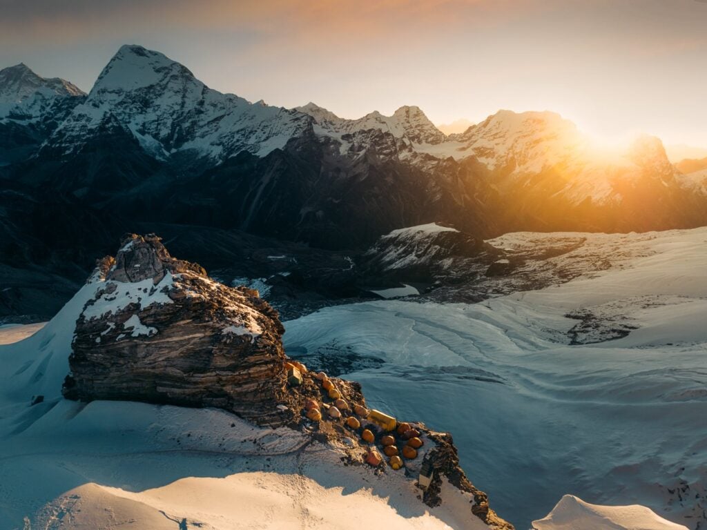
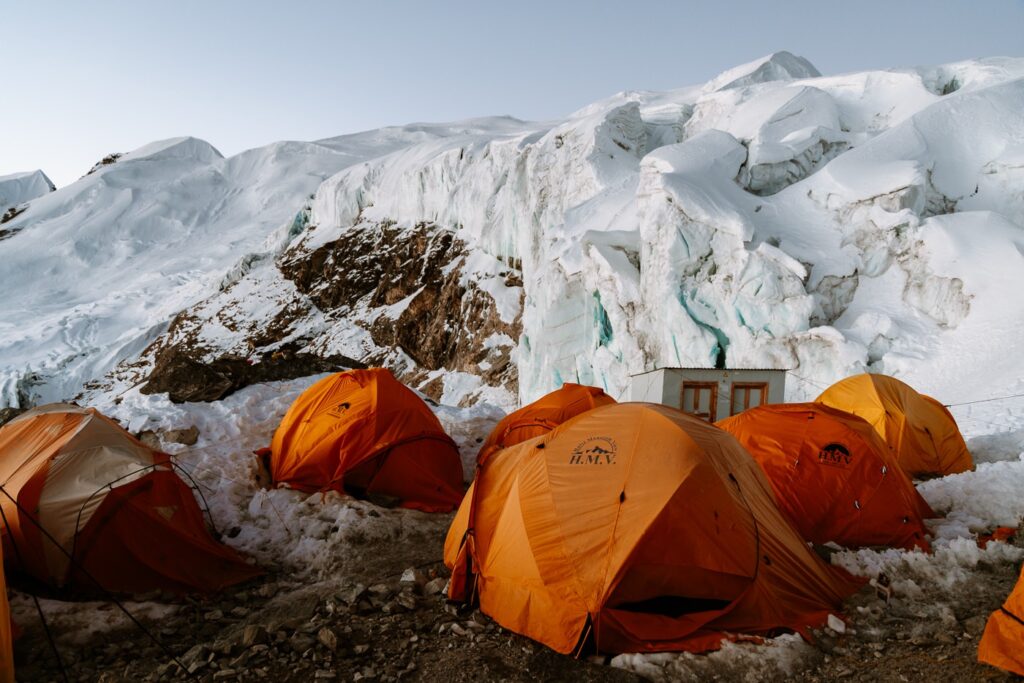
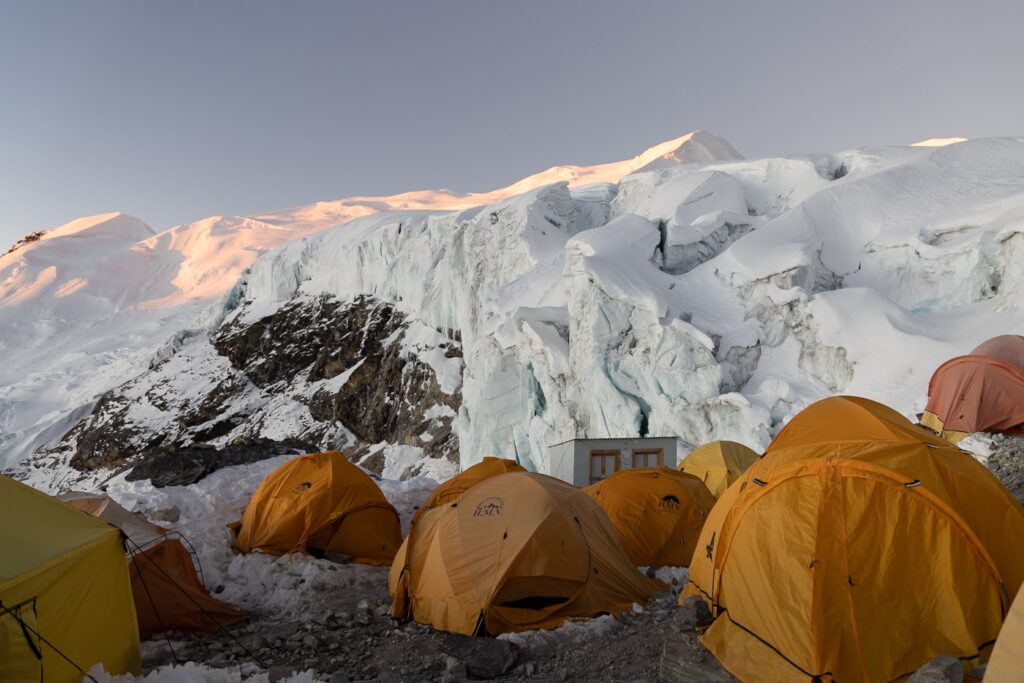
Mera Peak High Camp is perched on the edge of a steep cliff below a small rocky outcrop. On either side are imposing, ancient glaciers providing shelter from harsh winds. As soon as we arrived, Gyalje set up our expedition tent and began preparing tea and dinner.

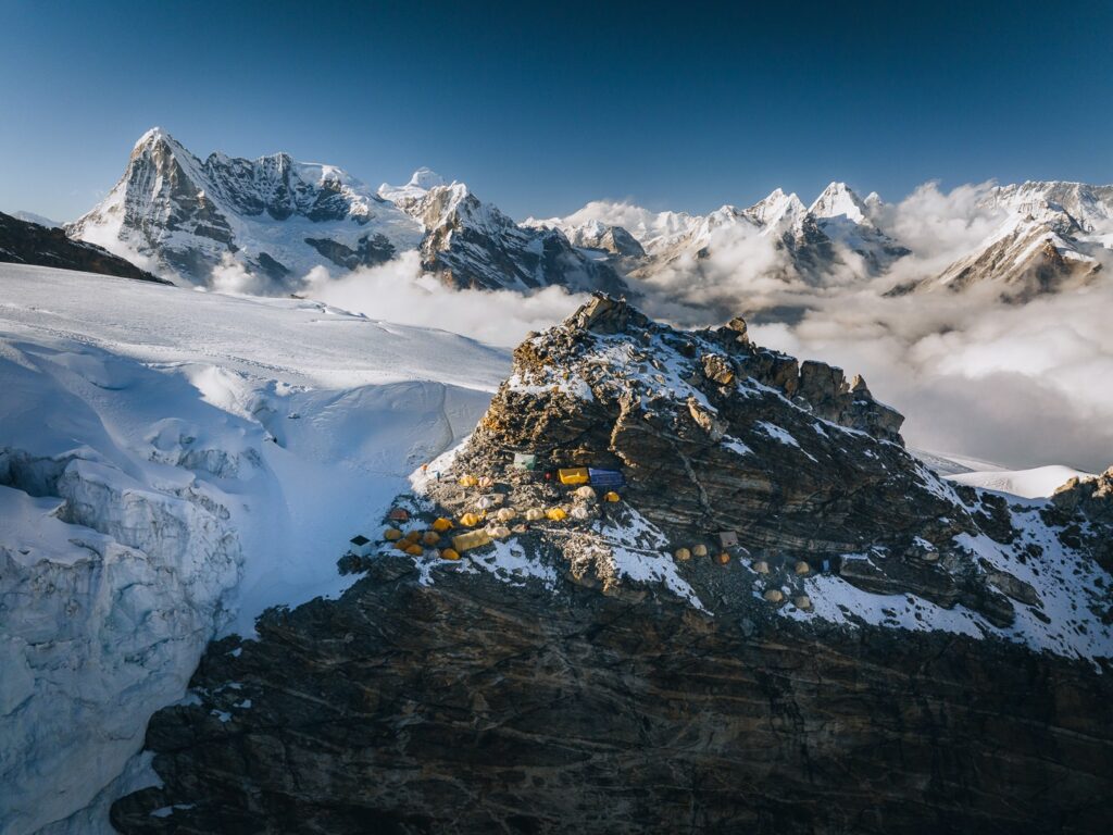

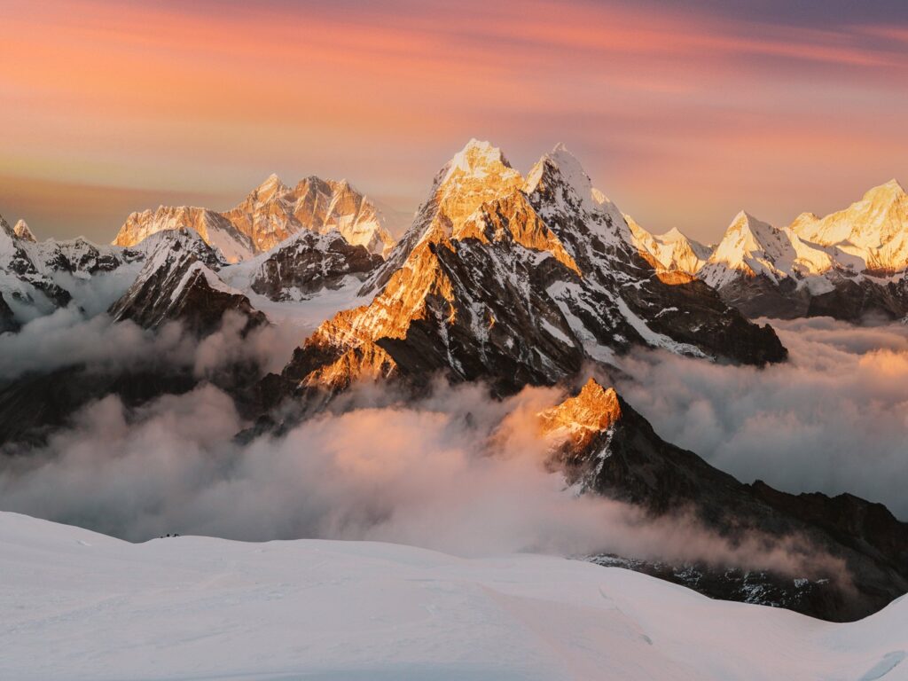
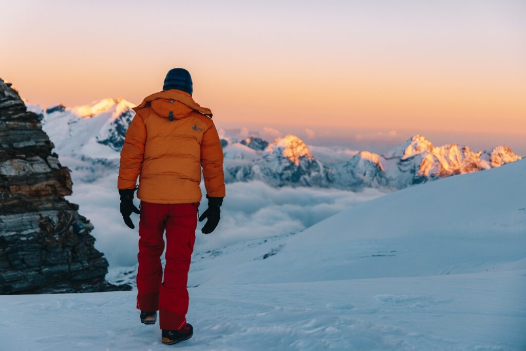
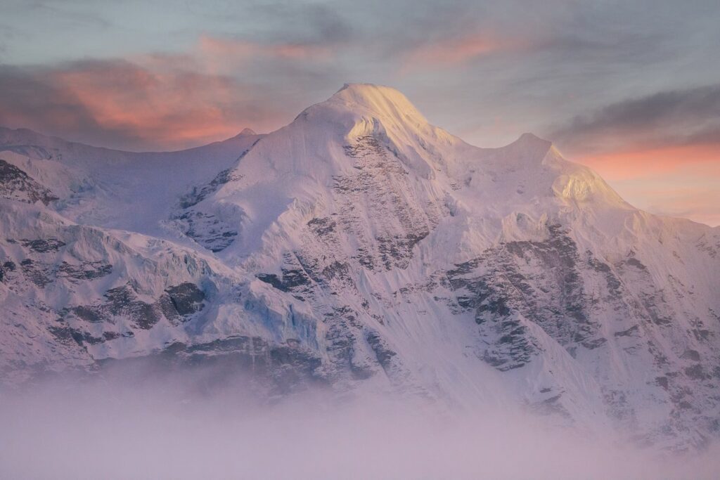
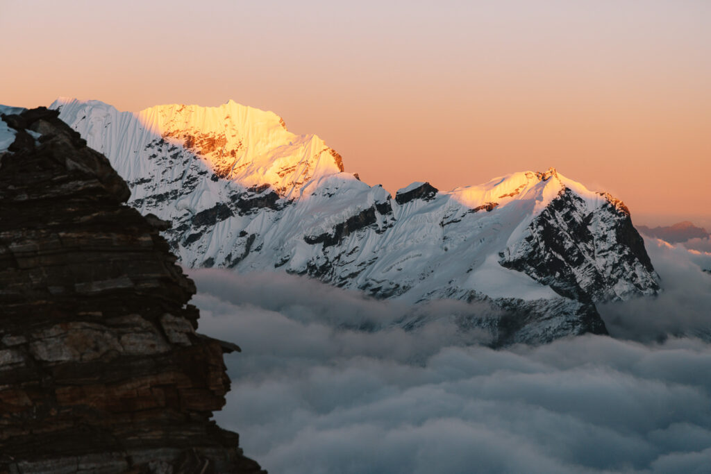
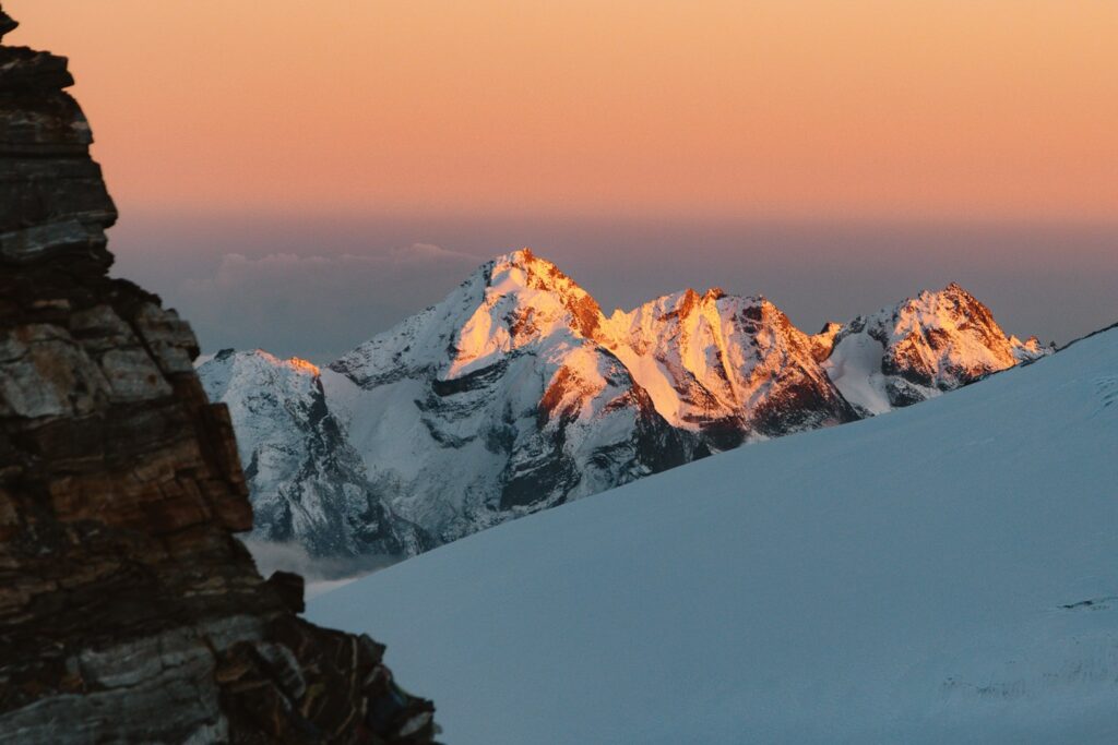
We spent the rest of the afternoon admiring what was one of the most magical sunsets of my life. However, as soon as the sun set the temperature dropped to -10ºC so we quickly retreated to our tents, got in our bags, and tried to get some shut-eye before the 1 am wake-up call.
Below are some of my favorite shots from that sunset at Mera High Camp.


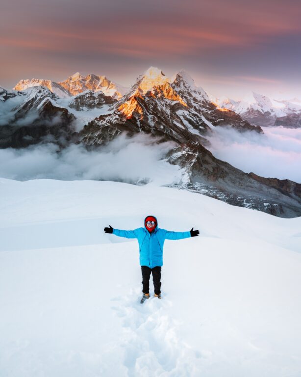
Day 12: Mera Peak Summit (6476 M) to Khare (4900 M)
- Duration: 8-10 hours
- Total ascent: 696 m
- Total descent: 1615 m
After a sleepless night, we ate a porridge breakfast at 1 am and slowly crawled out from our bags and strapped on our harnesses, mountain boots, and crampons. Weather conditions were okay besides the high winds and cold weather. The temperature was -25ºC when we departed and we were very grateful that we brought the huge summit down jackets and extra socks.
By 2 am, we were all roped up together and began the slow, cold climb to the summit of Mera Peak. The trail was very much the same as the day previous, yet this time the wind was whipping our faces and the altitude, combined with the severe cold really slowed our pace.
We were all feeling great, besides Haylea who had terrible headaches the night before. Our fears became reality when she started to lose orientation and had quite bad spells of dizziness and nausea. She decided to push on a little further but was on the point of spewing as we approached just short of the summit.

Unfortunately, for me, this meant that I also couldn't watch the sunrise from the summit, but I made the call to rope her up and bring her back down to High camp so that the remainder of the team members could.
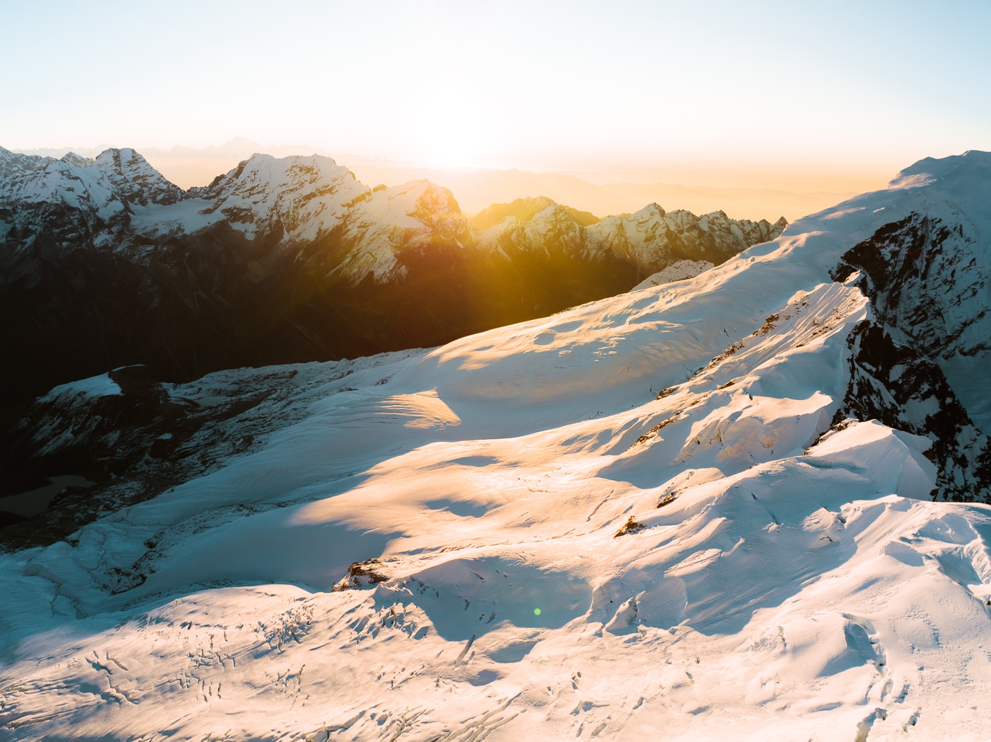


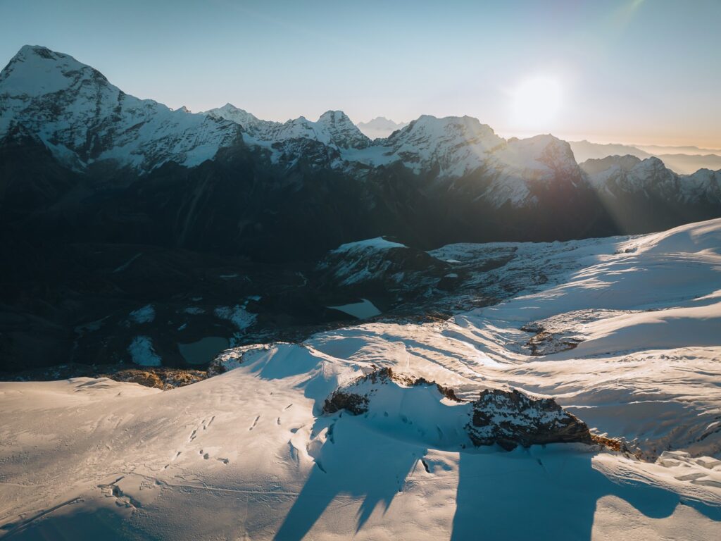

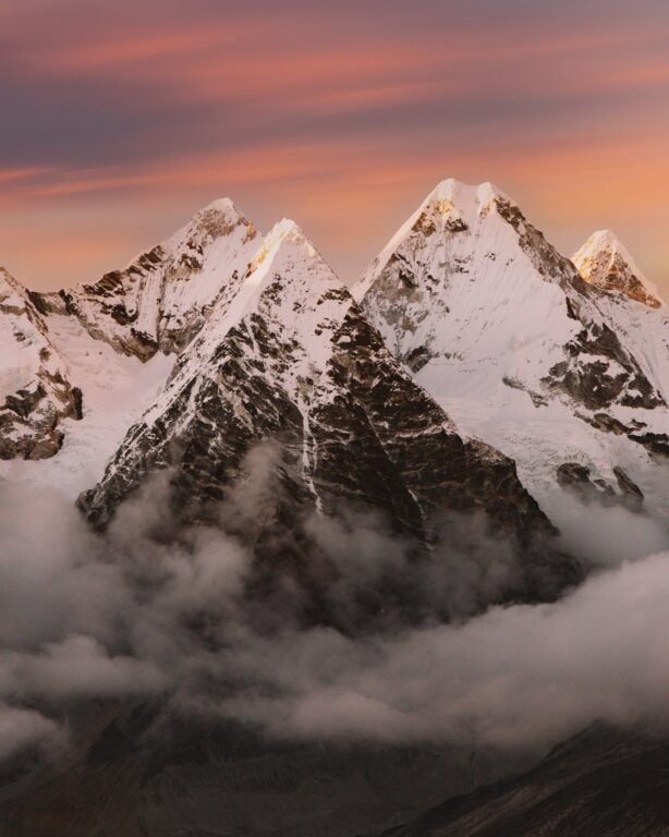
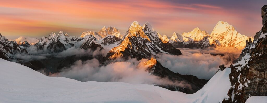
Luckily, the sunrise view from High Camp was unbelievably beautiful. From here, we could see five of the world's highest mountains, including Cho Oyo, Kangchenjunga, Makalu, Lhotse, and Everest. I snapped plenty of photos and flew my drone around the massif, capturing some of my favorite alpine footage to date. Haylea's condition was also improving at the lower altitude of High Camp. But, I knew that she should descend further soon.

So, after the successful summiteers returned to camp, we quickly ate some morning tea and began the long, steep descent back to Khare. Upon reaching Khare Haylea's headache remained but she felt much better.


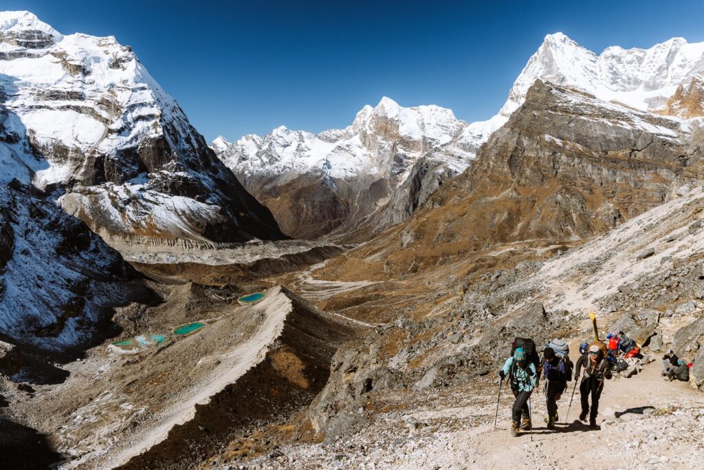
Day 13: Trek From Khare to Kothe (3600 M)
- Duration: 4-6 hours
- Total ascent: 60 m
- Total descent: 1360 m
Stoked about the views but admittedly a little bitter about how close Haylea and I got to the summit, we began the long, sweeping descent from Khare, passing Thangnag on the way. This was the only day whereby we doubled back on our route, and we were very happy about this as the walk down the valley was kind on our battered knees.
Admittedly, we slept in a little in Khare, which meant a late start. We arrived at Kothe with our headlamps on but the local Sherpa woman at Mera Lodge did not mind and began cooking potatoes, rice, and dal for us.
Dropping nearly 3000 meters of altitude in 48 hours definitely felt strange on our bodies. That night we got some of the best sleep we'd had in the past two weeks.


Day 14: Trek from Kothe to Thuli Kharka (4230 M)
- Duration: 5-7 hours
- Total ascent: 1100 m
- Total descent: 470 m
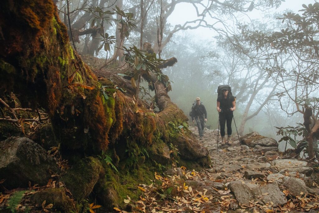
The trail from Kothe to Thuli Kharka is regarded as one of the most difficult trekking days on this route. It begins at the back of Kothe, hidden behind the "Namaste Lodge". From here, the trail begins climbing gently through dense pine and rhododendron forest before descending down the Hinku Valley to meet with the river further downstream.


After being in the cold, high altitude for such an extended time, we were really enjoying the warm, sunny weather. We found a beautiful blue swimming hole on the river and a few of us took a dip.
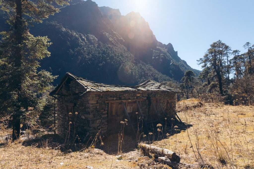
Shortly after, the trail cuts back into the forest and climbs a ridge, passing a few small streams and some abandoned stone buildings. At the halfway point, there is a small village where we stopped for a hot noodle lunch.


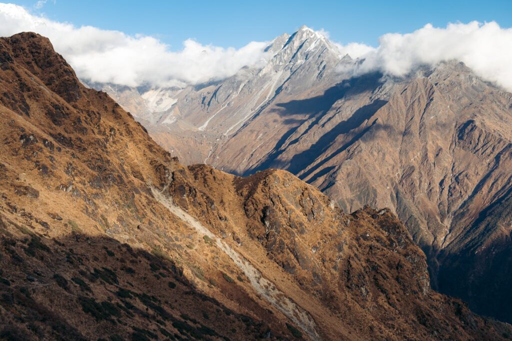

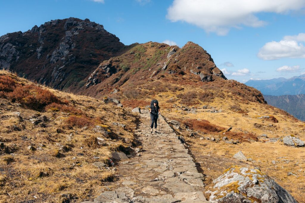
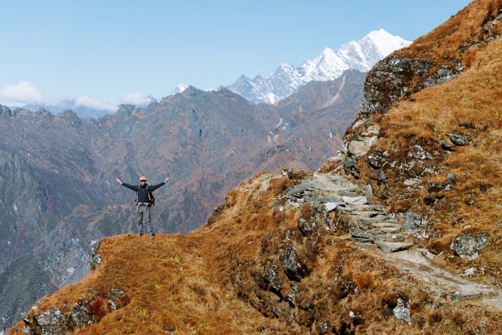
This marks the start of the steep ascent up to Thuli Kharka, gaining altitude again quickly through sections of exposed, rocky meadows and dense pine jungle.
As we climbed, we had a fabulous view of Mera Peak, as well as, across the valley, the descending trail from Panch Pokhari that we used a week prior.

Approaching Thuli Kharka, we gained a small pass at just over 4300 meters and then descended gently before sharply climbing to another pass slightly higher than the one previously. This trail was not in great shape when we climbed, with signs of landslides and a narrowing, worn track.


Finally, we began the undulating path to Thuli Kharka, dropping down wild, rocky terrain and cutting the corner where the township suddenly appeared in view.
We stayed in a small, stone lodge run by a very friendly Sherpa lady who fed us one of the best dal baht meals we'd had so far and lit the fire just for us.


Day 15: Trek from Thuli Kharka to Lukla (2800 M) Via Zatrwa La (4610 M)
- Duration: 5-7 hours
- Total ascent: 425 m
- Total descent: 1855 m
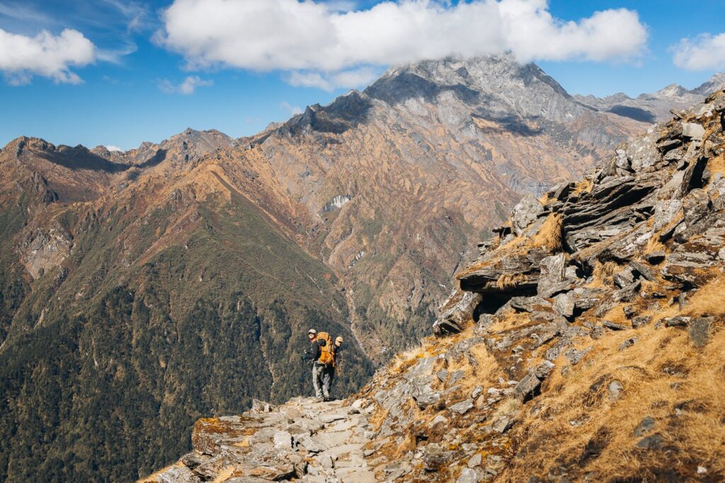
The final day of trekking was upon us. Today, we'd climb the Zatrwa La Pass and drop nearly 2000 vertical meters back down to Lukla.
After an early start, we set off for the pass. The trail is clearly visible as it steeply winds up the hillside directly behind Thuli Kharka. On the way up, we were treated to great views of the village overlooking the rolling jungle hills of the Lower Himalayas below.

Following roughly an hour of trekking, we gained the Zatrwa La (Zatrwa Pass) at 4610 meters. At the top, we were surprised to see a small tea hut. We decided to drink tea and relaxed here for a brief moment before beginning the descent.


Immediately after the pass, the rocky trail descends slightly and then climbs yet another pass. From here, the long, steep descent begins all the way from Lukla. Honestly, this is one of the steepest sections of the Mera Peak hike and I would not like to have to climb it from the other side without any existing altitude acclimatization.


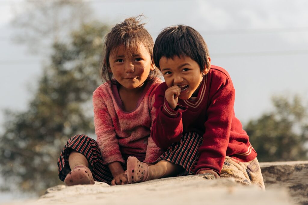
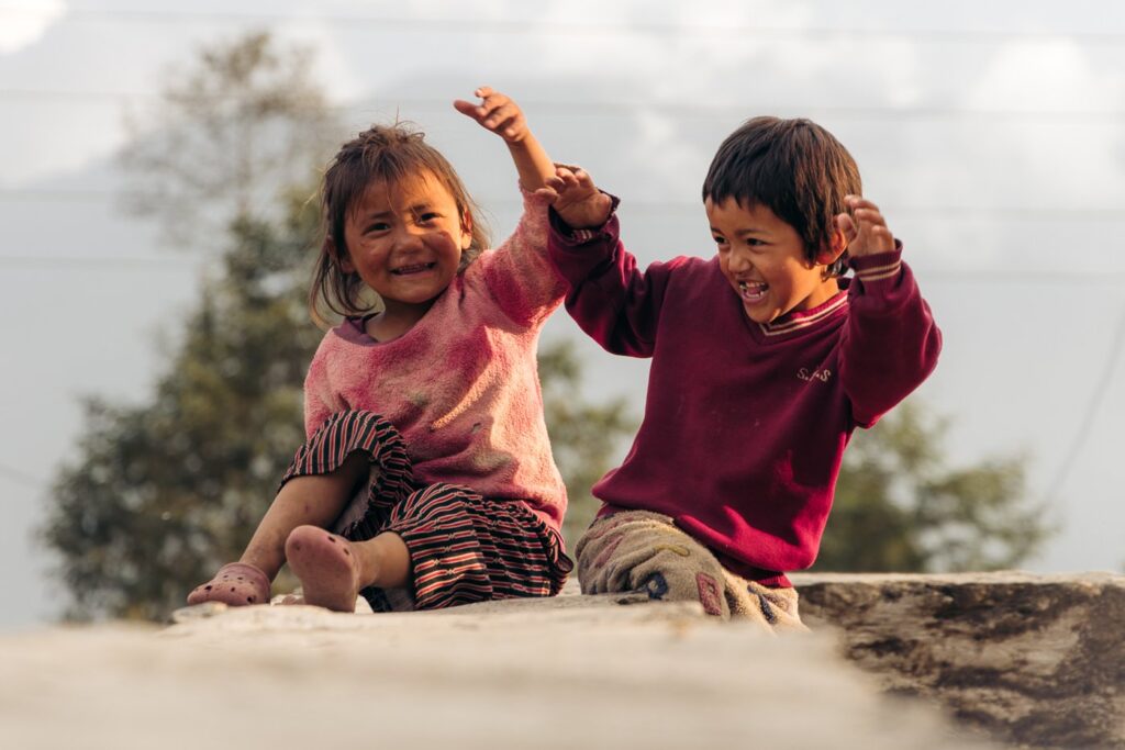
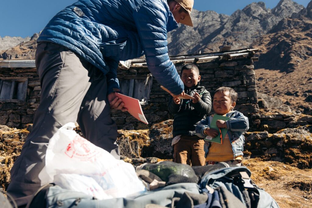
Soon, we descended back down to roughly 4000 meters and arrived at the small village of Kharkateng, where we sat and enjoyed lunch and met some shy kids who didn't mind their portrait taken.


Dropping below 4000 meters again, we began to gradually become immersed in increasingly denser forest terrain. Soon, we noticed Lukla in the distance, illuminated by sun rays bursting through the Himalayan clouds.
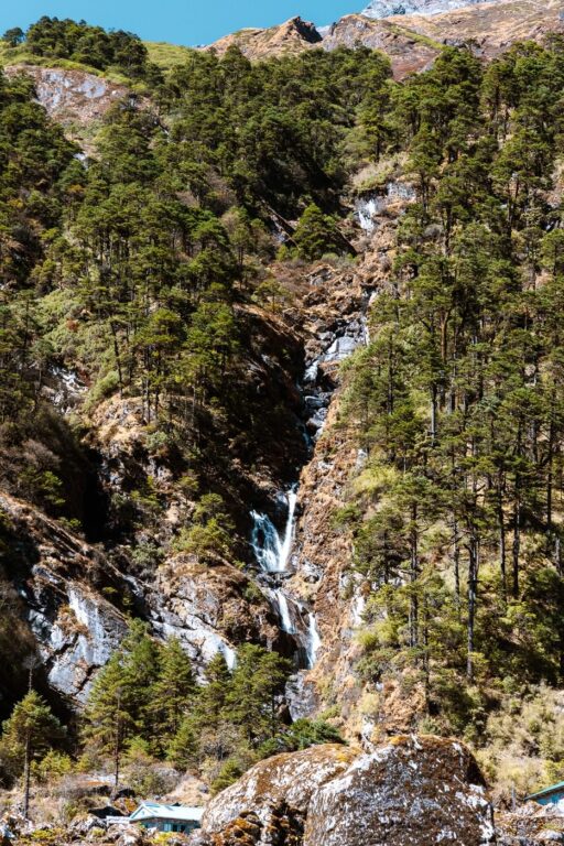
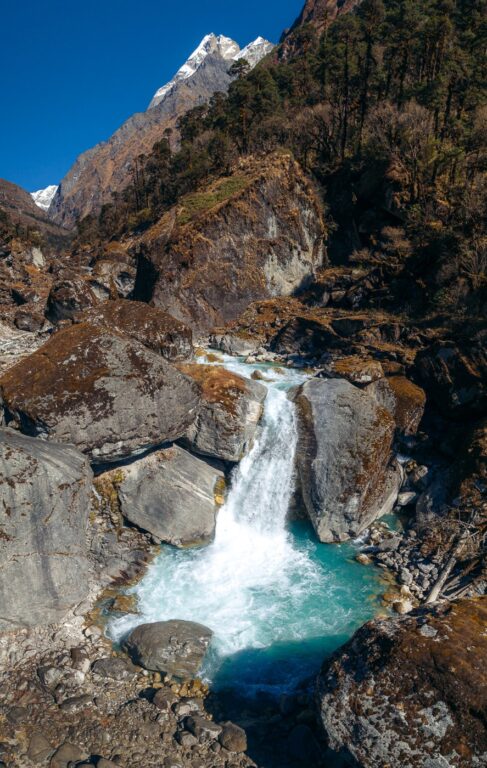
The rest of the final day was quite relaxing once the trail began to level off slightly to a comfortable decline. We passed several waterfalls and flowing streams where we filled our bottles.


Arriving at Lukla was a strange feeling. I noticed that the village had developed a lot in the past three years since I'd last been there. We celebrated the end of our self-guided trek to Mera Peak with burgers, milkshakes, and warm apple pie.

I recorded the hikes each day using my Garmin GPS watch. The GPX map and exact routes are available on my Strava.
Day 16: Fly to Ramechhap & MiniBus to Kathmandu
Unfortunately for us, the Civil Aviation Authority of Nepal had transferred all inbound and outbound Lukla flights to the village of Ramechhap. This meant we were unable to fly directly to Kathmandu airport. I tried to gather some information on how long this policy would last, but it seems it might be in place for a while.
On the advice of Jangbu Sherpa, we had purchased tickets for the following day, giving 2-3 extra days on top of our original itinerary. However, thanks to Jangbu, who seems to have contacts everywhere in the Khumbu, he changed our flights for this afternoon for us after a quick WhatsApp message.
However, due to busy flights, we were put on flight 11 out of 12, which meant waiting at a cafe for most of the day. We didn't mind the downtime and used the opportunity to catch up with the online world after two weeks off the grid.

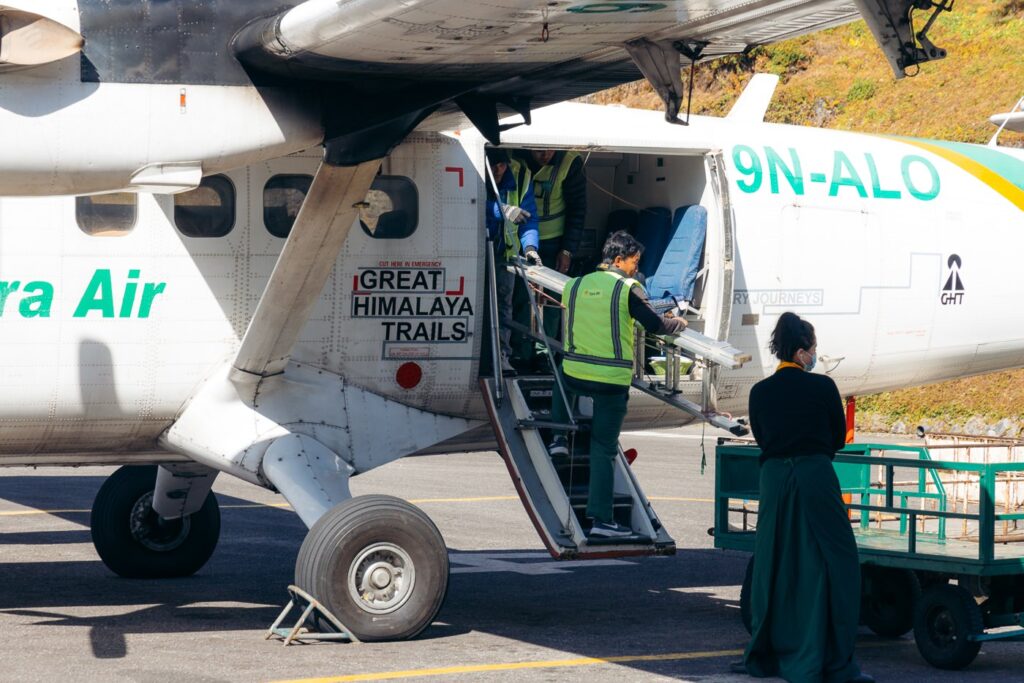

The flight to Ramechhap was a smooth one, but I was a little bit nervous since the last time I was in Lukla, I witnessed a devastating plane crash that resulted in the deaths of the pilots and airport guards.
After roughly 15 minutes, we landed in the Nepali plains at the remote village of Ramechhap. From there, we jumped in a shared minibus (2000 Nepali Rupees), which took us and eight other passengers all the way to Kathmandu. This road is a typical Nepali road, with some nail-biting sections and hairpin turns on the edge of massive drops.


After six hours, we arrived in Thamel during peak traffic hours. We checked into the amazing Flock Hostel where we'd left our baggage and enjoyed a well-deserved wood fire pizza in town.
Options to Continue on from Mera Peak (Mera Peak to Island Peak or Baruntse)
Being an entry-level and relatively easy trekking peak, Mera Peak is often utilized to prepare for bigger ascents and more technical climbs like nearby Mount Baruntse (7162 m) or Makalu (8481 m).
Of course, these expeditions will need to be arranged with a guiding company.
However, it is possible to save some money for expeditions to nearby Khumbu peaks by trekking to Baruntse Base Camp (5640 m) independently from Khare after the Mera Peak summit. However, this route includes the infamous Amphu Lapcha pass, which is regarded as one of the toughest in Nepal. In fact, it is apparently more difficult than climbing Mera Peak or Island Peak. As a result, you'll need some proper mountaineering equipment for this pass. Refuge Lodge told me that they can organize a guide and gear for the Amphu Lapcha pass for the cost of $800 USD.
Alternatively, some trekkers combine Mera Peak with a climb of the popular trekking peak, Island Peak (Imja Tse 6150 m), or to prepare for an Ama Dablam (6812 m) expedition. It will take three days to reach the village of Chukhung from Khare via the Amphu Lapcha pass, where you will find the nearby Island Peak base camp.

Where to Stay in Kathmandu (Thamel) Before & After The Climb
The trekking and tourist hub in Kathmandu is called Thamel. This is where you will find all of the best trekking shops, hostels, restaurants, bars, and hotels in Kathmandu. If you're planning a trek in the Himalayas, you'll want to find a hotel or hostel that allows you to leave your luggage there until you return. Below are the three best accommodation options that offer this service.
- Kathmandu Guest House - long famous for being "the place" where climbers stay before big expeditions. Be prepared to meet lots of serious mountaineers going to or returning from major Himalayan expeditions.
- Aloft Kathmandu - overlooking the city from the heart of Thamel, Aloft is one of the best places to stay before big expeditions and is very popular with climbers and trekkers. You'll get access to a huge indoor pool, a massive gym, and a truly epic buffet breakfast.
- Flock Hostel - the best backpacker hostel in Thamel. This place has very clean dorms with curtains and private rooms with excellent views. There's also an amazing on-site cafe and restaurant serving delicious coffees and international meals and is rated #1 on Trip Advisor for breakfast and dinner in all of Kathmandu!

FAQs About Climbing Mera Peak
Mera Peak is one of the safest 6000-meter mountains to climb in Nepal as it requires very little previous experience in mountaineering. The most dangerous aspect of climbing this mountain is that it is very easy to gain altitude too quickly, which can result in AMS (Acute Mountain Sickness) or more serious medical problems like HACE or HAPE.
It is possible to reach the summit and return to the village of Khare in two days, staying at Mera High Camp. However, some trekkers prefer to do it in three days by adding an extra day at Mera Peak Base Camp. It also takes at least a week to trek to Khare prior to this, and 3-4 days to get back to Kathmandu from Khare. Unforeseen circumstances like poor weather or altitude problems can happen. So, make sure to plan accordingly, leaving plenty of time before paying for international flights from Kathmandu international airport.
Yes, all registered Nepali Sherpa guides will be able to call in a rescue helicopter in case of an emergency. Nepal's Himalayan evacuation systems have improved dramatically in the past years and climbers will typically not need to wait more than 20 minutes for a chopper in good weather.
I can't give medical advice on this blog and it is best to contact your doctor. Many trekkers take Diamox as a preventative for AMS symptoms, but you should be aware of the side effects.
It is a short flight, a 15-20 minute flight.
Yes, on a clear day, five of the world's tallest mountains (8000 m peaks) are visible, including Mount Everest, Lhotse, Makalu, Cho Oyu, and Kangchenjunga. You'll also trek below amazing high mountains including Kyashar and Kusum Kangru.
There are three summits, each over 6000 meters above sea level. These include Mera North (6476 m), Mera Central (6461 m), and Mera South, (6065 m). Most climbers will reach Mera Central but it is also possible to climb Mera North quite easily from here as well.
No, this is a trekking peak. However, this is a good opportunity for beginner mountaineers to gain some basic skills like use of crampons and attaching self-anchors.
The best seasons run between Spring (early April to late May), and Autumn (late September to late October).
Yes, a guide is compulsory to climb Mera Peak as it is a permit requirement.
This mountain is not technically difficult but that doesn't mean that it isn't hard work. 6476 meters is very high and a good level of fitness is required.
While Mera Peak is a taller mountain than Island Peak (6476 m as opposed to 6160 m), Island Peak is considered a more technical and therefore difficult mountain to climb in Nepal due to crevasse crossings etc. However, the trek into Mera Peak is more difficult than the one to Island Peak base camp, since there are many more sections of undulating elevation gain.
More Himalayan Trekking & Climbing Posts
I hope that you've enjoyed this long blog post about climbing Mera Peak in Nepal. I wish you all the luck for your Mera Peak adventure! If you're on the fence about trekking agencies, I urge you to take the less-beaten path via Mahakulung or book a local Nepali Sherpa guide over a western guide to support these communities.
While you're here on my blog, make sure to check out some of my other trekking and climbing posts! I've written extensively about trekking and climbing in the Himalayas, Europe, and South America!

Sarba
Friday 10th of February 2023
Beautifully crafted article about Mera peak trek and climb.
Manaslu Circuit Trek via Larkya Pass 12 Days
Tuesday 31st of January 2023
Visitor will definitely get a great information through your blog. Thanks for sharing.
Himalayan Forever Treks
Friday 20th of January 2023
Its very useful link.