
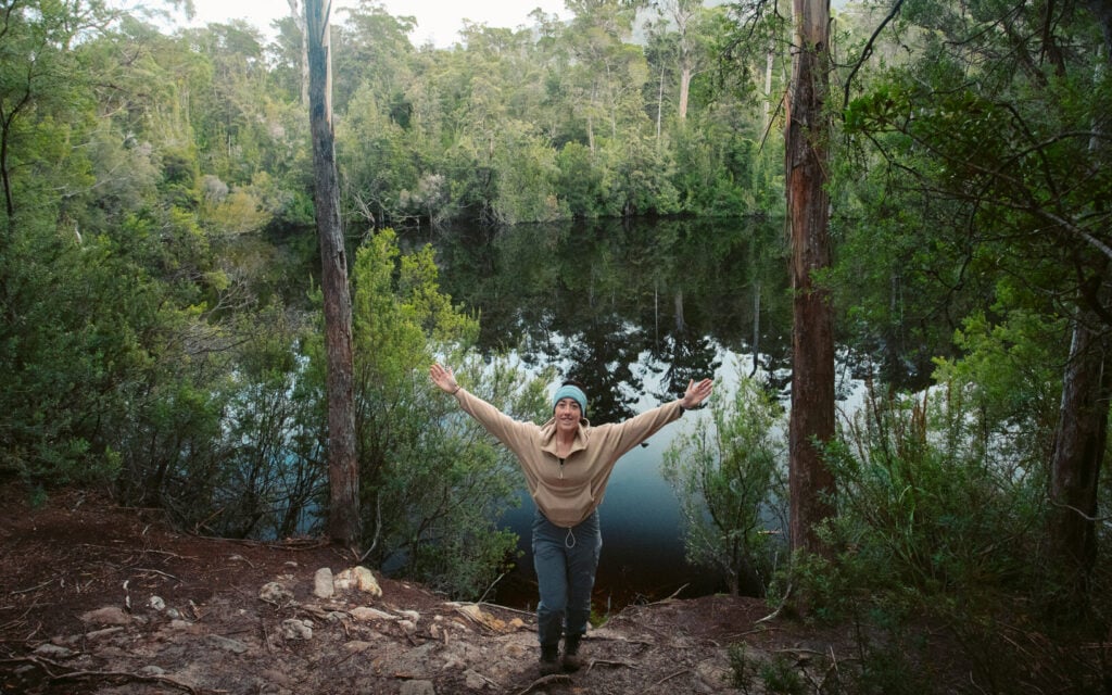
A comprehensive hiking guide with a list of some of the best hikes in Tasmania! Discover some of Tasmania’s best short day walks and multi-day treks in this personalised list of epic Tassie walks to help you plan your trail-chasing adventures in the Apple Isle.
I think it’s fair to say that Tasmania takes the cake for being the best hiking destination in Australia. Besides the obvious fact that the nature here is incredible, what really drew me to Tasmania as a hiking destination is the diversity of the trails.
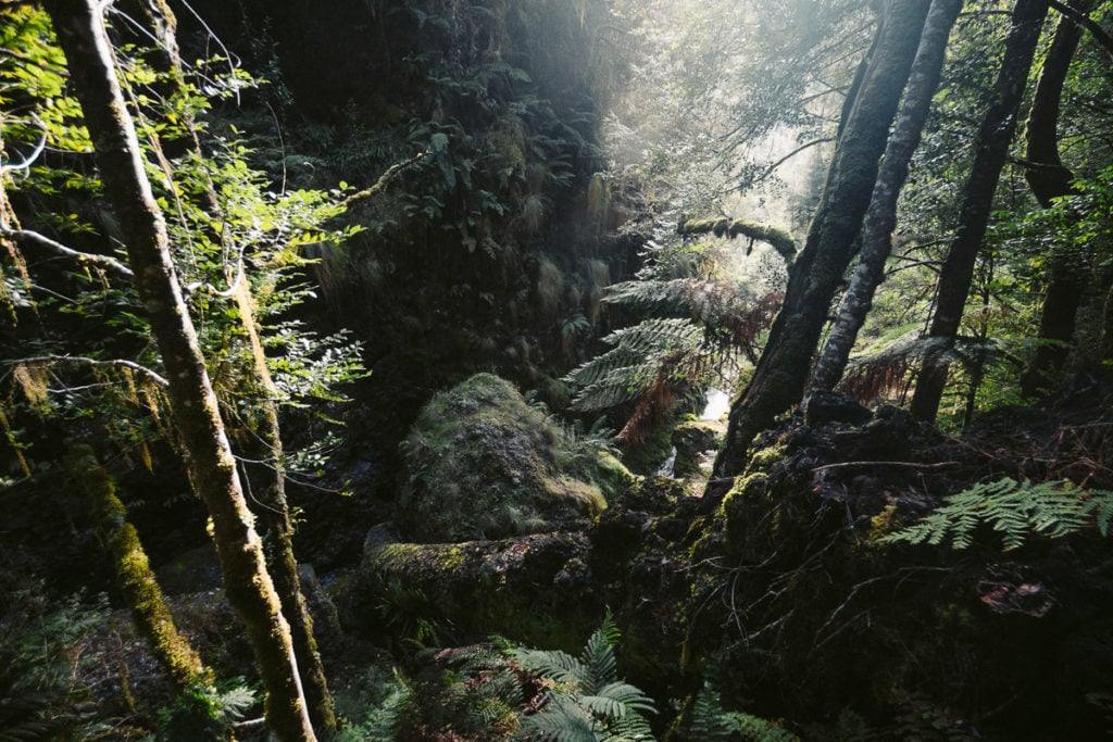
In Tassie, you can find yourself walking rugged coastal tracks, immersed in mind-blowing temperate rainforest and climbing icy mountain peaks– sometimes all on the same day!
I’ve spent several months exploring Tasmania, chasing the best hiking experiences available and photographing my adventures along the way. This Tasmanian hiking guide is a culmination of many incredible memories that I now want to share with you.
I’ve listed all of the best hiking trails in the state, including great Tasmania short walks and epic multi-day hikes and provided my stories to help you explore some of the same.
- A Quick Foreword for This Ultimate Tasmania Hiking Guide
- First: The Best Tasmania Hiking Tours
- Tasmania Hiking Guide: 36 Awesome Hiking Trails in Tassie
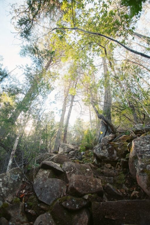
- 1. The Montezuma Falls Track
- 2. The Nut
- 3. The Three Falls Circuit
- 4. Dove Lake Circuit at Cradle Mountain
- 5. Bridal Veil Falls and Champagne Falls Track
- 6. The Mount Wellington Hikes
- 7. Leven Canyon Lookout
- 8. Nelson Falls Track
- The Ultimate Tasmania Travel Resource
- 9. Hogarth Falls Track
- 10. Quamby Bluff
- 11. Hartz Peak Track
- 12. Arve Falls Track
- 13. Bay of Fires Lodge Walk
- 14. Pelverata Falls Track
- 15. Adamsons Falls Track
- 16. Duckhole Lake Track
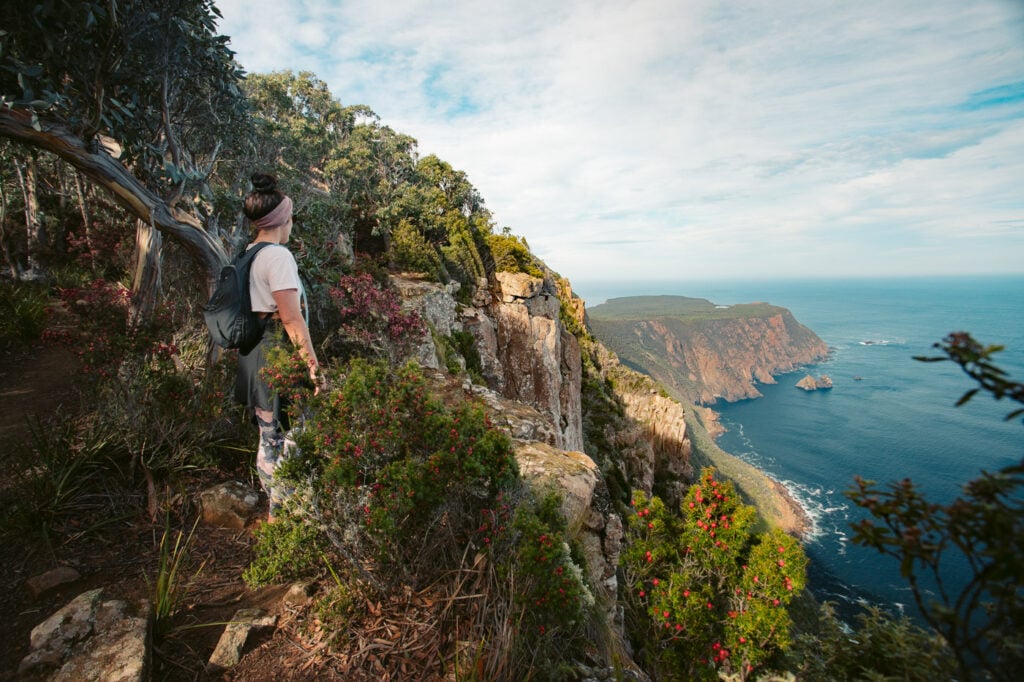
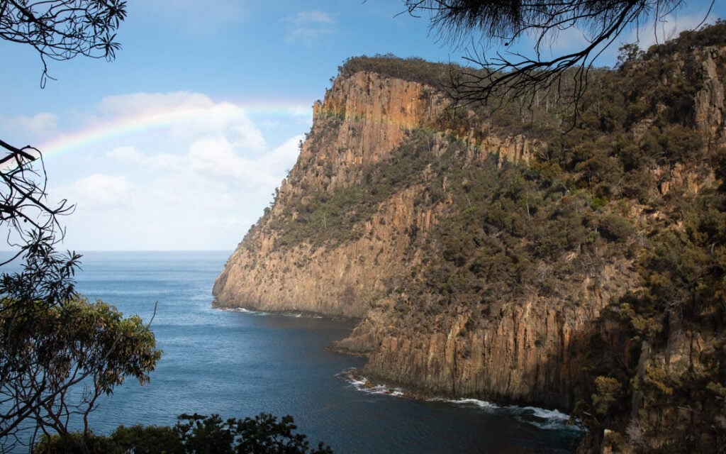
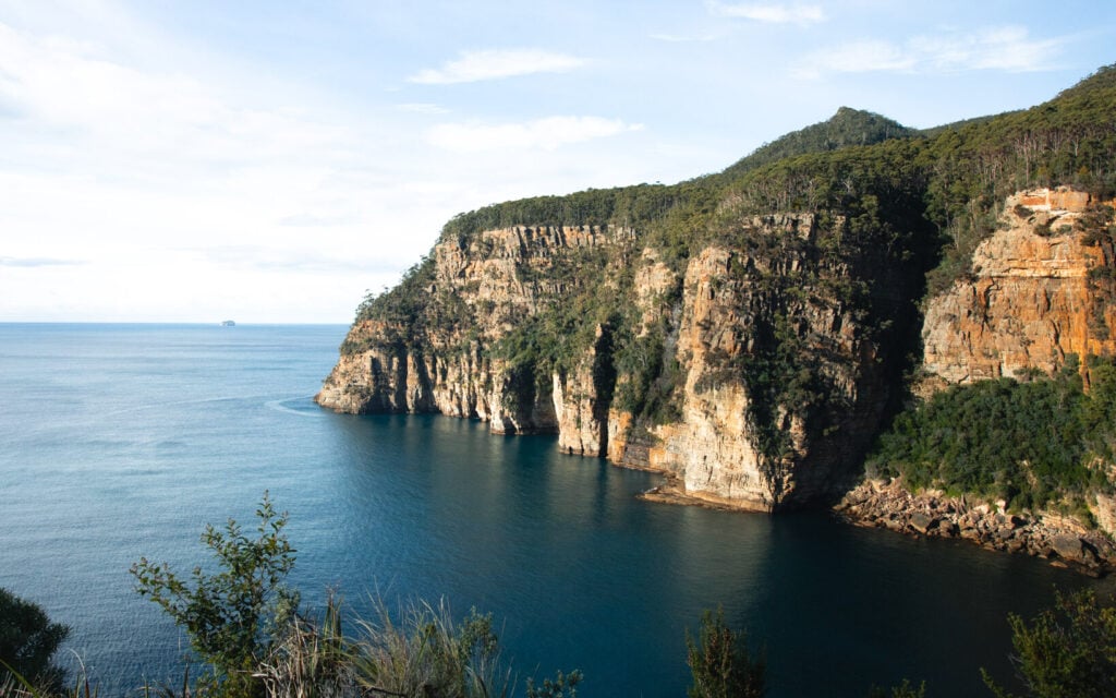
- 17. Cape Raoul Track
- 18. Three Capes Track
- 19. Collins Cap Trail
- 20. Snug Falls Track
- 21. Wellington Falls: Disappearing Tarn
- 22. Tarkine Walks
- 23. Styx Tall Trees Walk
- 24. The Fluted Cape Walk
- 25. Waterfall Bay, Devils Kitchen & Tasman Arch Track
- 26. Maria Island Circuit
- 27. Bishop and Clerk Track
- 28. Mount Maria Summit Track
- 29. Freycinet Peninsula Circuit
- 30. Mount Amos Summit Hike
- 31. Cape Tourville Lighthouse Walk
- 32. The Apsley Gorge Trail
- 33. The Evercreech Falls & White Knights Walk
- 34. Halls Falls Trail
- 35. Saint Columba Falls Track
- 36: Federation Peak
- More Guided Tasmania Hiking Tours
- More Hikes in Tasmania: The Wishlist
- How to Get to the Trailheads: Best Way to Get Around in Tasmania
- Best Areas to Visit in Tasmania For Hiking and Bushwalking
- About the Tasmanian National Park Fee
- More Tasmania Travel, Hiking and Adventure Guides


A Quick Foreword for This Ultimate Tasmania Hiking Guide
To be honest with you right off the bat, listing every single best hiking trail in Tasmania is impossible, or at least a life's mission! The truth is that there are just so many great walks and treks that there are bound to be a few I've missed here.
However, my goal is to create the best free Tasmania hiking resource you'll find online. I've personally hiked all of these trails and given my personal account to help you choose your adventures.
But, at the bottom of this post, you'll find a "hikes in Tasmania wish list" which rounds off some of the tracks and hiking trails that I've yet to hit but plan to soon. There's also a short section dedicated to helping you plan your Tasmania hiking adventures which aim to answer most of your questions.
First: The Best Tasmania Hiking Tours
While there are loads of hikes and epic bushwalks you can take on the Apple Isle, below are the top 3 organized tours you can book online.
- From Hobart: Hike in Freycinet & Wineglass Bay - explore the best beautiful coastal trails on Tassie's east coast in a single day trip.
- From Hobart: Maria Island Active Tour - awesome full day of hiking and exploring Maria Island– the best place in Tassie for wildlife spotting!
- From Launceston: Cradle Mountain Day Tour - experience alpine Tasmania on an epic full-day walking trip in Cradle Country.

Tasmania Hiking Guide: 36 Awesome Hiking Trails in Tassie
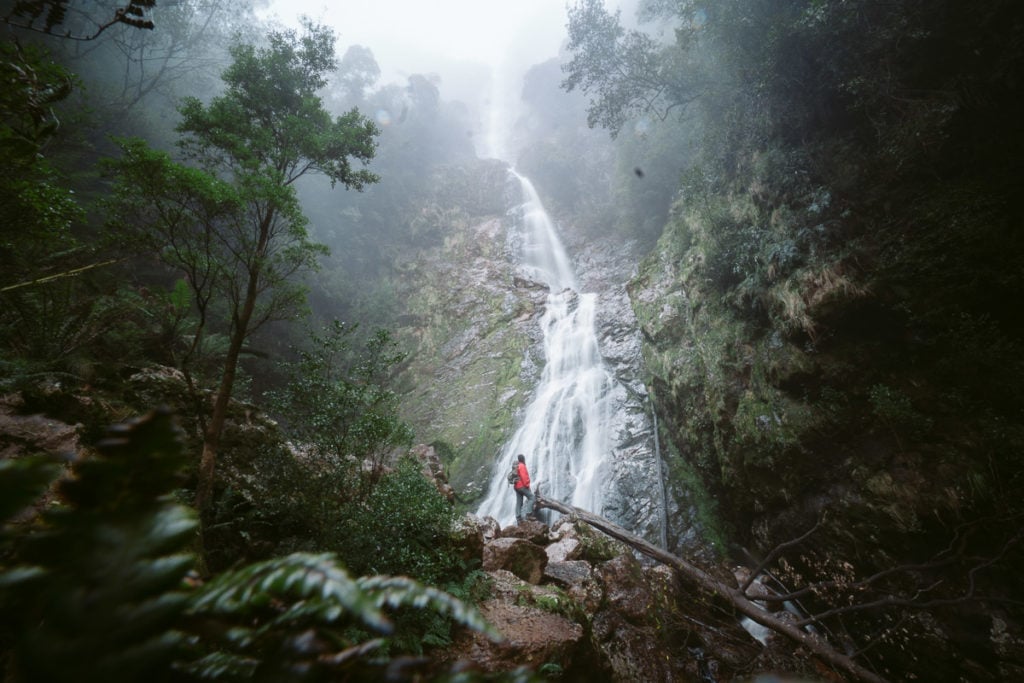
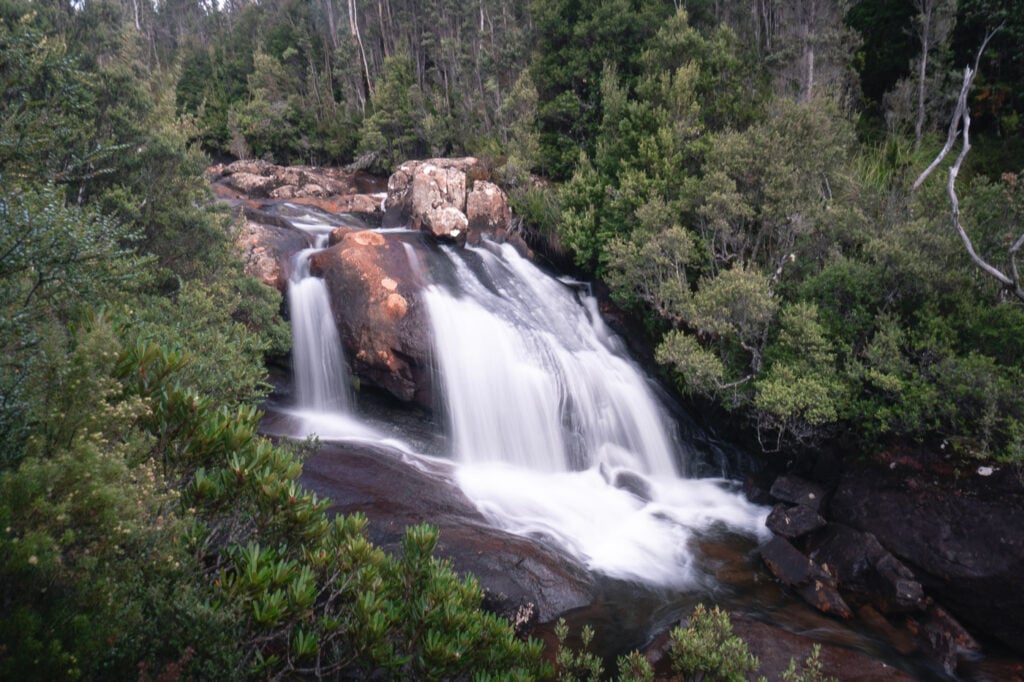
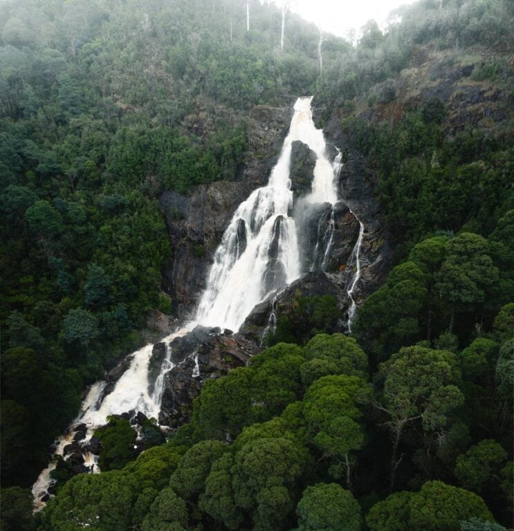
1. The Montezuma Falls Track
- Hiking Distance: 11 kilometres return
- Duration: 3 hours return
- Elevation: 120 metres total elevation gain (gradual and mostly flat)
- Duration: 3 hours return
This waterfall hiking trail is located near Williamsford, which is approximately two kilometres south of Rosebery in Tasmania's west.
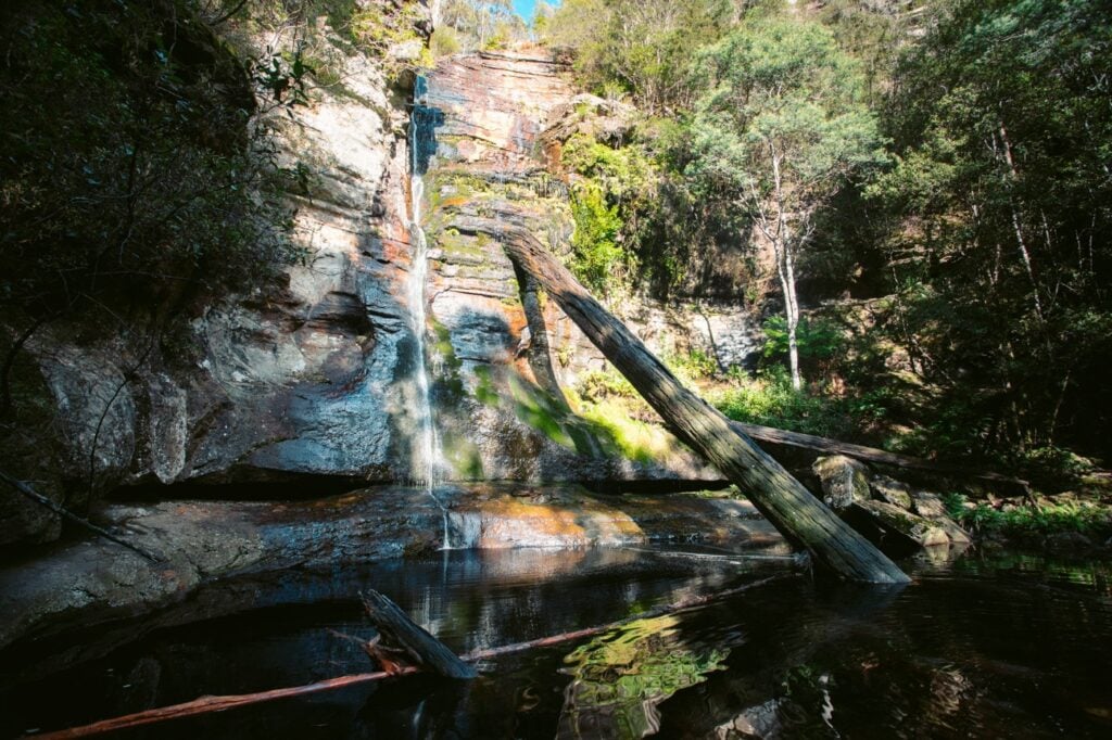
Montezuma Falls has the crown for being Tasmania's highest permanent waterfall. This hike was one of my favourite in Tasmania, following an easy yet scenic forest track along an old mining route.
At the end, you'll be rewarded with a view directly below the sleepy, multi-tiered giant known as Montezuma Falls.

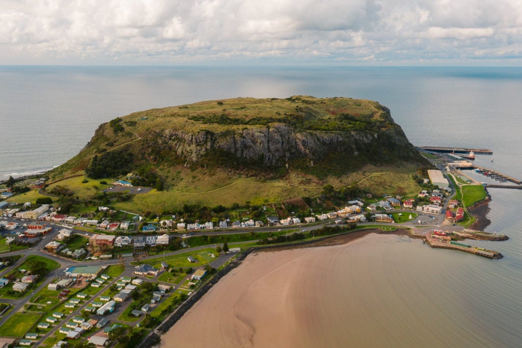
2. The Nut
- Hiking Distance: 2.9 kilometre circuit loop
- Duration: 45 minutes - 1 hour
- Elevation: 170 metres total elevation gain |
The Nut height: 152 metres AMSL - Difficulty: Moderate (well-maintained but a little steep)
Climbing the Nut is a right of passage for hikers in Tasmania. While perhaps not the most scenic walking trail in the state, it could be considered one of the most unique.
The Nut is located in the northern township of Stanley and is the remains of a volcanic plug. This mounded hill now sits on the edge of the island overlooking the Bass Strait. This hike is fairly easy and I'd highly recommend it if you're visiting the northern parts of Tasmania.

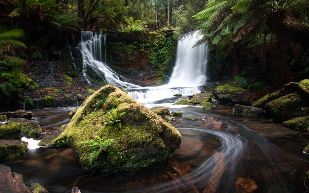
3. The Three Falls Circuit
- Hike Distance: 6 km loop
- Duration: 2 hours
- Elevation: Mostly flat with short sections of easy stair climbing
- Difficulty: Easy
The lower rainforest section of Mount Field National Park is truly one of Tasmania's best wet rainforests. And, easily the best way to experience all of its incredible natural scenery is to take the easy 6-kilometre loop hike known as the Three Falls Circuit.
This waterfall walk features some of Tasmania's most famous waterfalls including Russell Falls, Horseshoe Falls and Lady Barron Falls. You'll also get to check out the famous tall trees section of Mt Field National Park, making it one of the most rewarding short walks in Tasmania!
Book: Mt Field Day Trip From Hobart (top-rated in Hobart)

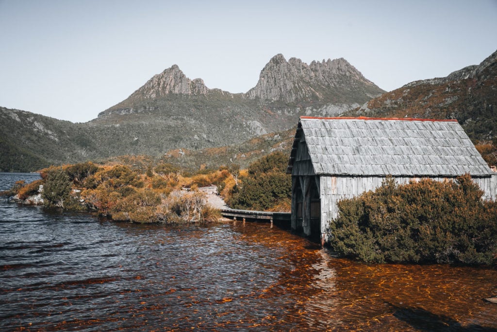
4. Dove Lake Circuit at Cradle Mountain
- Hiking Distance: 5.7 kilometres (loop)
- Duration: 2-3 hours
- Elevation: 130 metres total elevation gain (undulating)
- Difficulty: Easy
Cradle Mountain is one of the most famous hiking areas in Tasmania, and for good reason. This scenic alpine region features some of the most iconic Tasmanian hiking trails including Cradle Mountain summit and the Overland Track.
If you're after a relatively easy day walk in Cradle Country, look no further than the Dove Lake Circuit Track. This beautiful lakeside loop circumvents the lake and ducks into dense alpine rainforest while also offering excellent views of the surrounding peaks.
How to get here: How to Get to Cradle Mountain


How to Save Money on Tassie Tours & Experiences
Looking to save some travel money on tours in Tassie?
I've partnered with Backpacker Deals to offer $5 off all tours and experiences in Tasmania using my code OLLY5 (and you don't have to be a backpacker to save).
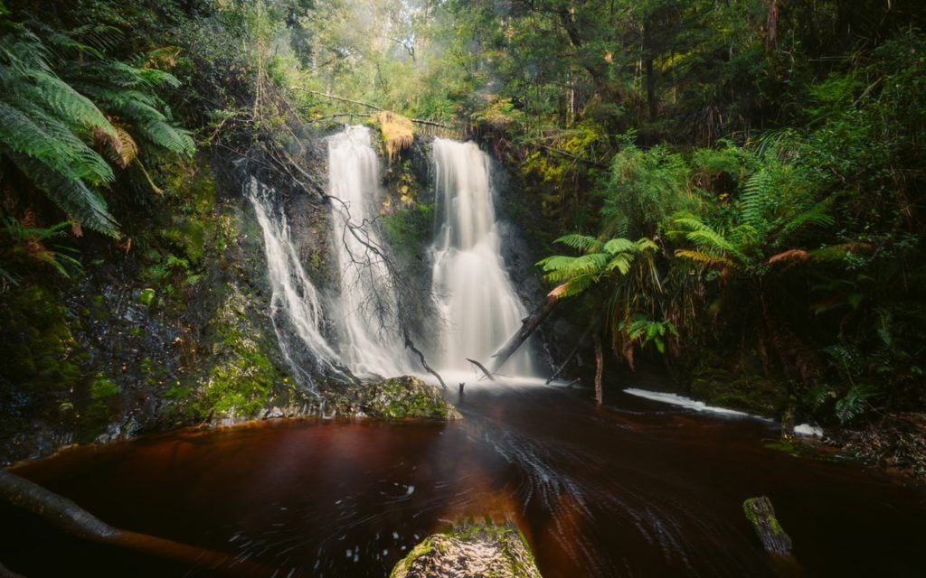
5. Bridal Veil Falls and Champagne Falls Track
- Hiking Distance: 5.2 km circuit
- Duration: 1.5 - 2 hours
- Elevation: 300 metres total elevation gain
- Difficulty: Easy-moderate
There are so many great hikes and walking tracks in Tasmania's Cradle Country. However, its popularity often means that the trails are a little crowded. If you're up for a great waterfall hike without the crowds, consider checking out the Bridal Veil Falls and Champagne Falls track.
You'll find this walk near the Lemonthyme Wilderness Retreat on the way up to Cradle Mountain. It's a little bit of a detour to get here, but let me assure you that the trip is more than worth it. Especially if you're a waterfall fan as this track offers two on the same loop track!
Stay near the trail: Lemonthyme Wilderness Retreat


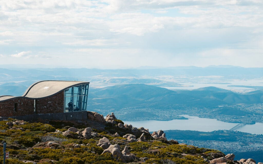
6. The Mount Wellington Hikes
Mount Wellington is is one of the most well-known mountains in Tasmania. That's because this culturally significant peak sits above the capital city of Hobart. The international airport is often the first port of call for visitors to Tasmania and therefore many travellers choose to explore and stay in Hobart first.
Luckily, there are loads of different walking tracks and scenic trails at the foothills of Mount Wellington and towards the peak. Many decide to head to the famous "Springs", a starting point for several short-medium length walks.
My favourite hiking trail on Mount Wellington is one to the summit, which incorporates many of the highlight tracks into a convenient loop back to The Springs.
Book a bus instead: Wellington Bus All-Day Pass (cheapest online)

RELATED POST: 26 Awesome Things to do in Hobart
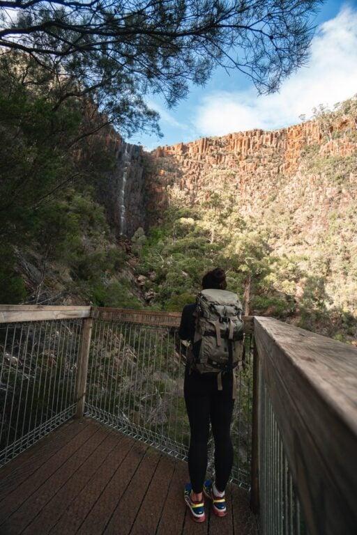
7. Leven Canyon Lookout
- Hiking Distance: 1.9 km circuit loop
- Duration: 1 hour
- Elevation: 149 metres elevation gain
- Difficulty: Easy
The Leven Canyon is located in Northern Tasmania, approximately 50 kilometres south of Devonport. This beautiful canyon lookout track is a great bang-for-time microadventure for those on a road trip in the north.
The views from the top are fantastic, and better yet, this Tasmanian hiking trail is a circuit loop, meaning you'll get more views and less doubling-back!

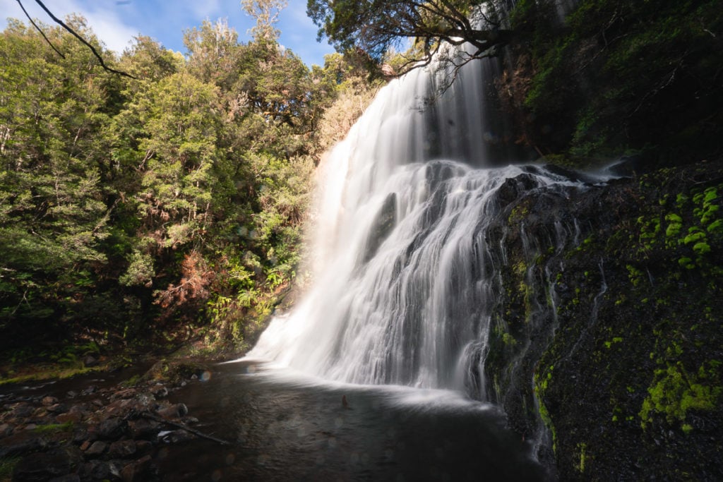
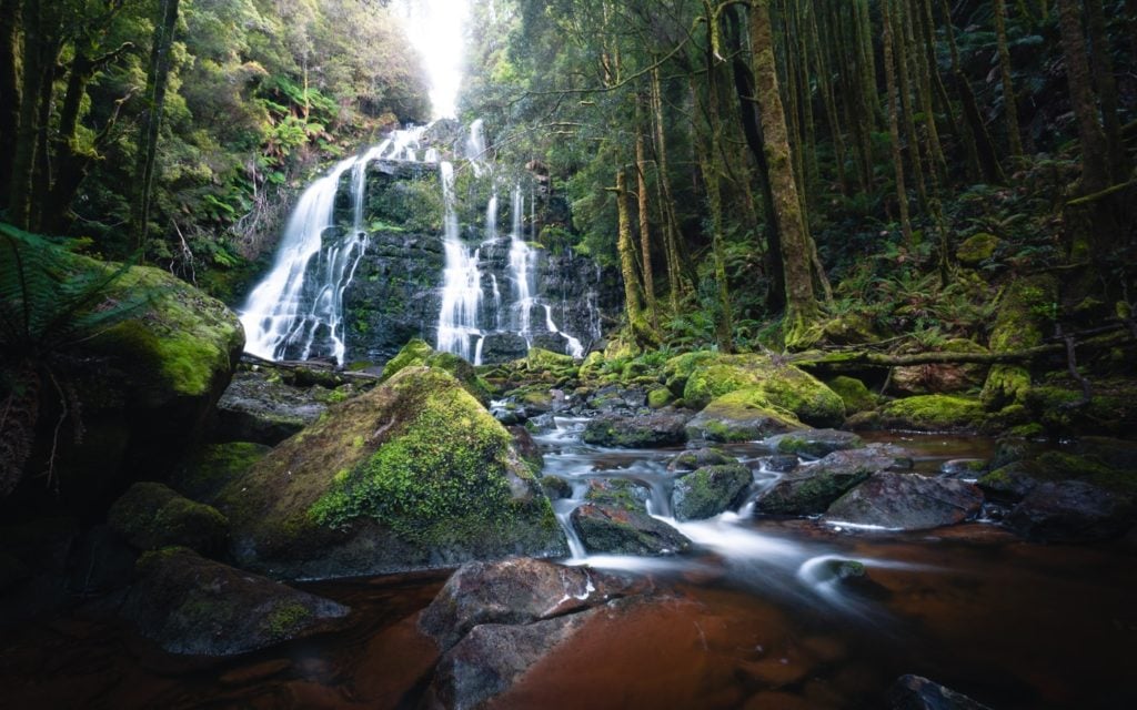
8. Nelson Falls Track
- Hiking Distance: 1.4 kilometres return
- Duration: 45 minutes
- Elevation: N/A
- Difficulty: Very easy
Jetting across the island state and we've arrived in the unmissable Western Wilds. The Strahan and West Coast region has a lot to offer but one of my favourite short hikes, the Nelson Falls track, just should not be missed.
Nelson Falls is located just outside of Queenstown after the the beautiful 99-bends road on the edge of Franklin-Gordon Wild Rivers National Park. It's a perfect road-side stopover hike for those driving to and from Queenstown and Derwent Bridge.
The waterfall track features amazing examples of native Tasmanian temperate rainforest and the waterfall itself is in my opinion, one of the best in the sate!


The Ultimate Tasmania Travel Resource
Looking for more Tasmania travel guides & adventure inspiration? Below are my most comprehensive blog posts that will serve as a great free resource for your trip.
9. Hogarth Falls Track
- Hiking Distance: 2.1 kilometres return
- Duration: 45 minutes - 1 hour return
- Elevation: N/A
- Difficulty: Very easy
The Hogarth Falls hike is another notable waterfall trail in the south of Tasmania. This hike is one of the easiest day walks on this list, but considered a must-visit for those stopping by Strahan.
One great thing about this Tasmanian waterfall hike is just how easily accessible it is. Visitors will find the car park to the waterfall track just a few minutes drive from the main ferry port in Strahan. The truth is that you can even walk here from town!

10. Quamby Bluff
- Hiking Distance: 7 kilometres return
- Duration: 3-5 hours
- Elevation: Total elevation gain: 523 metres |
Quamby Bluff height: 1227 metres - Difficulty: Moderate - Hard
Quamby Bluff is a 1227 metre peak north of the main escarpment of Tasmania's Great Western Tiers range. It's a very prominent mountain and can be seen from the Bass Highway connecting Launceston and Devonport.
This walk is great as Quamby Bluff is also one of the easiest mountains to climb in the Great Western Tiers of Northern Tasmania. While the difficulty steps up a little on this hike compared to others on the list, it's still a very doable day walk for most!


#1 Water Bottle Filter
Enter the Grayl GeoPress Water Filter & Purifier Bottle! I take this bottle on every hike and use it as my go-to source for filtering water all over the world. I've even used it to drink tap water in India!
// Compare how the GeoPress stacks up against the best water bottle filters on the market.
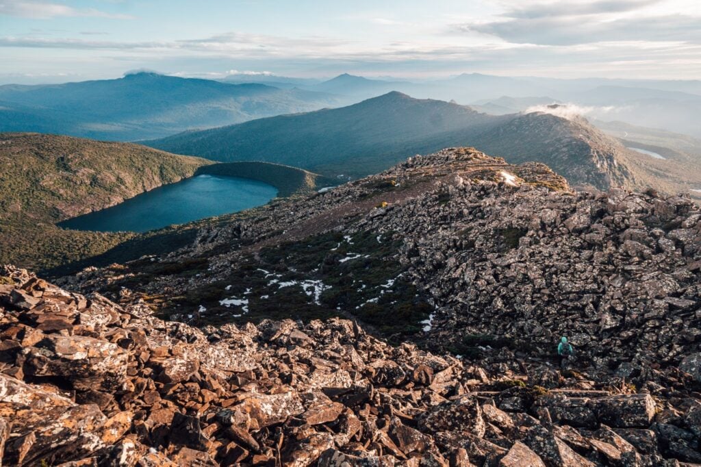
11. Hartz Peak Track
- Hiking Distance: 8 kilometres return (out-and-back)
- Duration: Official time: 4 hours
My recommended time: 2.5 hours - Elevation: 519 metres total elevation gain
Hartz Peak: 1253 m AMSL - Difficulty: Moderate
Hartz Peak is a beautiful mountain located in the easily-accessible Hartz Mountains National Park in the South of Tasmania. The alpine surrounds will make you feel like you are deep in uncharted Tassie wilderness but in reality, this is one of the easiest summit walks you'll find in Tasmania above 1200 metres.
Views from the top extend far beyond the Harts Range and deep into some of the most iconic mountains in Tasmania such as Precipitous Bluff and the Arthur's Ranges.

12. Arve Falls Track
- Hiking Distance: 0.8 kilometres return
- Duration: 10 minutes
- Elevation: N/A
- Difficulty: Very easy
On the way into the Hartz Mountains National Park, you'll pass the short walking track to Arve Falls, one of the quickest and easiest waterfall hikes in Tassie.
This waterfall is also one of the most unique in the sate as it sits near 1000 metres above sea level, resulting in it often being surrounded by a blanket of snow.
This quick, 10-minute easy walk is a must if you're visiting the Hartz Mountain to hike Hartz Peak.

Related: 26 Incredible Waterfalls in Tasmania
13. Bay of Fires Lodge Walk
- Hiking Distance: Varies
- Duration: 2-5 days
- Elevation: N/A
- Difficulty: Easy - Moderate
The Bay of Fires is one of the most beautiful regions in Tasmania and arguably in all of Australia. While not typically a hiking destination, in true Tassie outdoor fashion an entire array of guided lodge walks have been set up to explore the region on foot.
I've written a comprehensive guide to the Bay of Fires region which includes some recommendations for hikes and guided walking companies, so check that out if you're planning a trip here and looking to do some guided walks.

14. Pelverata Falls Track
- Hiking Distance: 6 kilometres return
- Duration: Official: 3 hours, easily completed in under 2 hours return
- Elevation: 290 metres total elevation gain
- Difficulty: Moderate
The Pelverata Falls hike offers a great opportunity to get out and explore the natural sounds of the Huon Valley. This is also a dog-friendly waterfall hike that leads to one of Tasmania's tallest waterfalls!
The track is well-maintained and generally fairly easy. At the end, you'll arrive at a steel viewing platform beneath the falls.

15. Adamsons Falls Track
- Hiking Distance: 6.8 kilometres return (from trailhead)
Our distance: 9.8 kilometres from the Chestermans Road/Coal Hill Road fork - Duration: 2.5 -3.5 hours return
Our time: 2 hours 45 minutes from the Chestermans Road/Coal Hill Road fork - Elevation: 265M total elevation gain (undulating)
370M for us - Difficulty: Difficult (muddy, fallen trees everywhere)
Deep in the far south of the state is the trailhead to one of my absolute favourite waterfall hikes in Tasmania. The Adamsons Falls hike is an epic adventure and definitely a waterfall that you have to earn. This hiking trail enters into Southwest National Park, one of Tasmania's most rugged and unforgiving regions.
Getting out here is also quite a challenge in itself. Unfortunately, we were limited in how far we could get our big van so we were forced to extend the walk by a few kilometres.
The track is also very overgrown, wet and cold, making navigation challenging. This, combined with the relative remoteness and lack of phone reception also adds to the danger so make sure that you are prepared if you commit to this Tasmanian hiking trail.

16. Duckhole Lake Track
- Hiking Distance: 4.4 km return
- Duration: 1-2 hours
- Elevation: Mostly flat
- Difficulty: Easy
The Duckhole Lake track is another short hiking trail in the deep south on the edge of Southwest National Park. This walk is much more pleasant and easy-going than Adamsons, Falls (although definitely not as epic!).
This mostly boarded track winds its way into the forest towards Duckhole Lake, which is actually a sinkhole that has been filled by rainwater. There are usually a few ducks swimming in this natural rainforest pool and if you’re lucky, you might even spot a platypus or two as we did.
The Duckhole Lake track and the Adamsons Falls track are great walks to check out for those visiting the Hastings Caves and Thermal Springs.

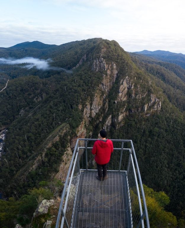
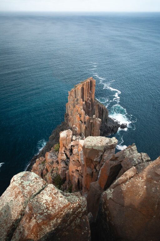
17. Cape Raoul Track
- Hiking Distance: 16.4 KM return (18 KM including a short side-trip to the Shipstern Bluff Walk)
- Duration: 3.5 - 5 hours return
- Elevation: 645 m total elevation gain (undulates)
- Difficulty: Moderate
Driving over to the wild and raw Tasman Peninsula and you'll find yourself with a plethora of epic Tasmanian coastal hiking trails. One of my personal favourites is the Cape Raoul Track, a fairly long but scenic trail leading to the often-neglected Third Cape.
The walk is a fairly long walk and begins by gently climbing up the eucalypt forest and then descending down to the long plateau reaching out to Cape Raoul. Additionally, hikers will have the option to take a short detour to a viewpoint over Shipstern Bluff, one of the most notorious big-wave surf breaks on earth!
Book: Incredible Port Arthur & Three Capes Panorama by Seaplane

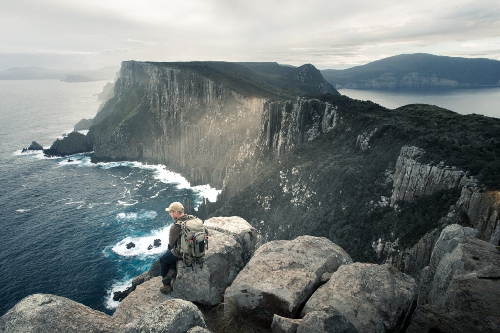
18. Three Capes Track
- Hiking Distance: 44.6 km
- Duration: 2 or 3 days
- Elevation: 1853 metres total elevation gain
- Difficulty: Moderate (entry-level multi-day hiking)
The Three Capes Track is the first overnight hike in Tasmania on this list, and also one of the most popular! That's because this track has recently received an expensive overhaul with long boardwalks and awesome huts.
The Three Capes Track is located on the Tasman Peninsula and traverses scenic heathland, lush temperate rainforest and the jagged, towering coastal cliffs of Cape Pillar and Cape Hauy.
Typically, this 3-4 day walk is targeted at entry-level overnight hikers as a paid experience. However, it is also possible to complete the walk for free (besides the national park fee), by organising your own transport and camping at the several dedicated sites.

19. Collins Cap Trail
- Hiking Distance: 8.2 KM return
- Duration: 2.5 - 3 hours return
- Elevation: 660 metres total elevation gain |
Collins Cap: 1098 metres AMSL - Difficulty: Moderate
Collins Cap is a mountain peak located within Wellington Park, just outside of Collinsvale near Hobart. This walk is a fairly short yet steep hike finishing at Collins Cap, where you'll be rewarded with awesome views over Collinsvale, Collins Bonnet, the lush Derwent Valley and the whole Mount Wellington plateau.
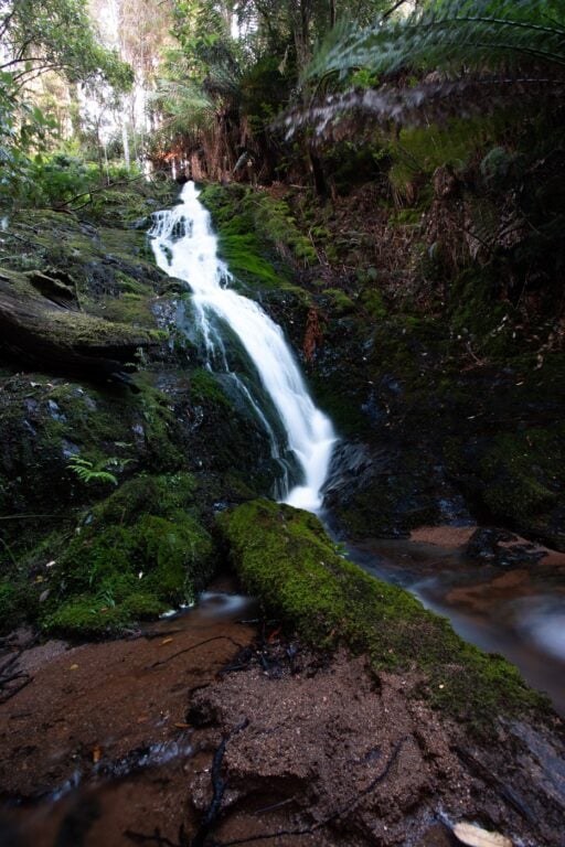
There's also a very picturesque waterfall on the way up called Myrtle Gully Falls, an added bonus for this one!

20. Snug Falls Track
- Hiking Distance: 2.9 kilometres return (out-and-back)
- Duration: 40 minutes - 1 hour
- Elevation: 145 metres total elevation gain, all on the way back up
- Difficulty: Easy
The Snug Falls track is a great, short, dog-friendly waterfall hike near Snug, just 24 kilometres south of Hobart. The Snug Falls walk is fairly easy walk in Tasmania's southeast leading to the base of an awesome waterfall within a basin clearing.
Unfortunately, the waterfall wasn't flowing that well when we visited, and I've been told that this is due to it being very season-dependent. However, we still really enjoyed this track and spent a fair bit of time enjoying the serenity by the large pool.

21. Wellington Falls: Disappearing Tarn
- Hiking Distance: 20 km return (Fern Tree)
- Duration: 5-7 hours
- Elevation: 950 m total elevation gain
- Difficulty: Moderate but a long day hike
One of the longest day-hikes available on Tasmania's Mount Wellington is the Wellington Falls walk. This one follows the the Pipeline Track, Silver Falls Track and then the Milles Track all the way to an impressive waterall. Along the way, you'll experience vastly changing lanscapes including temperate rainforest, huge boulder fields and even alpine conditions.
There's also an illusive and seasonal tarn which you might be lucky enough to spot on the way up known as the Disappearing Tarn.

22. Tarkine Walks
The Tarkine, or Takanya, is Australia's largest body of temperate rainforest. It's a very wild, wet and undeniably beautiful region that is unfortunately under threat! Logging and mining companies are expanding in the region at the cost of this rich, biodiverse global treasure.
I believe that the more people that get to explore this beautiful landscape for themselves, the stronger the movement to protect it will grow. That's why I'm encouraging you, keen hikers to go and explore (respectfully), the Tarkine Rainforest.
Since Takanya is largely managed by Tasmania's Forestry industry (logging), there are not many well-known or well-established hiking trails. However, I have covered a few my comprehensive guide to the Tarkine Drive. Some of my favourites include the Trowutta Arch walk, Lake Chrisholm and the Milkshake Hills.
Book: Tassie in 3 Days - Includes West Coast (Tarkine)

23. Styx Tall Trees Walk
- Hiking Distance: 1 kilometre loop
- Duration: 20-30 minutes
- Elevation: Mostly flat
- Difficulty: Very easy
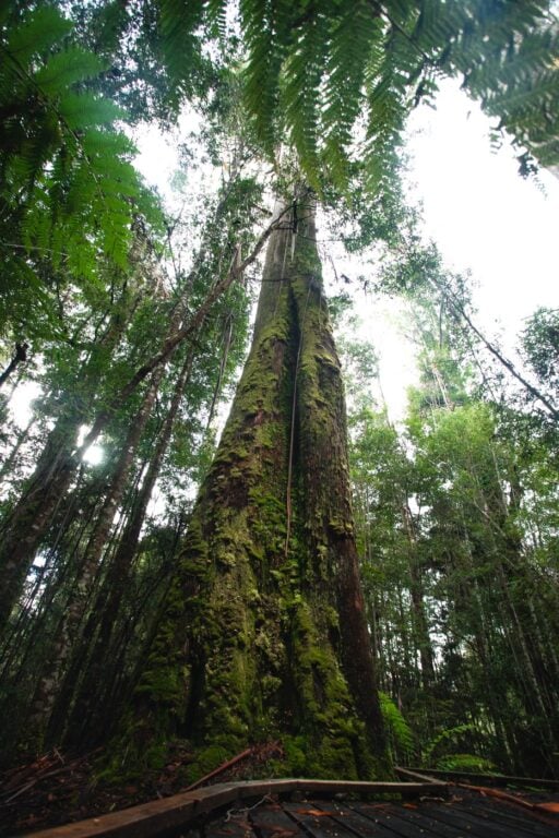
Many people visit Tasmania to witness one of the last, truly wild places on earth. A visit to the Southern Forests of Tasmania allows you a glimpse of some of the tallest and biggest trees in the Southern Hemisphere. The Styx Tall Trees Conservation offers the chance to see some of the absolute tallest eycalypt regnans!
This area is located near Maydena, approximately an hour's drive from Hobart. If you're planning a visit out to Mt Field National Park (you should), then a detour to the Styx fits in well!

24. The Fluted Cape Walk
- Hiking Distance: 7.2 km (circuit loop)
- Duration: 2-3 hours
- Elevation: 345 m total elevation gain |
315 M AMSL at the cape lookout - Difficulty: Moderate
Bruny Island is an adventure paradise with some of the best hikes to do in Tasmania. One of the most rewarding on the island is the Fluted Cape Walk, offering excellent coastal views and abundant wildlife spotting opportunities!
The Fluted Cape track is a well-maintained loop hike that starts and finishes at the Adventure Bay car park and climbs to the top of the Fluted Cape, overlooking the dramatic Bruny Island coastline.
Book a trip to Bruny: Bruny Island Day Trip From Hobart (best in Tas)

25. Waterfall Bay, Devils Kitchen & Tasman Arch Track
- Hiking Distance: 3.4 km return
- Duration: 1 hour return
- Elevation: Mostly flat
- Difficulty: Easy
Looking for another short hike on Tasmania's Tasman Peninsula? Consider checking out the Waterfall Bay track. This scenic trail is a great easy out-and-back track passing several famous geological formations including the Tasman Arch and Devils Kitchen.
The track is wide, easy to follow and mostly flat for the duration. There are plenty of spots to spot on the track to admire incredible coastal views and the unique geological phenomena that make the Tasman coast so famous.
Book: Port Arthur Historic Site Ticket

26. Maria Island Circuit
- Hiking Distance: 50 km (including a side-trip to the Isthmus, Bishop and Clerk pinnacles & Mount Maria summit)
- Duration: 3 days
- Elevation: 1935 m total elevation gain
- Difficulty: Moderate but long, entry-level multi-day hike
Maria Island is widely known as one of Australia's best island sanctuaries. Many visitors make the trip every year to see the incredible wildlife diversity, to learn about Tasmania's convict history and to hike its epic granite and bushland peaks.
Also, since there are no cars on the island, Maria is a hiking and bushwalking paradise. The best walk available is a full traverse of the island known as the Maria Island Circuit. This was one of my personal favourite and most iconic hikes in Tasmania! Although it's fairly long, you don't have to take the full 3 days. I've written, in detail, about all the hiking options on Maria in the blog post linked below.
Alternative: Active full-day walking tour of Maria Island

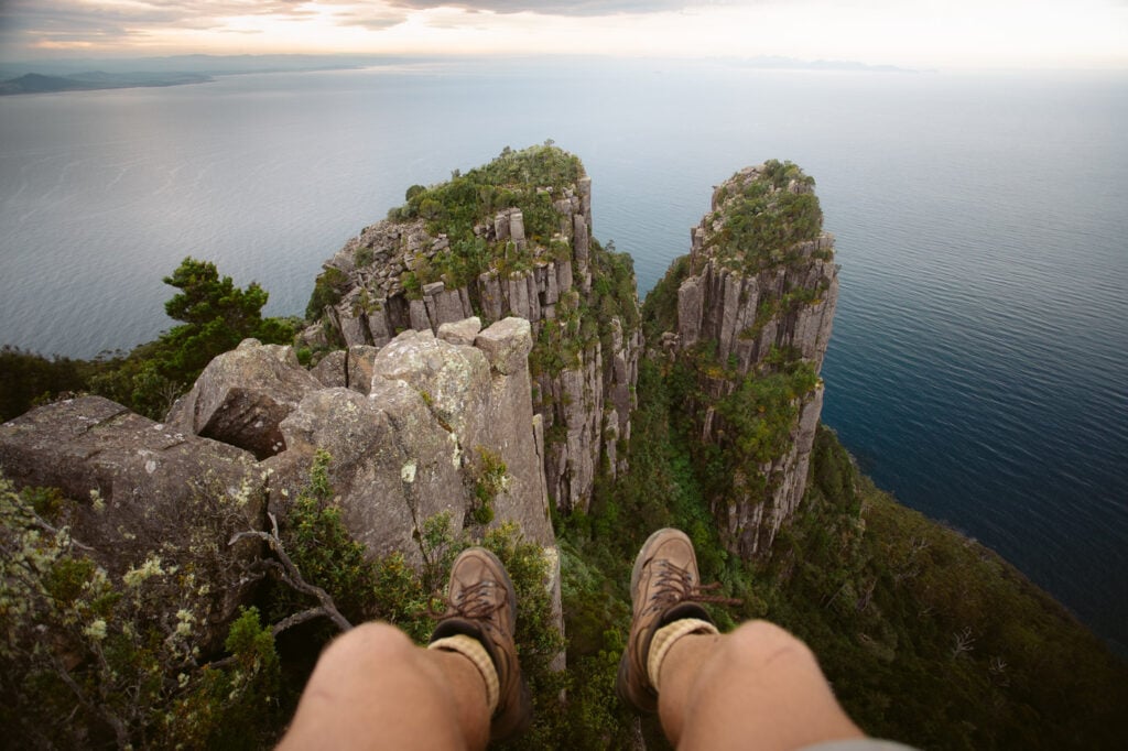
27. Bishop and Clerk Track
- Hiking Distance: 11 km return to Darlington via Fossil Cliffs
- Duration: 3-5 hours
- Elevation: 630 m elevation gain
- Difficulty: Moderate (TasParks Grade 4)
Another great Tasmanian walking track on Maria Island's northern coastline is the Bishop and Clerk Track. This rewarding coastal walk leads to a series of prominent dolerite columns overlooking the Tasman Sea.
These columns got their name due to their resemblance of a hat-wearing bishop beside a clergyman.
Hikers can summit these towering columns for incredible views over Maria Island.

28. Mount Maria Summit Track
- Hiking Distance: 12.4 kilometres
- Elevation: 620 metres elevation gain
- Duration: 3 hours
- Difficulty: Moderate
The Mount Maria track is a steep climb to the highest peak on Maria Island. This track departs from a fork on the Maria Island walk and continuously climbs for 6.2 kilometres to an altitude of 720M AMSL. If you're not walking the Maria Island Circuit, it is possible to rent a bike and drop it at the fork.
Although the views are great, and the peak is higher, I believe the view from the Bishop and Clerk pinnacles are better. In saying that, you will get to see the southern end of the island and the beautiful isthmus from Mount Maria.

29. Freycinet Peninsula Circuit
- Hiking Distance: 46 km (walked in a "figure-eight" with Mount Freycinet summit & Bryans Beach track)
- Duration: 2 or 3 days
- Elevation: 1800 total elevation gain
- Difficulty: Tasmanian Parks Grade 3 (entry-level multi-day trekking)
The Freycinet Peninsula Circuit is an epic circuit track around Freycinet National Park on the East Coast of Tasmania. Here, you'll discover one of the most beautiful regions of Tasmania including white, sandy beaches to rocky mountain summits.
The circuit is great if you're looking to see the most you can during your visit. This is because it covers most of the famous trails including the Wineglass Bay lookout track, Hazards Beach track and a climb to the top of Mount Freycinet summit— the tallest peak in Freycinet.
It's possible for hikers to walk this circuit in either two or three days. We decided to walk it in two, with a rather short first day and quite a long second day. All of the main campsites are on the beaches at either Cook's Beach, Hazard's Beach or the south end of Wineglass Bay.
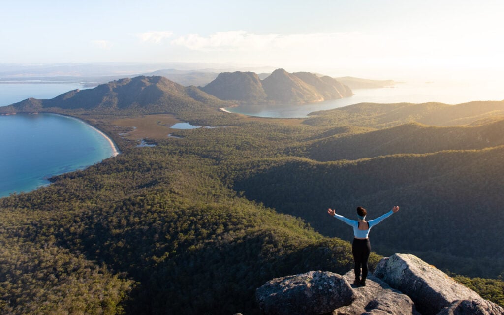

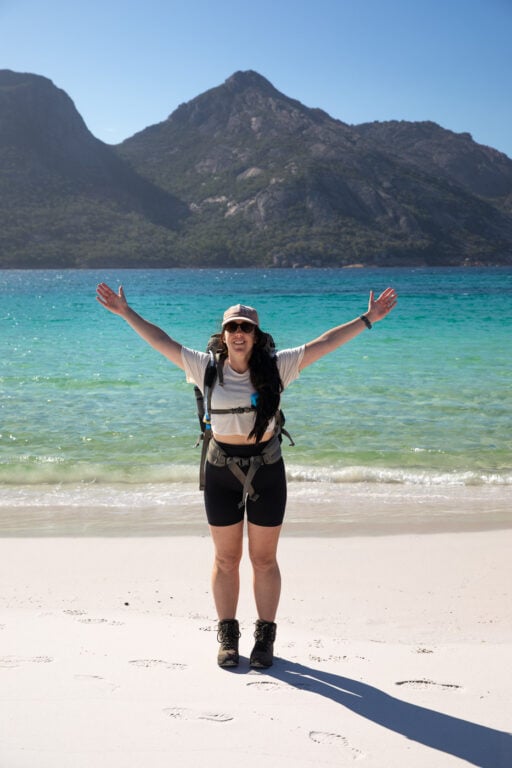
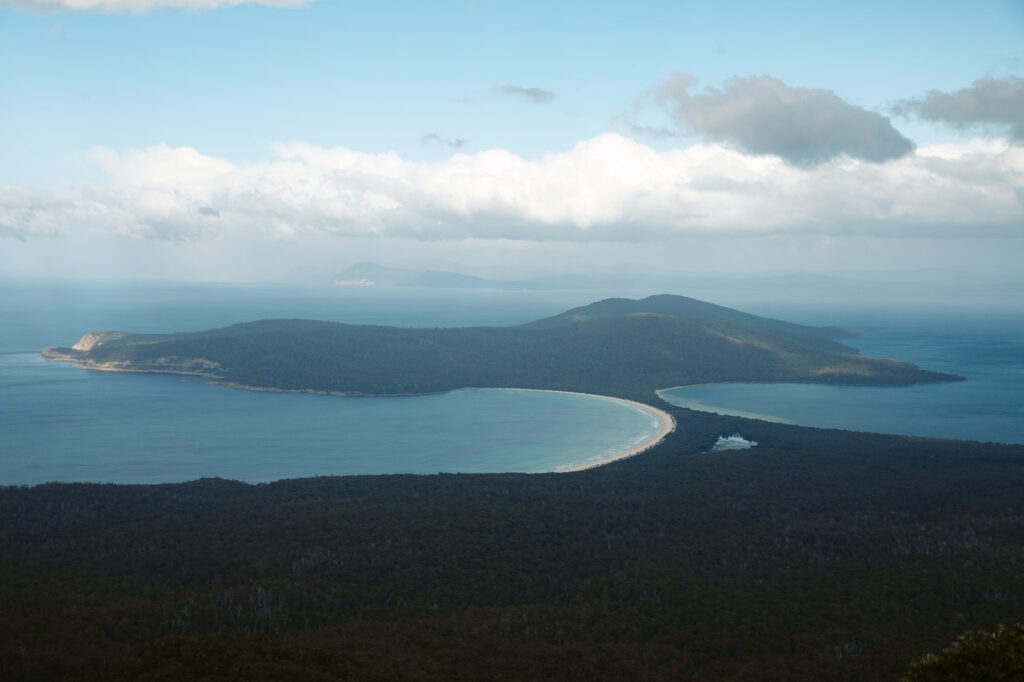
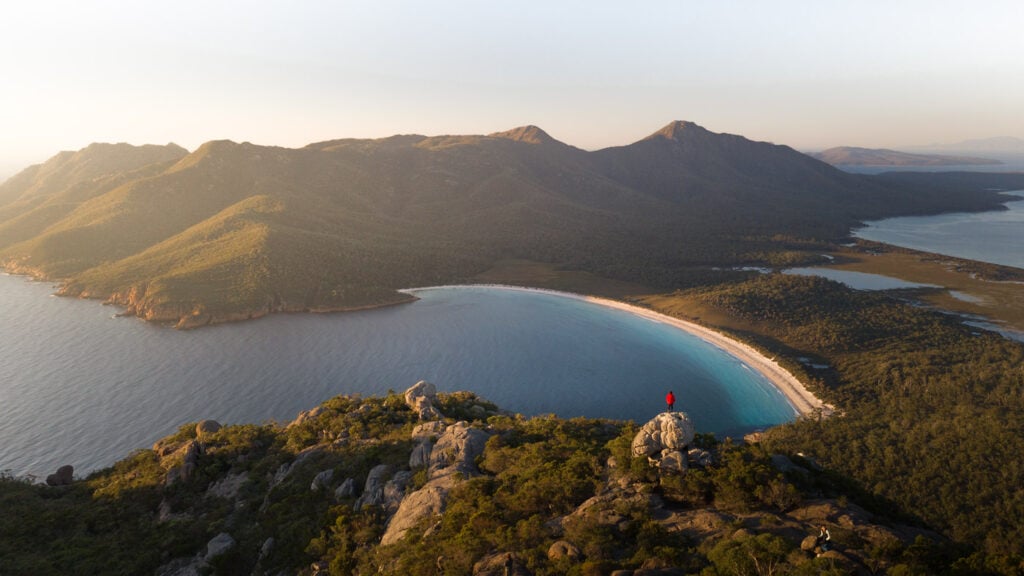
30. Mount Amos Summit Hike
- Hike Distance: 4 kilometres return
- Duration: 2-3 hours return
- Elevation: 434 m of elevation gain |
Mount Amos summit: 454 m AMSL - Difficulty: Tasmanian Parks Grade 4: rock scrambling required
Mount Amos in Freycinet National Park is widely considered to be one of Australia's best summit viewpoints. The mountain overlooks Wineglass Bay and the Freycinet Peninsula, a sweeping, Jurassic landscape that is guaranteed to leave you speechless.
While not long by any means, it does require a fair bit of rock and boulder scrambling to reach the summit. Therefore, it is best to be prepared.
I highly recommend making the extra effort to get up to Mt Amos for sunrise. This viewpoint spot was absolutely magical and ended up on the top of my personal list of best hikes in Tasmania!
2 Day Trip: Epic Wineglass Bay & Bay of Fires Trip (from Hobart, includes Mount Amos hike)

Complete Review: Staying at a private island resort in Freycinet (Picnic Island)
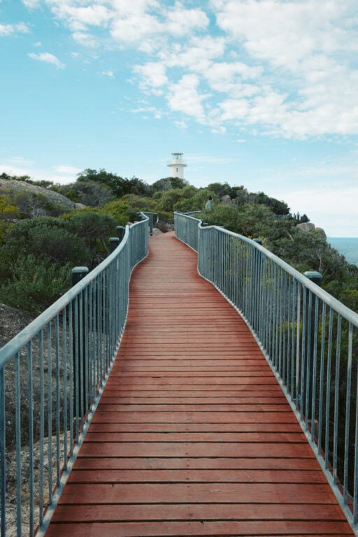
31. Cape Tourville Lighthouse Walk
- Hiking Distance: 600 m loop
- Duration: 15-20 minutes
- Elevation: Flat
- Difficulty: Very easy
It's a shame that Cape Tourville is often overshadowed by many of the other popular walks and lookouts in Freycinet National Park. While all are equally astonishing, visiting the Cape Tourville Lighthouse on the easternmost cape of Freycinet is a must for anyone fond of an epic lookout.
The Cape Tourville lighthouse and lookout loop is a very easy, mostly flat loop walk on a raised boardwalk. It is suitable for anyone and is wheelchair accessible.
The views from the lookout include a glimpse of Wineglass Bay, the amazing Hazards, the southern Freycinet Peninsula, Mount Freycinet, as well as a rocky outcrop abundant with seals known as "The Nuggets".

32. The Apsley Gorge Trail
- Hiking Distance: 6 km return (out-and-back) | 8 km if rock-hopping back along the river
- Duration: 2 hours return (out and back), apparently 4-5 hours if rock-hopping
- Elevation: 315 m total elevation gain
- Difficulty: Relatively easy (Tasmania Parks Grade 2 or Grade 3 if taking the river circuit)
The Apsley Gorge Circuit is a scenic bushwalking track located within the Douglas-Apsley National Park, just outside of Bicheno. It's one of the few walking tracks in the park and is a great choice if you're looking for a swim and to enjoy the serenity and crystal clear waters of the Apsley River.
This circuit can be completed as an out-and-back hike to the gorge or as a longer and more difficult circuit walk.
Unfortunately, due to recent flooding, the full circuit was impossible when I visited. Regardless, I had a great time on the shorter section and the views were still more than worth the low effort out here.

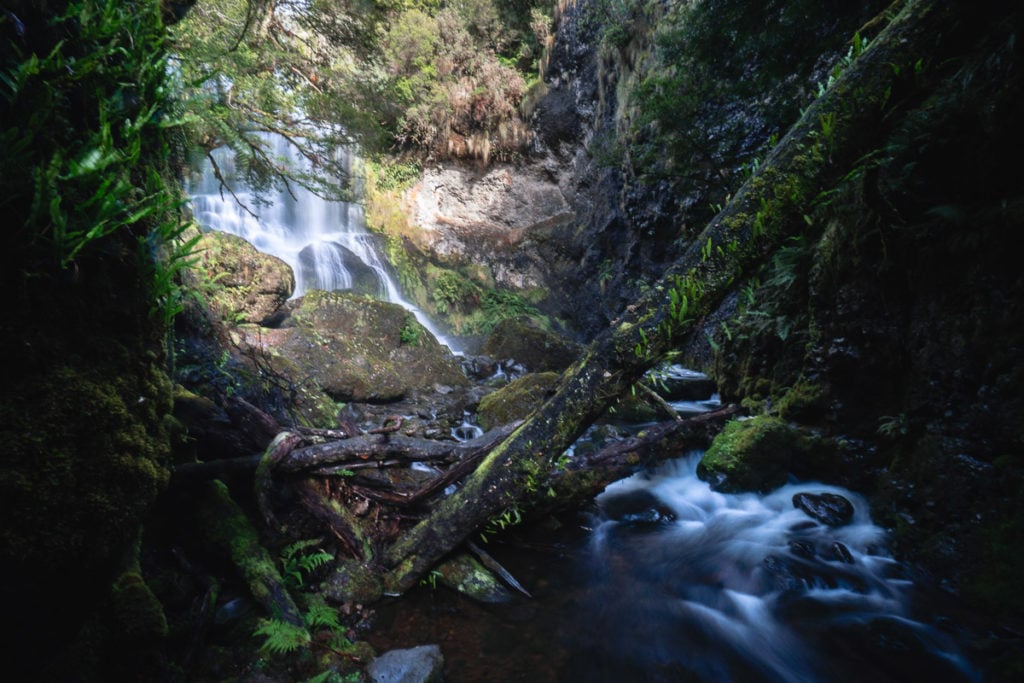
33. The Evercreech Falls & White Knights Walk
Evercreech Forest Reserve is an incredibly underrated forest area in North Eastern Tasmania offering two scenic rainforest walks and great opportunities for free camping.
Both loops are short but very picturesque, showcasing the very best of the natural beauty of the region. The Evercreech Falls loop is a little longer and wraps around the creek to the base of a small rainforest waterfall.
The second trail, the "White Knights of Evercreech" features five of Australia's largest White Gums, or Manna Gums (Eucalyptus viminalis). They stand over 90 metres tall and some of the thicker ones are over 300 years.


34. Halls Falls Trail
- Hiking Distance: 2.5 km return
- Duration: 1 - 1.5 hours
- Difficulty: Easy
The Halls Falls trail features a set of multiple cascading waterfalls located on the Groom River near Pyengana in the East of Tasmania. This short waterfall circuit leads to several viewing points of the waterfalls, as well as a rock-pool area and a historic, 19th-century weir.
The track is mostly an in-and-out trail but you will have the option of taking a loop back to the car park from about halfway to the falls. The surrounding nature here is a little drier than what you might in the surrounding region. There is a good mix of Aussie eucalypts and temperate rainforest myrtle trees and tall man ferns along the length of the track.

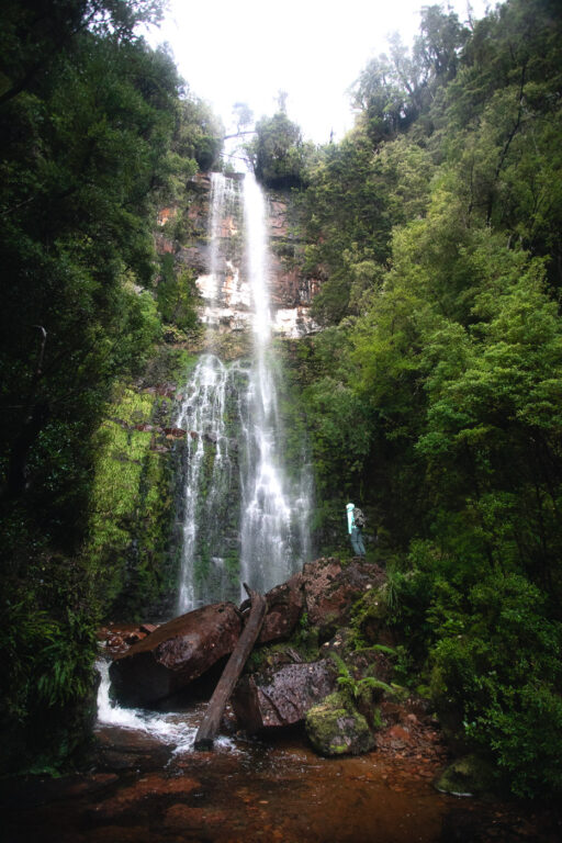
35. Saint Columba Falls Track
- Hiking Distance: 1.2 km return
- Hike Duration: 20-30 minutes return
- Elevation: Mostly Flat
- Difficulty: Easy
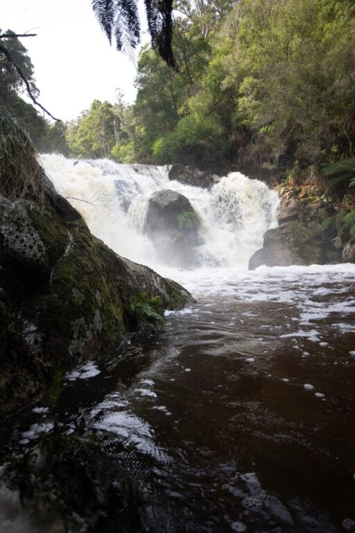
St Columba is considered one of Tasmania's tallest permanent waterfalls. It's an absolutely magnificent sight and definitely should be added to your list of must-do walks in Tasmania. The walking track down to its base is an easy, short rainforest stroll surrounded by tree ferns and temperate rainforest flora.
At the end, you'll find a steel viewing platform providing the best view of the waterfall. When we visited, it was absolutely roaring and it was impossible to even stand on the platform a testament to just how wild this waterfall is!

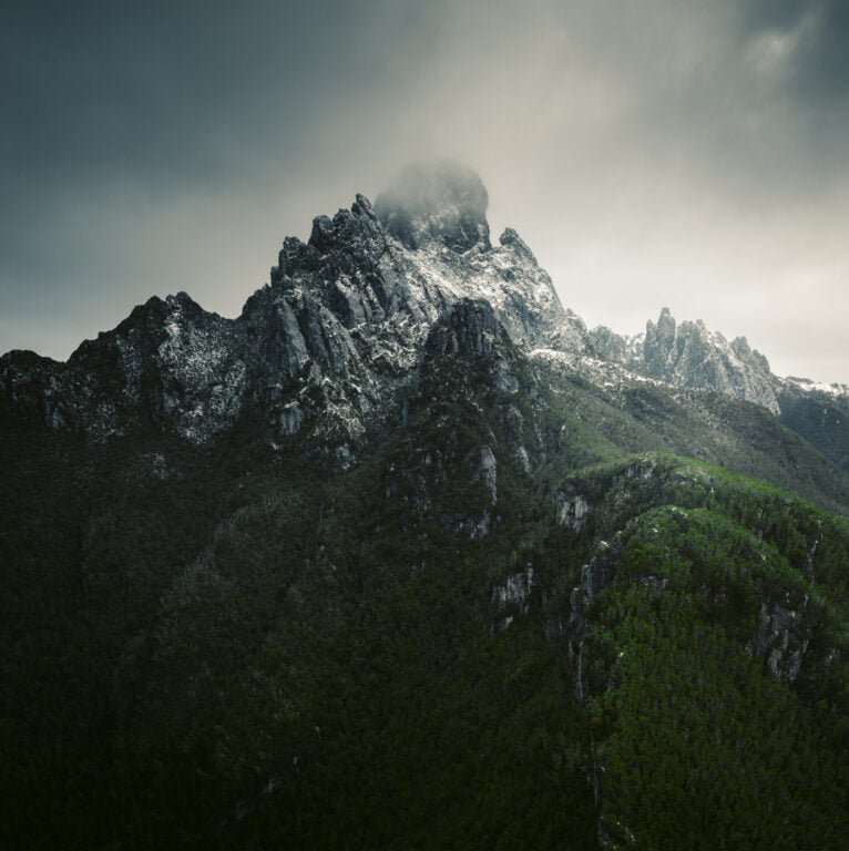
36: Federation Peak
- Hiking Distance: Official: 40 km
Recorded to Berchevaise Plateau return: 64.92 KM - Duration: 2-5 days
- Elevation: Total elevation gain roughly 1800 m
Federation Peak: 1274 m AMSL - Difficulty: Very Difficult, experience mandatory;
Tas Parks: T5 level - wilderness track
This final hike on this list of epic trails in Tasmania is not for the faint of heart! Federation Peak is the iconic Tasmanian spire mountain located deep in the Southwest National Park wilderness. Nicknamed Feddy or Fedder, this 1274 metre peak is nowhere near the tallest mountain in Tasmania but holds the fiercest reputation.
Usually attempted over 2-5 days, we tried in 3 in the midst of Winter and were unsuccessful at the summit due to icy, wild conditions. We were very well prepared for the hike but the unfortunate truth for us was that weather is king out here!
If you're an experienced bushwalker looking for a real mental and physical challenge, this is one of the best you'll get in Tasmania.


More Guided Tasmania Hiking Tours
I'm a huge fan of independent, raw adventures. All of the hikes on this list were completed independently with our own transport. However, for those that would prefer to learn more about the regions they're hiking in and be led by some of the best walking guides in Australia, then Tassie is an excellent place to book guided walks.
Below I've linked to some of the most reputable and best guided walk tours in Tasmania. You can book all of these online and the inclusions are listed on the booking page.
- Freycinet Peninsula 4-day Guided Walk with Freycinet Experience Walk
- 4-Day Tasmania Walking Tour (Bay of Fires, Freycinet, Bruny Island, Port Arthur)
- Maria Island Active Walking Tour
- Mount Wellington, Mount Field (Day Trip)

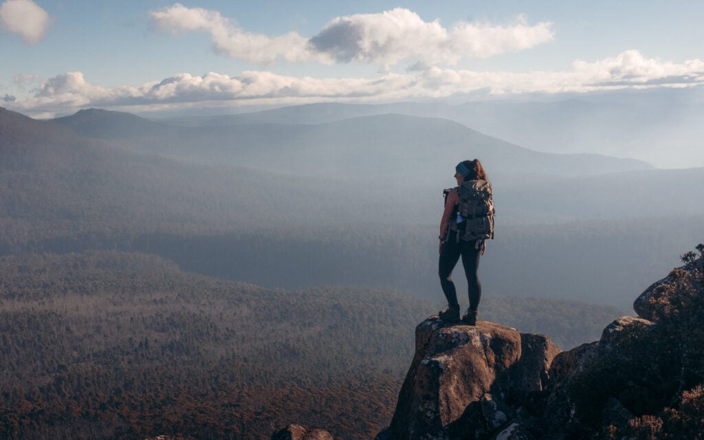
More Hikes in Tasmania: The Wishlist
Obviously, hitting every single hiking trail in Tasmania is just not possible unless you dedicate an entire lifetime to the pursuit! I compiled this comprehensive Tasmanian hiking guide after my first trip to the Apple Isle and I'll definitely be back to tick off some that I didn't have time for.
Below is a list of a few more epic Tasmanian hikes that are on my wish list! Each have links to corresponding guides by other bloggers and outdoor writers.
- Mt Murchison
- The Overland Track
- South Coast Track
- Walls of Jerusalem
- Mount Roland
- Cradle Mountain Summit
- Frenchman's Cap
- Mount Ossa
- Mount Anne
- The Arthur's Traverse (West & East)
- The Great Tasmanian Traverse

How to Get to the Trailheads: Best Way to Get Around in Tasmania
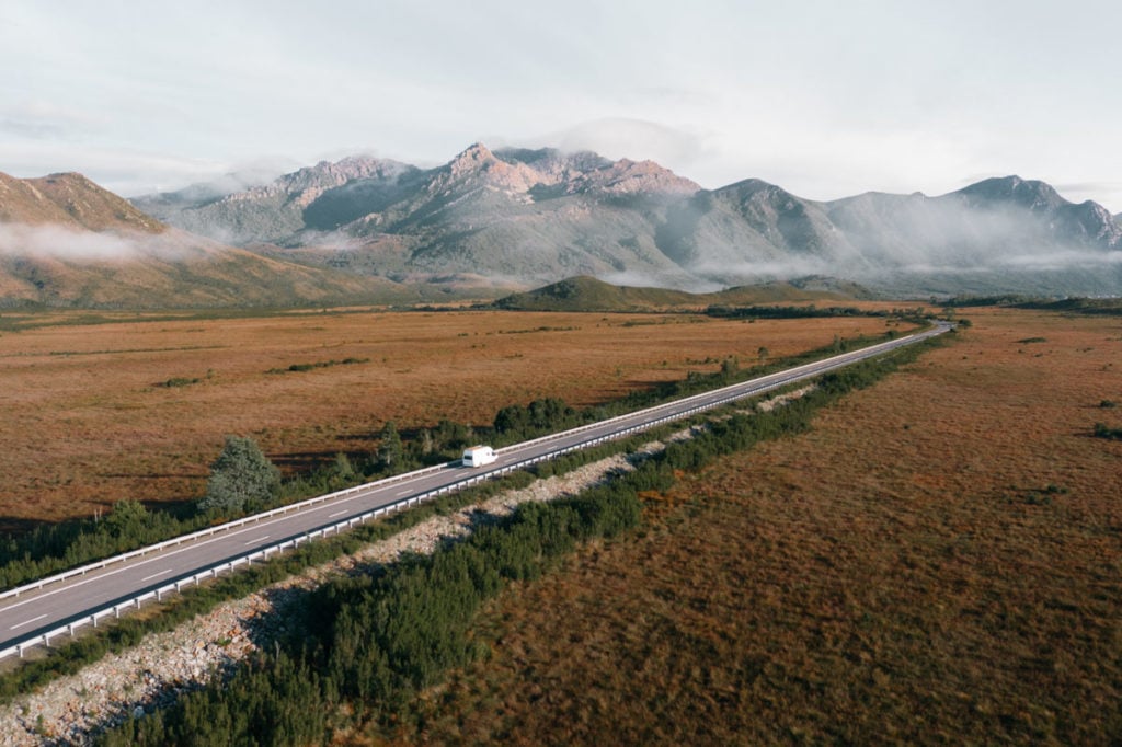
Having your own car to explore the beautiful island of Tasmania is by far the best way to get around. If you're fortunate enough to drive in on the Spirit of Tasmania car ferry, then that is definitely the best way to go. Otherwise, I really recommend renting a car. That's because many of these Tassie hiking trails are remote and public transport is very limited.
However, if you haven't yet had a looked for a rental, then you might be in shock! Tasmania is the most expensive place to rent a car in Australia. In fact, I haven't seen prices that crazy anywhere else in the world after many years of travelling full-time.
With that said, there. area few ways to get a good deal. Below I've linked to the best resources to use to rent a car in Tasmania to save you some coin.
- RentalCars.com – a rental car comparison site. Great way to compare rates and availability across companies.
- Spaceships Vans – this one’s for the backpackers and budget travellers. One of the most affordable camper van options in Australia. I’ve had great experiences with them in New Zealand and Australia and always recommend them.

READ ABOUT OUR ADVENTURES: The Van Journal in Tasmania
Best Areas to Visit in Tasmania For Hiking and Bushwalking
Initially, a lot of people misjudge just how big Tasmania is! It's a mecca for adventure and of course, there are so many different regions offering different experiences for hikers.
Below is a list of different parks and regions featured in this Tasmania hiking guide. If you're planning a trip to Tasmania, make sure to check out my list of the best areas to stay to get better deals on accommodation in each region.
- The North (and Northwest)
- Mount Roland, Leven Canyon, Arthur River, The Tarkine, Arthur-Pieman - East Coast
- Mount William National Park, Bay of Fires, Freycinet National Park, Douglas Apsley National Park - Tasman Peninsula
- Maria Island
- South Tasmania
- Southwest National Park, Bruny Island, Mount Wellington, Mount Field, Hartz Mountains - Central Tasmania
- Central Plateau, Cradle Mountain, Walls of Jerusalem National Park - West Coast
- Franklin Gordon Wild Rivers, Granite Tor, West Coast Range, Mount Murchison
About the Tasmanian National Park Fee
Unlike many other Australian states, visiting a Tasmanian National Park requires a paid permit. Visitors usually purchase these online or at any of the NP Visitor Centres throughout Tasmania.
National Parks Pass Cost:
- 24-hours: $40 per vehicle/$20 per person
- Holiday Passes – up to 2 months: $80 per vehicle/$40 per person
- Annual Pass all parks: $90 per vehicle (up to eight people)
These passes are valid for entry to all of Tasmania’s parks and the receipt must be displayed in your vehicle. If you are spending a fair bit of time in Tassie, then I recommend picking up the Annual pass as it covers your vehicle and up to eight people in your party.
More Tasmania Travel, Hiking and Adventure Guides
That wraps up this comprehensive Tasmania hiking guide featuring 36 Must-do Hikes in Tasmania! If you enjoyed this free hiking resource, make sure to check out some of my other guides, featuring more hiking trails, waterfalls, adventures and all-around great travel inspiration.
Also, I do my best to regularly update the information for these Tasmanian hiking trails and the independent guides for each. However, as you might expect this is quite a task!
If you find something that needs updating or if you have some suggestions or feedback, please leave a comment or reach out to me!
Tasmania Story: Why You Need to go Hiking!

Debby
Thursday 25th of August 2022
Thank you for the effort and detail of your travel guide. We are heading south in October for a month and your detailed information has helped greatly in us being able to plan our trip regarding what is achievable and what is not during our time there as two moderately active seniors in a caravan. It gives us wonderful selection of camps, trails, sights and activities which we are keen to see and do. It has also reduced the time we would have spent in Tourist information centers finding out what to see locally. I think I have read every page, thanks again.
Ruth
Monday 3rd of January 2022
Thank you for this impressive list! Will be heading to Tassie for two weeks shortly :D
Olly Gaspar
Monday 3rd of January 2022
Enjoy, hope you make time for some of the hikes!