
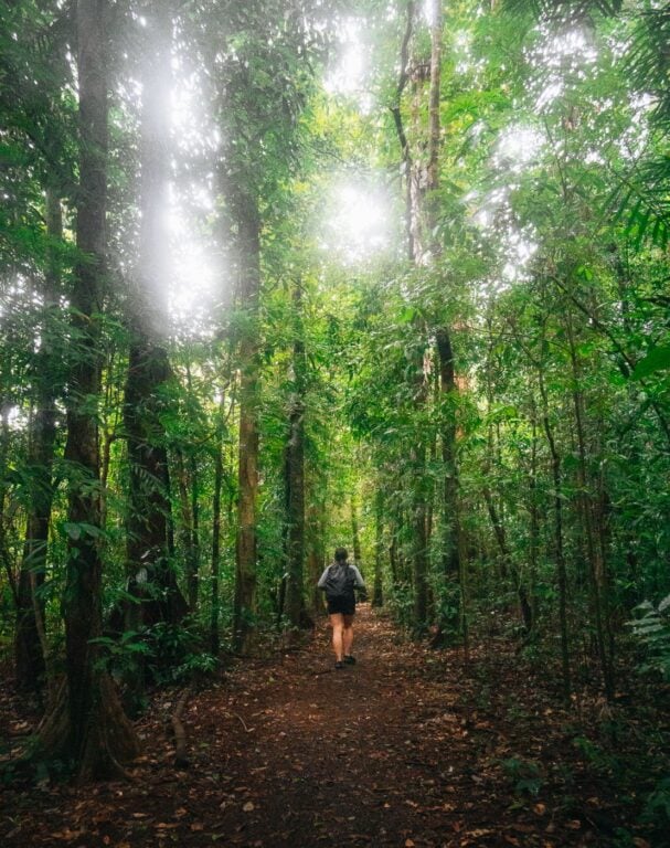
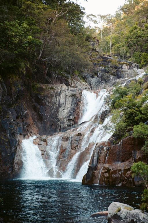
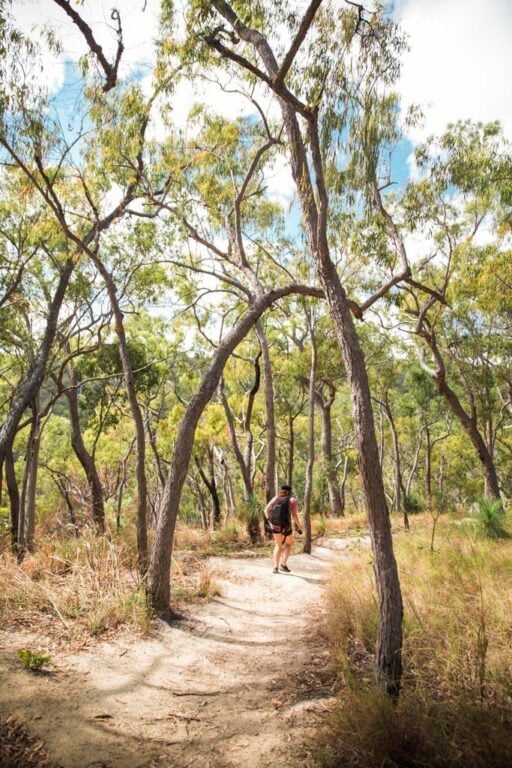
An epic list of the best rainforest walking tracks and hikes in Cairns. Includes a broad range of easy walks to difficult tropical bushwalks and off-the-beaten-path trails.
When searching for epic places to visit in Australia, you might pick Cairns for some of its celebrated highlights, like the Great Barrier Reef or the ancient Daintree Rainforest. Truthfully though, Cairns offers so much more than that.
Cairns is Australia’s outdoor adventure capital!
So, for travellers and adventurers who would prefer to bathe in a rainforest waterfall over a resort jacuzzi, you found yourself in the right place on this Cairns hiking guide.
From epic tropical rainforest tracks to rocky outcrops above the clouds, let’s just say hikers and bushwalkers won’t be disappointed in what Cairns has to offer. Without further ado, let’s dive into this list of the best Cairns hikes and walking tracks to help you plan some epic adventure day trips.
- A Foreword for “Cairns Hiking Guide: 38 Best Hikes in Cairns”
- 38 Best Hikes & Walking Tracks in Cairns
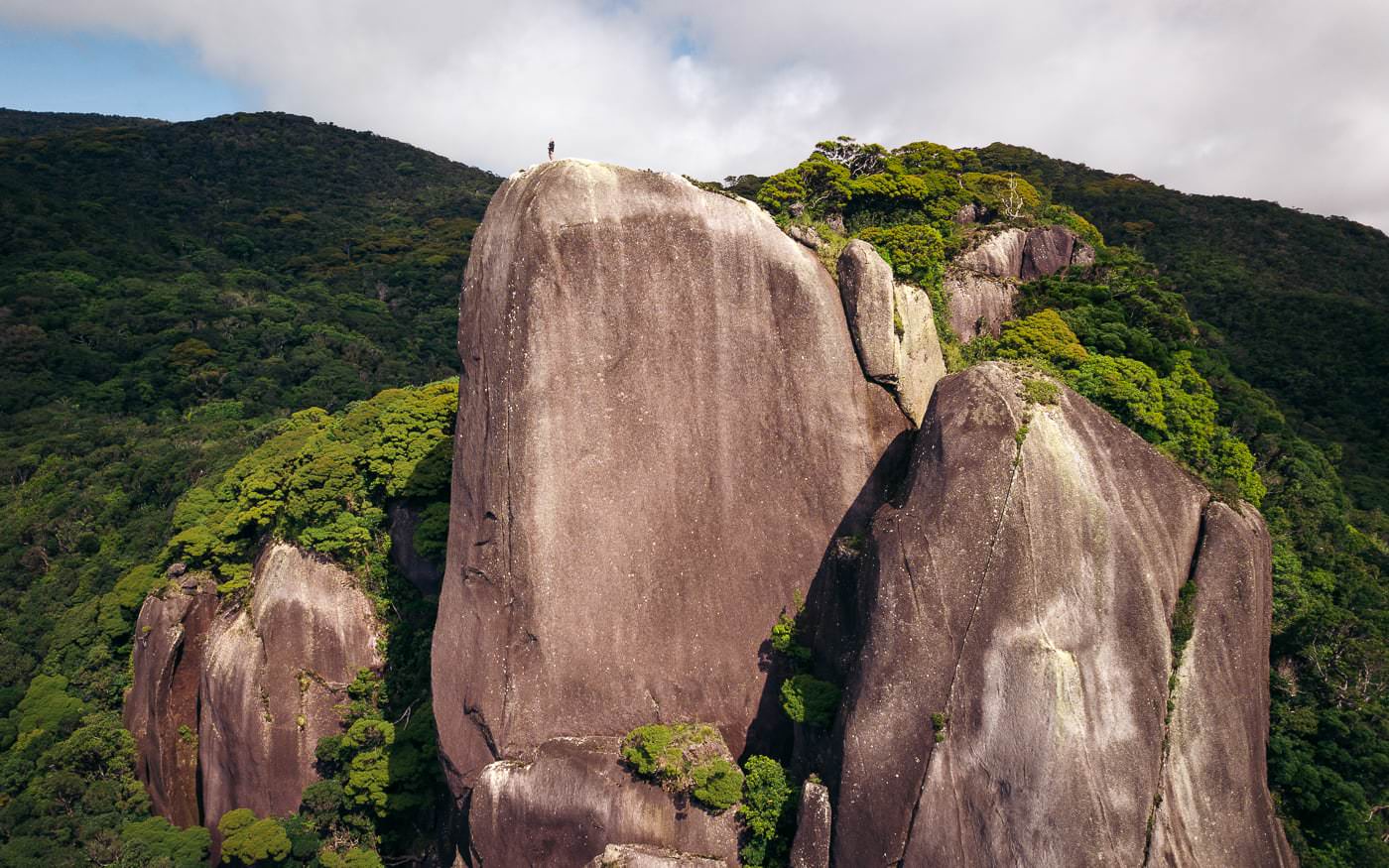
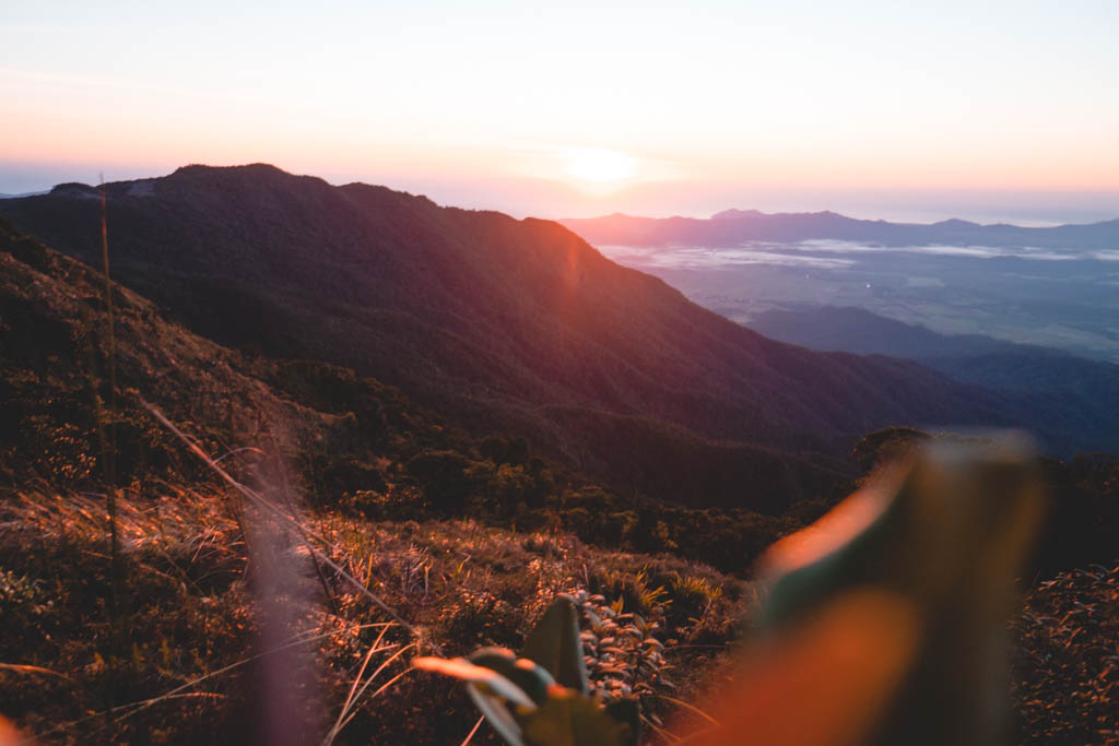
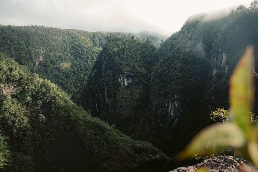
- 1. Walsh’s Pyramid
- 2. White Rock Lookout
- 3. Glacier Rock Lookout
- 4. The Arrow Tracks (Short Hikes Near Cairns CBD)
- 5. Mount William Track
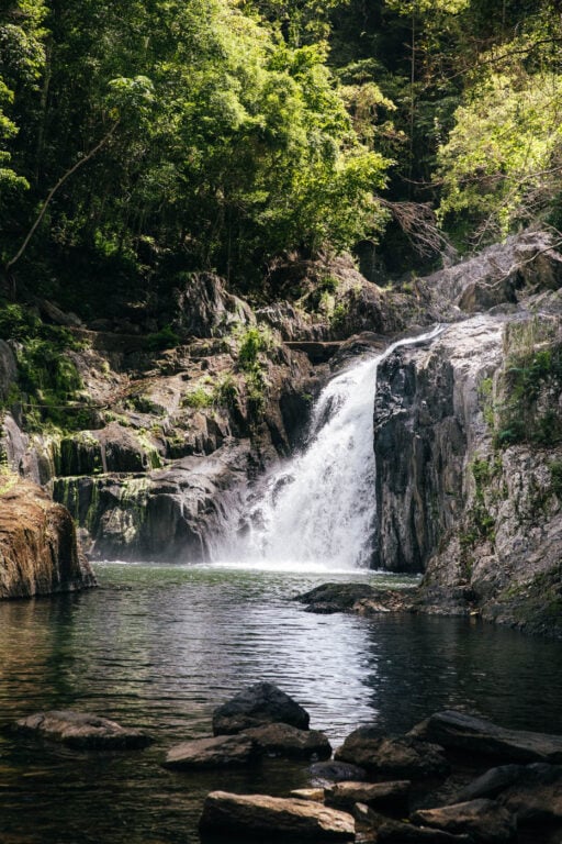
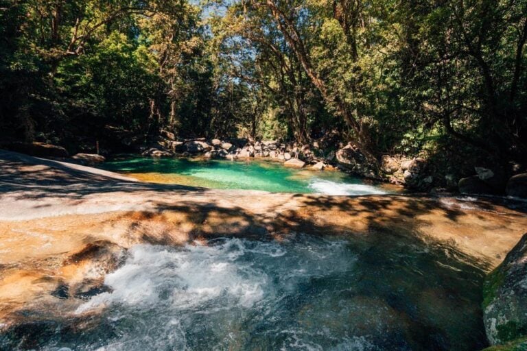
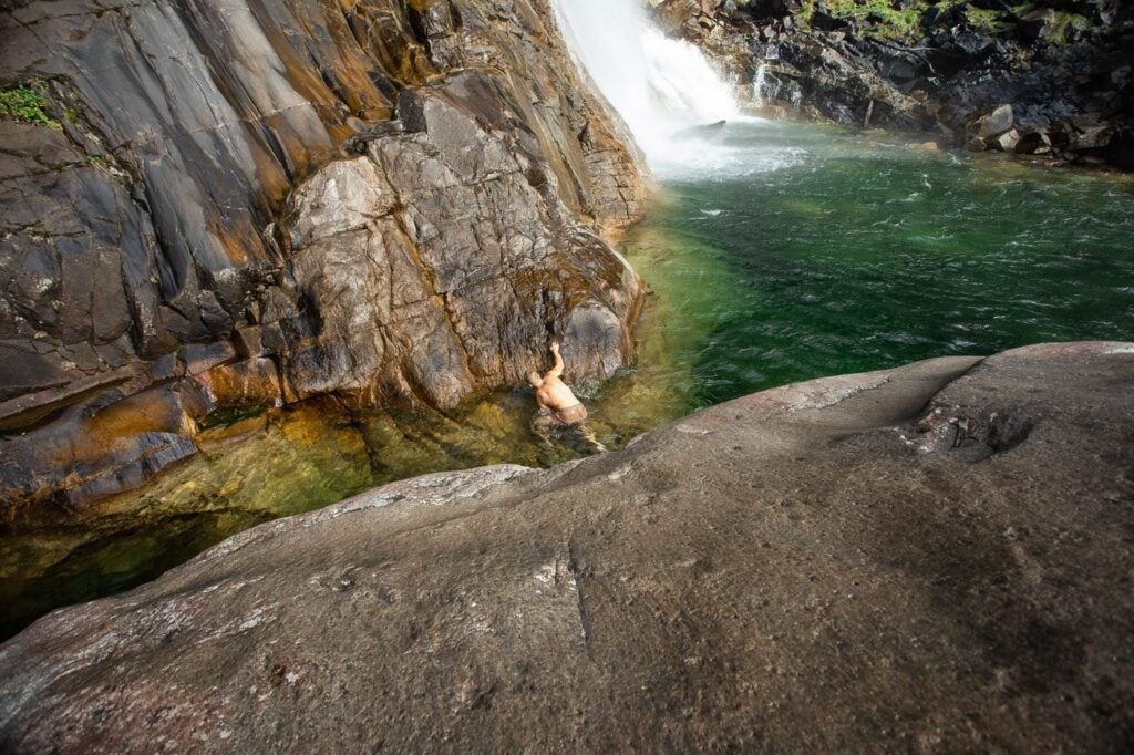
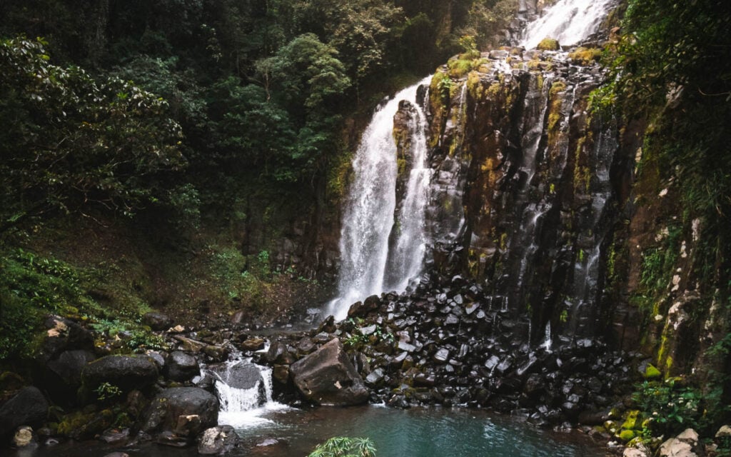
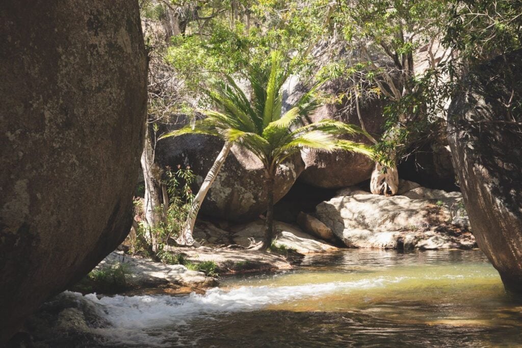
- 6. Crystal Cascades and Fairy Falls
- 7. Stoney Creek Falls (Old Weir Falls)
- 8. Saddle Mountain Summit Hike
- 9. Ivan Evans Walk/Waddlebla Trail
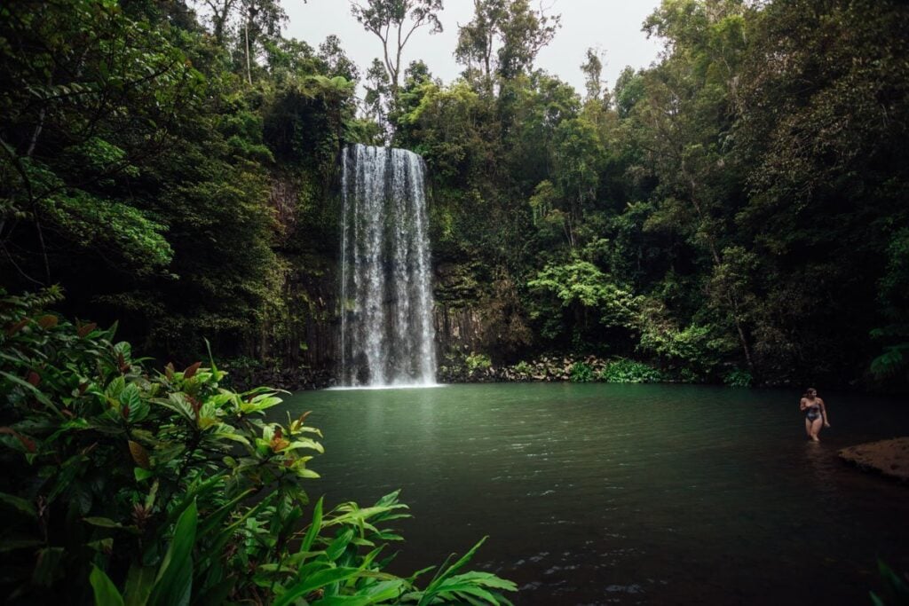
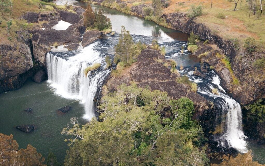
- 10. Barron Falls Track
- 11. Mount Bartle Frere Summit
- 12. Josephine Falls Track
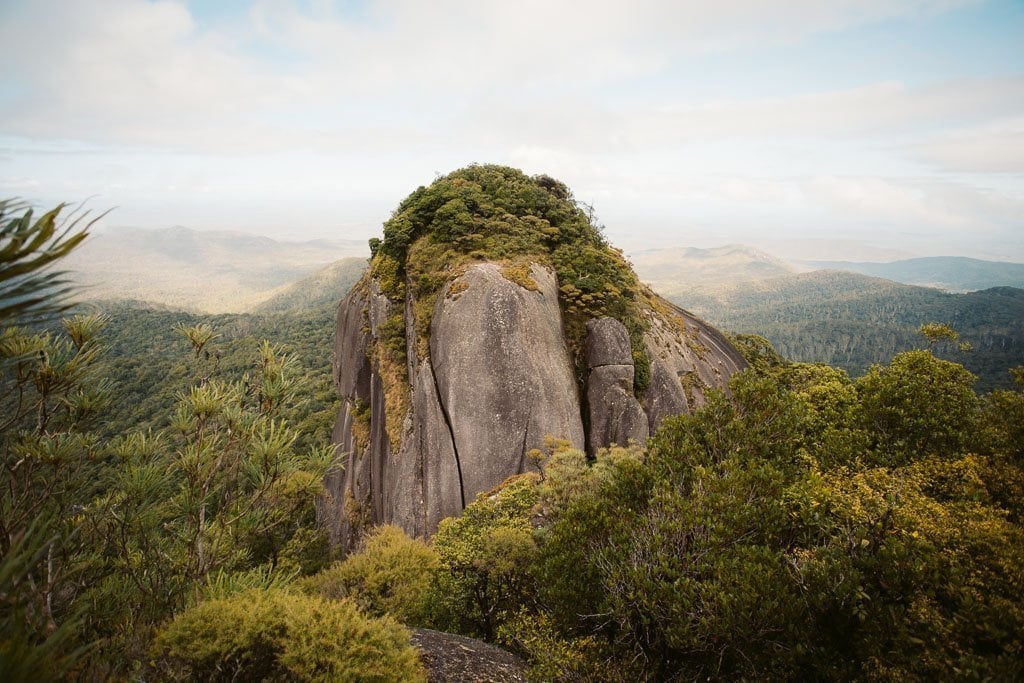
- 13. Kahlpahlim Rock (Lamb Rock)
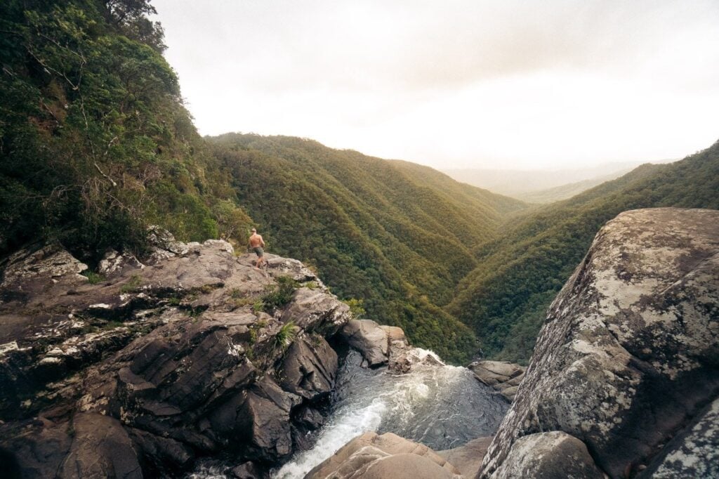
- 14. Windin Falls Track
- 15. West Mulgrave Falls Track
- 16. Turtle Rock Hike
- 17. Behana Gorge Track/Clamshell Falls
- 18. Nandroya Falls
- 19. Hypipipamee Crater Loop
- 20. Millaa Millaa Waterfall Circuit
- 21. Cannabullen Falls (Top of Waterfall)
- 22. Tully Gorge Lookout
- 23. Big & Little Millstream Falls Tracks
- 24. Souita Falls Track
- 25. Mungalli Falls Track
- 26. Isabella Falls
- 27. Tchupala and Wallicher Falls Track
- 28. Babinda Boulders and Devil’s Pool
- 29. Fitzroy Island Lookout Track (Summit) – Best Cairns Island hike
- 30. The Earl Hill Track
- 31. Davies Creek Waterfall Track
- 32. Emerald Creek Falls Track
- 33. Hartley’s Creek Falls Hike
- 34. Spring Creek Falls Track
- 35. Mossman Gorge Tracks
- 36. Devil’s Thumb Hike (most Epic Cairns Hike)
- 37. Wankaroo Falls, Wooroonooran National Park
- 38: Mount Sorrow Summit at Cape Tribulation
- Cairns Hiking Resources
- Cairns Hiking FAQs
- More Cairns Hiking Guides & Adventures From Far North Queensland


Best Cairns Outdoor Experiences
- Fitzroy Island Full Day Trip - the closest (and cheapest) Great Barrier Reef Island to visit from Cairns. Check out the world-famous famous Nudey Beach and hike to the island summit // Fitzroy Guide
- Daintree & Mossman Gorge Trip - visit the oldest rainforest in the world in the Daintree National Park. Visit Cape Tribulation, Mossman Gorge and get an included cruise.
- Great Barrier Reef by Catamaran - visit the outer reef and snorkel or scuba dive at two pristine reef locations.
- Scenic Helicopter Flight - a once-in-a-lifetime opportunity to see the Great Barrier Reef from above on a scenic helicopter flight from Cairns city.
- ... 7 more top-rated tours here
Travel tip: By far, the best islands for snorkeling in Cairns are the Frankland Islands (pristine reef). There is only one boat trip allowed to stop on these islands and you can book this directly with BackpackerDeals + use code OLLY5 to get $5 off.
A Foreword for "Cairns Hiking Guide: 38 Best Hikes in Cairns"
In this blog post, I've formulated a complete list of all of the most epic hikes and walks in and around Cairns. I've spent several months exploring, documenting and photographing all of the best hiking trails in the region to compile this epic list.
Consequently, this is a long post but still only contains a short brief for each hike. However, here are a few things to note:
- I've written comprehensive hiking guides for each and every Cairns walking track listed in this blog post. You'll find the link beneath each heading.
- For hikes with waterfalls exclusively, make sure to check out my comprehensive guide to the Best waterfalls in Cairns and surrounds.
- Many of the hikes and trails included in this list are a fair drive from Cairns CBD itself. Travelers will want to rent a car for the most freedom since there is very little public transport to the best hiking trails.
- This list is not ranked in any particular order. Instead, I have grouped trails and routes that are closer together to help you better plan your trips.
Lastly, at the bottom of this post is a comprehensive Cairns hiking guide. This includes useful tips and resources that will help you out on your adventures in Cairns.

38 Best Hikes & Walking Tracks in Cairns
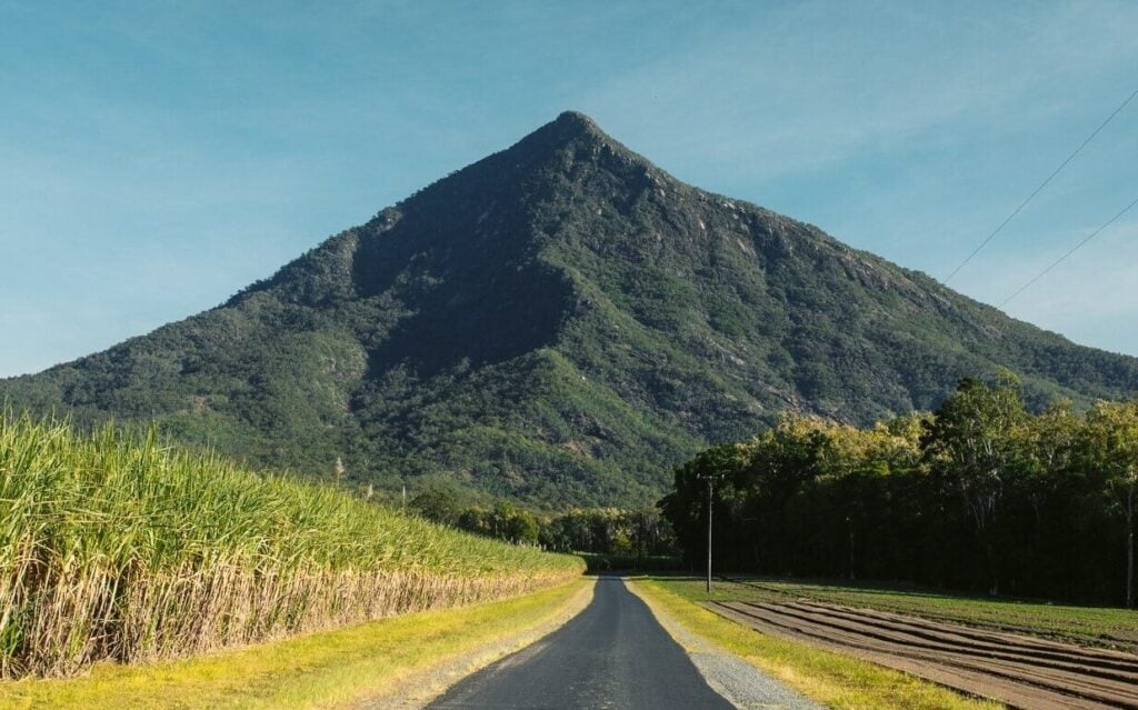
1. Walsh's Pyramid
- Hike Distance: 6.2 km (return)
- Duration: 3.5-5 hours (return)
- Elevation: Approximately 900 m total elevation gain |
Peak height: 922 m AMSL - Difficulty: Moderate (strenuous)
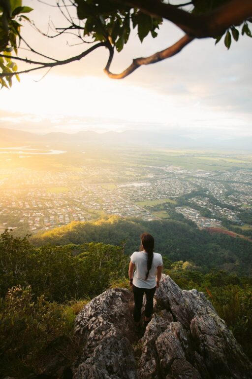
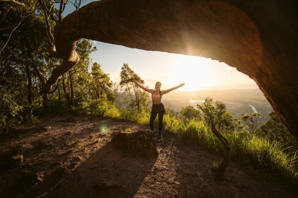
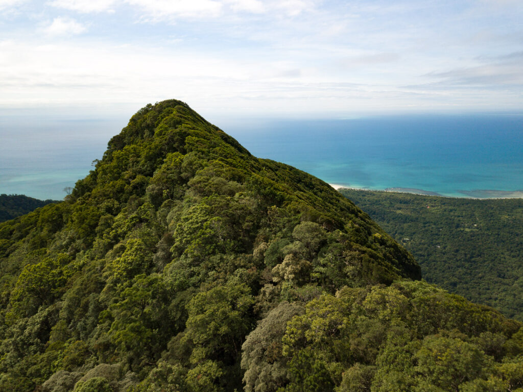
This one is perhaps the most iconic hike in Cairns. Just south of town is the world’s tallest freestanding natural pyramid; Walsh’s Pyramid. Hikers who are keen to tackle the summit will be rewarded with some of the best panoramic views of the Cairns and Innisfail Coast.
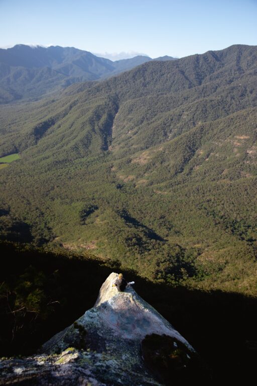

Walsh’s Pyramid’s elevation stands at 922 metres above sea level. However, hikers start pretty close to sea level, so the total elevation gained is close to 900M. Due to its natural pyramid shape, this Cairns hike is a pretty straightforward slog to the top.
I suggest starting early to beat the heat and grab a chance at an epic sunrise.


Don't Miss This Cairns Packing List
Preparing a trip to Cairns? Don't miss these must-bring items on your list!
2. White Rock Lookout
- Hike Distance: 5 km (return on same track)
- Duration: 1.5-2 hours return
- Elevation: 315 m elevation gain |
White Rock Elevation: 510 m AMSL - Difficulty: Moderate
The White Rock hike is an out-and-back walking track leading to “White Rock Lookout”— one of the best peak lookout points near Cairns CBD.
White Rock Lookout is located on the Lamb Range just beside the suburb of Mount Sheridan. The walking track is within Dinden National Park, beside the Lake Morris Reserve on the mountains overlooking Cairns.
While there is a suburb near Cairns which shares the same name, don't mistake them. Instead, this trail begins near the top of the steep and winding Lake Morris Road and nowhere near the suburb.
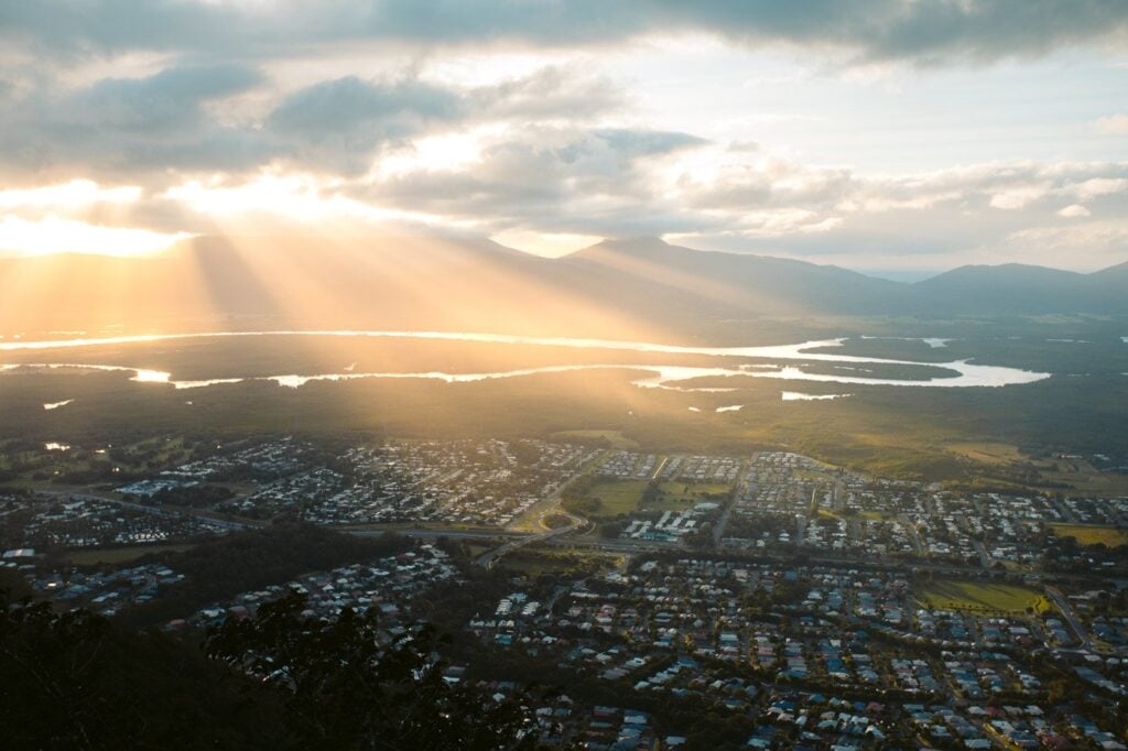

Views span 180 degrees from Cairns to Walsh’s Pyramid and the Gillies Range.
Just below, you’ll have a perfect vantage point of the suburbs south of Cairns. Also, a bit further out is an uninterrupted view of the entire Trinity Inlet!

3. Glacier Rock Lookout
- Hike Distance: 5.9 km return
- Duration: 2-2.5 hours
- Elevation: 395 m elevation gain |
450 m AMSL - Difficulty: Easy
The Glacier Rock hike is a medium-length out-and-back trail offering magnificent coastal views from Cairns to the Northern Beaches. If you’re up for a decent, rewarding hike near Cairns or Kuranda, then the Glacier Rock walking track is an excellent choice.
From the Glacier Rock lookout, there are spanning views of the coast, including the Northern Beaches, Cairns CBD, the Barron River, Earl Hill, the Mount Whitfield Conservation Park and the distant mountains of the Lamb Range.

4. The Arrow Tracks (Short Hikes Near Cairns CBD)
Mount Whitfield Summit Loop (Lumley Hill Lookout)
- Hike Distance: 8.5 km (loop)
- Duration: 2.5-3.5 hours return
- Elevation: 465 m elevation gain |
315 m AMSL at Lumley Hill Lookout - Difficulty: Easy-Moderate
The Cairns Arrow Tracks are a very popular set of walking tracks near Cairns. They are named after the different routes marked by coloured arrows: red, blue, yellow and green.
Due to their easy access and proximity to Cairns CBD, these Cairns walking tracks are the most popular in the area. Departing from the Cairns Botanical Gardens, walkers have a selection of several walking tracks in the Mount Whitfield Conservation Park.
However, if you're up for the longer tracks with better views, I'd suggest taking the Red and Blue Arrow Tracks.


#1 Water Bottle Filter
Enter the Grayl GeoPress Water Filter & Purifier Bottle! I take this bottle on every hike and use it as my go-to source for filtering water all over the world. I've even used it to drink tap water in India!
// Compare how the GeoPress stacks up against the best water bottle filters on the market.
5. Mount William Track
- Hike Distance: 13 km
- Duration: 4-6 hours
- Elevation: 1220 m elevation gain |
~1000 m AMSL at the summit - Difficulty: Hard
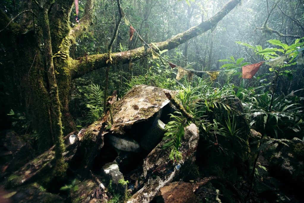
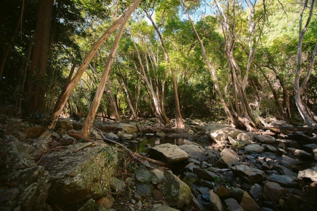
The Mt William hike is a very lightly trafficked walking track that branches off from Smiths Track near Stoney Creek, just north of Cairns. Although easily accessed, this Cairns hike is fairly demanding, steep, dense and absolutely full of leeches!
At the Mount William summit, you’ll find the remains of a 1986 plane crash, which tragically claimed the lives of eight people in 1986. Although this one doesn't offer much in terms of views, if you're up for a challenging hike with ever-changing flora as you ascend, this one might be a good bet.

6. Crystal Cascades and Fairy Falls
- Hike Distance: less than 1 km
- Duration: 15 minutes
- Elevation: Almost none, slight incline to the falls
- Difficulty: Very Easy
After pinning some of the epic hikes in Cairns included in this list so far, you might also want to squeeze in some time for the Crystal Cascades. This is only a very short and easy walk to either the main Crystal Cascades waterfall or the hidden and secluded Fairy Falls.
You will reach both of these waterfalls from the same location, just a short drive from Cairns. However, both the falls are on separate trails, each very easy and only roughly a 15-minute walk.

Travel tip: You're going to need a car or transport to get to many of the trails. Most of the trails are up in the National Parks and there is limited public transport to these spots. RentalCars.com is one of the best resources for finding and comparing deals across brokers.
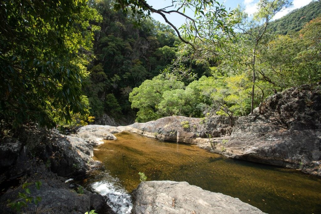
7. Stoney Creek Falls (Old Weir Falls)
- Hike Distance: 4 km (return)
- Duration: 40 minutes (return)
- Elevation: 100 m
- Difficulty: Easy
Stoney Creek is a popular freshwater swimming spot just a 20-minute drive from Cairns CBD. There is a dedicated car park (just near the Glacier Rock trailhead), with a nice swimming hole immediately adjacent.

However, if you're up for a longer walk to a better waterfall, I'd suggest taking the relatively easy trail to Old Weir Falls. This is accessed by taking the straight track from the footbridge fork leading up a wide, dirt track.
This Cairns walking track is fairly easy and not very long, with only a slight incline. So, it's the perfect waterfall track for bushwalkers chasing something easy with a refreshing freshwater swim at the end.

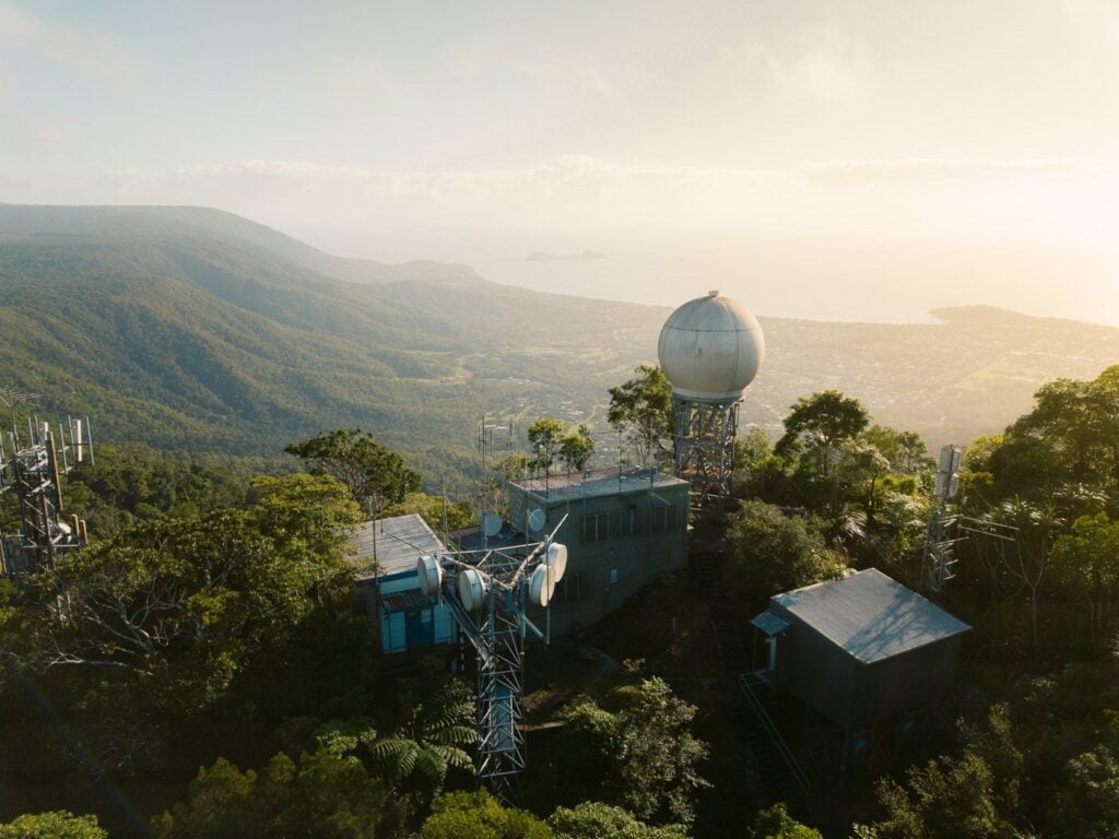
8. Saddle Mountain Summit Hike
- Hike Distance: 10.5 km return
- Duration: 2.5 - 3.5 hours
- Elevation: 670 m elevation gain |
Saddle mountain summit: 640 m AMSL - Difficulty: Difficult: steep and muddy
Saddle Mountain is a summit hiking trail located between Kuranda and Smithfield and accessed from the Northern Beaches. You begin by crossing through the Smithfield mountain bike tracks before entering the unsigned Saddle Mountain walking track.
This Cairns hike is steep and strenuous but well worth the views at the top, which is indicated by the unmissable weather radar at the summit. The track itself is narrow and very easy to miss initially. So, make sure to read the full guide below if you're going to attempt this steep but worthwhile hike in Cairns.

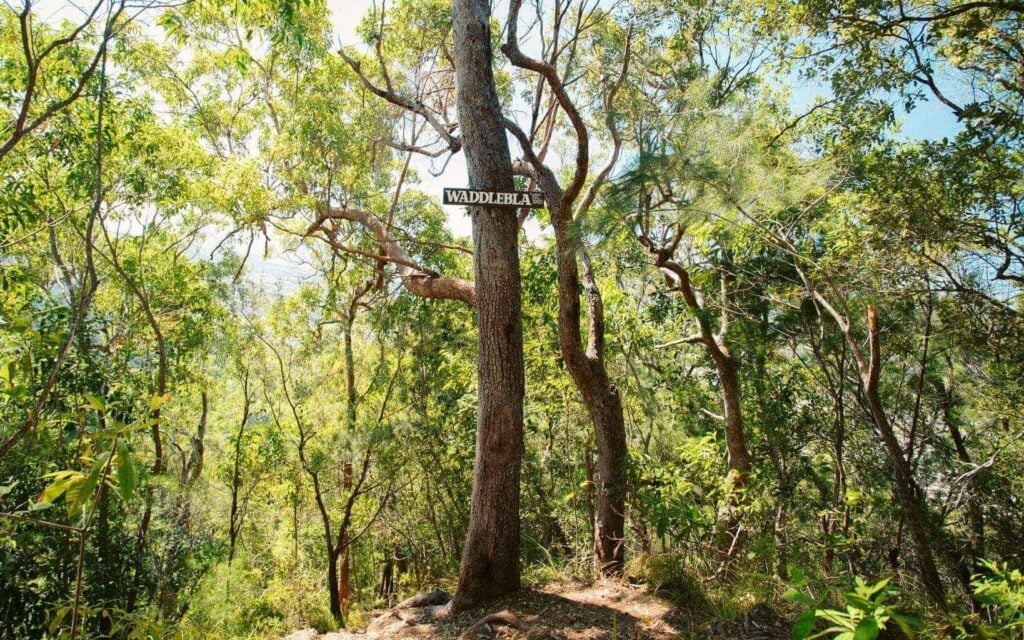
9. Ivan Evans Walk/Waddlebla Trail
- Hike Distance: 7-8 km return
- Duration: 1-3 hours (depending on your route)
- Elevation: ~ 600 metres elevation gain
- Difficulty: Moderate (steep in sections)
The Ivan Evans Walk is a popular Cairns walking track among locals out for a quick stroll close to town. However, the Ivan Evans trail itself is quite short and not much of an adventure on its own. For this reason, I chose to combine the Ivan Evans Walk with the steeper Waddlebla Trail up to Boi Boi Peak and Waddlebla Peak. This made it a much more challenging, more scenic and more rewarding hike.
Some sections of this trail involve walking on a downhill mountain bike run which is very steep. For this reason, you'll need to be vigilant and keep an ear and eye out for bikes.
Unfortunately, this hiking trail in Cairns doesn't offer much in terms of views. However, you could potentially combine this track with sections of the White Rock track to the lookout. This would make it one of my favourite tracks close to town!


50+ More Cairns Bucketlist Items
- Visit the Cairns Islands
- Kuranda Railway & Skyrail
- Rusty's Markets
- Day trip to Cape Tribulation
- ... +51 more things to do in Cairns!
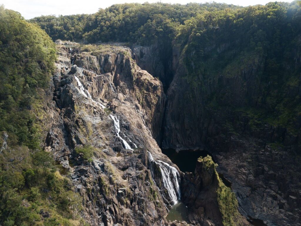
10. Barron Falls Track
- Hiking Distance: 500 metres return
- Duration: 20 minutes return
- Elevation: N/A
- Difficulty: Very easy
While not a strenuous bushwalk by any means, the short boardwalk stroll to the Barron Falls railway viewpoint is a must if visiting Kuranda. Barron Falls is the largest waterfall in the area and is truly a sight to behold following heavy seasonal rain.
The walk is quite short, yet has loads to offer in terms of a view and a taste of the incredibly diverse rainforest landscapes.
To get here, you can take the Skyrail to Kuranda. I recommend getting the combined Skyrail & Scenic Rail tickets to save money and get an easy and scenic transport route back to Cairns.

11. Mount Bartle Frere Summit
- Hiking Distance: 9 km to the summit
- Duration: 5 hours to the summit
- Elevation: 1600 m |
Mount Bartle Frere summit: 1611 m AMSL - Difficulty: Difficult
Those up for a serious Cairns hiking adventure should definitely consider tackling Queensland's tallest peak: Mount Bartle Frere.
There are two route options to hike Bartle Frere, from near the Windin Falls car park or the Josephine Falls car park.

I'd suggest taking the eastern approach to the summit via the Josephine Falls car park, a 5+ hour steep slog from near sea level to 1611M above the clouds. While you can tackle this famous Far North Queensland mountain in a single day, I'd highly recommend camping at the summit for extraordinary sunset and sunrise views!

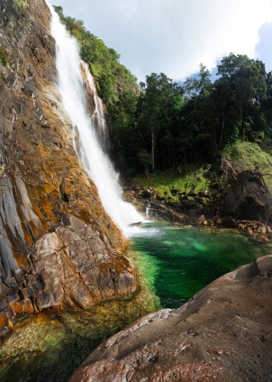
12. Josephine Falls Track
- Hiking Distance: 1.4 km return
- Duration: 25 minutes return
- Elevation: N/A
- Difficulty: Very Easy
While a fair drive from Cairns, Josephine Falls is still one of Far North Queensland's most iconic waterfall swimming locations. Sharing a car park with the Mount Bartle Frere trail above, the Josephine Falls walking track is a picturesque boardwalk stroll to turquoise rainforest swimming holes.
A visit to Josephine Falls is a must for those heading on a road trip from Cairns and also makes the perfect post-hike shower after the difficult Mount Bartle Frere summit.

13. Kahlpahlim Rock (Lamb Rock)
- Hiking Distance: 18 km return loop
- Duration: 4-5 hours
- Elevation: N/A
- Difficulty: Very easy
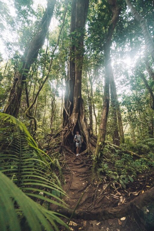
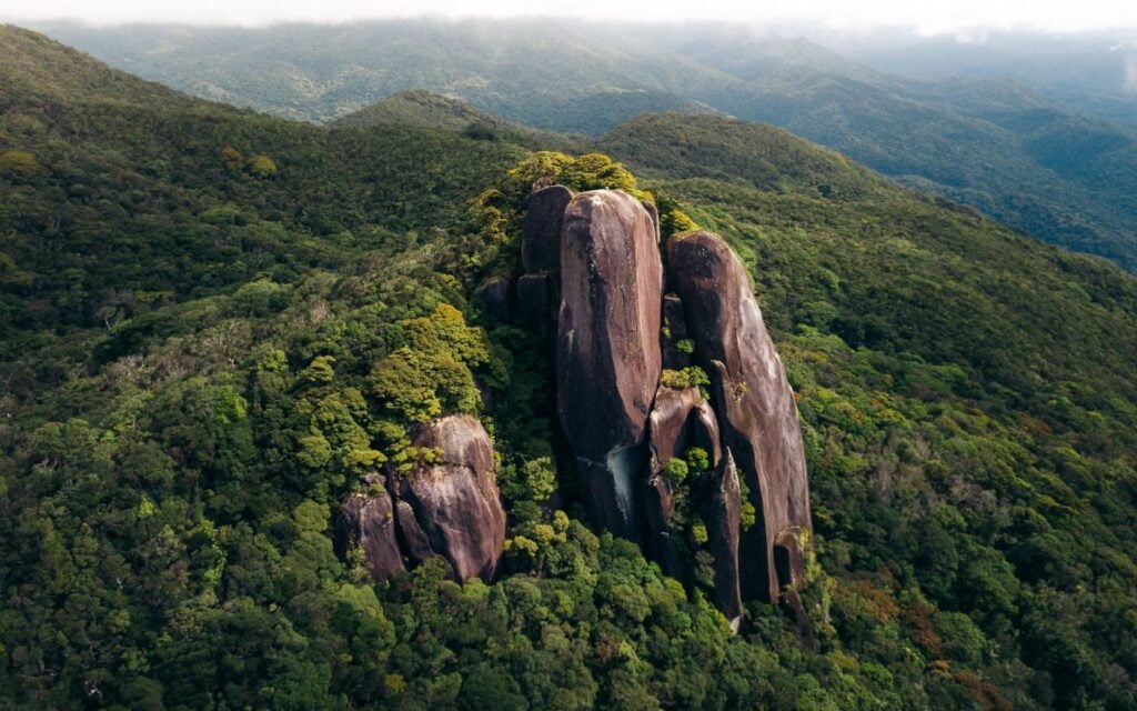
The Kahlpahlim Rock Hike, also known as Lamb’s Head, is a walking track located near the town of Mareeba. This is an enjoyable hike that can be attempted year-round and leads through both dense pine forests and thick, tropical rainforest.
The main event, Kahlpahlim Rock, is a stand-alone rock monolith overlooking the wild surrounding rainforest.
Best of all, this Cairns hike can be completed in a loop, which means you don't have to return on the same trail you came in on.

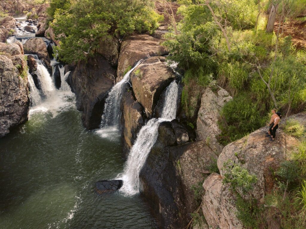
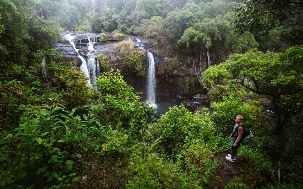
14. Windin Falls Track
- Hiking Distance: 11.5 km return
- Duration: 2.5-3 hours return
- Elevation: 350 m elevation gain (most on the return)
- Difficulty: Moderate (mostly easy)
Quickly becoming one of Far North Queensland's waterfall icons, Windin Falls offers one of the most dramatic waterfall viewpoints near Cairns. This hike is relatively easy as it undulates along a wide walking track in the Wooroonooran National Park.
It's only at the final stretch down to the waterfall infinite falls that this hike becomes a little steep.
For sunrise adventures, you really can't beat Windin Falls when planning an epic Cairns hike with a waterfall and view in one epic package!

15. West Mulgrave Falls Track
- Hiking Distance: 12 km return
- Duration: 4-5 hours return
- Elevation: 535M total gain (most on the way back)
- Difficulty: Difficult
I refer to the West Mulgrave Falls hike as "FNQ's Best-Kept Secret". That's because no matter how hard you try, you simply won't find much information about this incredible waterfall hike at all.
However, before strapping up the gear bag, make sure you're well prepared. This hike requires solid bush and navigation experience. The track is mostly overgrown with orange markers sparsely deployed along the route.

Beginning from an unmarked trail near the Windin Falls car park, the West Mulgrave Falls track winds through dense forest before steeply descending down a sharp canyon. After hours of battling through persistent wait-a-while and sloppy boar tracks, the reward is a swim at one of Australia's most magnificent waterfalls.
Just remember, the hard part is climbing back up the canyon on the return, so plan accordingly!

16. Turtle Rock Hike
- Hiking Distance: 6.7 kilometres (circuit)
- Duration: 1.5 hours – 2.5 hours
- Elevation: Gain 320 m |
910 m AMSL at Turtle Rock - Difficulty: Moderate
Another one of those hikes near Cairns that's truly "off the beaten path".
The Turtle Rock trail features a spectacular boulder lookout, light rock scrambling and an easy river crossing. You'll need to drive out to Dindin National Park to get here. However, it's well worth it, especially for adventurers keen on exploring what else the region has to offer.

17. Behana Gorge Track/Clamshell Falls
- Hiking Distance: 6.6 km
- Duration: 1.5-2 hours
- Elevation: 220 m total gain (undulating)
- Difficulty: Easy
The Behana Gorge walking track lies within the Wooroonooran National Park, approximately 35 minutes south of Cairns. This mostly sealed walking track follows a water pipe along the scenic cascades of Behana Gorge.

At the end of this relatively easy hike, you'll reach Clamshell Falls, a picturesque waterfall and swimming location that's worth a visit. It's also possible to do a canyoneering trip here, which is a fun option for those looking for a bit of adrenaline.


Stay in Port Douglas!
Port Douglas, just a short hop from Cairns makes for an ideal alternative (or addition) with great accommodation options such as:
- Top Resort: Sheraton Grand Mirage
- Mid Range: Oaks Resort
- Budget: Global Backpackers
- ...+10 more in this Port Douglas Accommodation Guide
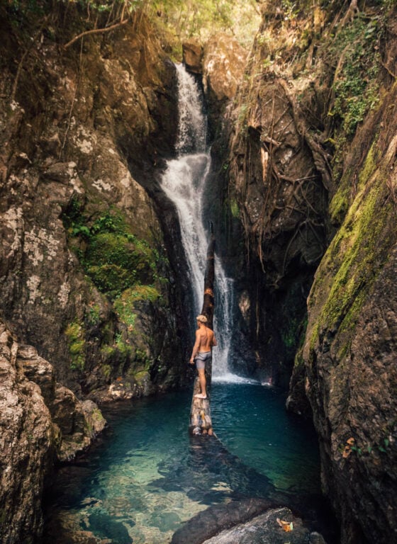
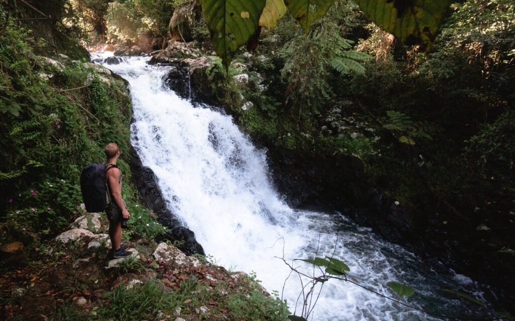
18. Nandroya Falls
- Hiking Distance: 5 km return
- Duration: 40 minutes-1 hour return
- Elevation: 100 m
- Difficulty: Easy-Moderate
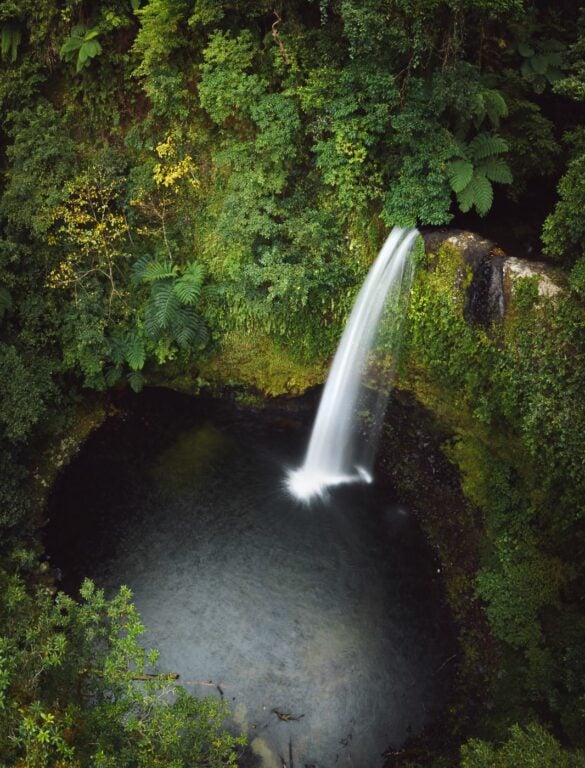
The Nandroya Falls waterfall hike is another magical rainforest bushwalk in the incredibly underrated Wooroonooran National Park near Cairns. This waterfall hike is one of my personal favourites in the entire Wet Tropics Heritage Area. The trail is narrow and surrounded by thick rainforest vines and tropical vegetation on all sides.

And, what's a great hike without an even better reward? Nandroya Falls is up there with one of the most impressive waterfalls in the area, go check it out for yourself!

19. Hypipipamee Crater Loop
- Hiking Distance: 1.2 km loop
- Duration: 30-40 minutes
- Elevation: Mostly flat
- Difficulty: Easy
Okay, this hike is a fair slog from Cairns. Nevertheless, you are planning a trip out to the Tablelands, aren't you? Many of the epic walking tracks on this list are in the area. A great example is the Hypipamee Crater loop, a short bushwalk featuring a huge volcanic crater viewpoint and a scenic waterfall and swimming spot.
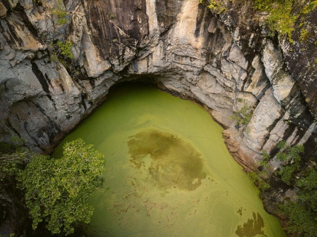
Wait, a volcano? Actually, the Hypipamee Crater is in fact, a diatreme. This is an ancient volcanic pipe caused by a gaseous explosion, which has since filled with water.
It was discovered in 1879 when a gold-prospecting party accidentally fell into it! Don't worry though, it's no longer easy to miss by any means.

20. Millaa Millaa Waterfall Circuit
The Millaa Millaa Waterfall Circuit is a trio of epic rainforest waterfalls located in the Atherton Tablelands Region just behind Cairns.
As to not confuse you, this isn't a big hiking circuit. Instead, travellers need to drive or take a bus to each waterfall along Theresa Creek Road in Millaa Millaa and take a short walk down to each.
For hikers and waterfall lovers visiting the Tablelands from Cairns, I'd highly recommend checking out the Millaa Millaa circuit. While the hikes aren't lengthy or difficult, the area is one of the most beautiful in Far North Queensland.
I haven't included hiking data for this place since each walk involves just a short descent to the waterfall from the corresponding car park. Well, all except Millaa Millaa Falls, which you can pretty much drive straight up to.
21. Cannabullen Falls (Top of Waterfall)
- Hiking Distance: 13.8 km return
- Duration: 4 hours return
- Elevation: 436 m total elevation gain (undulating)
- Difficulty: Moderate - Difficult
The Cannabullen Falls hike is an example of just how raw and underrated the region around Cairns and the Far North really is. The wide, remote trail to Cannabullen Falls is a step back in time.
Hikers will experience no more sound than the echoing calls of prehistoric birds and their own muddy feet as they traverse through the oldest surviving rainforest on earth.
This trail involves two creek crossings and a long, undulating trek through dense and wet rainforests that can get very muddy. The end goal is the top of Cannabullen Falls, one of Queensland's most incredible waterfalls. You likely won't see anyone else on this trail, so prepare accordingly.
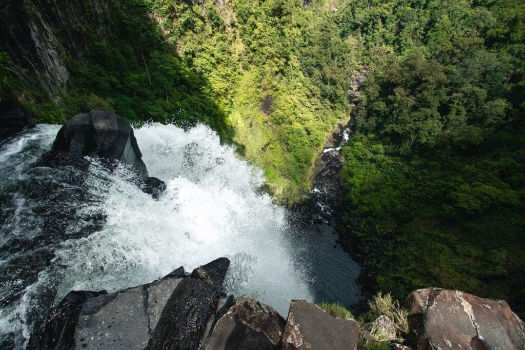

22. Tully Gorge Lookout
- Hike Distance: 1.5 km return
- Duration: 30 minutes return
- Elevation: N/A
- Difficulty: Very Easy
Tully Gorge is one of those raw Australian locations that leave a lingering feeling of absolute awe. This Jurassic Park-like waterfall and gorge is 293 metres tall and carved by the Tully River as it runs downstream from the densely forested Cardwell Range.
Again, this one's for the destination chasers.
From Cairns, expect at least a 2-hour 15-minute drive up the Gillies Range Road, past Millaa Millaa and Malanda en route to Ravenshoe, QLD’s highest town. However, as you'll see from this list of epic hikes in and around Cairns there are plenty of things to check out on the way.
The hike begins from the waterfall lookout and is fairly short and flat as it leads out to the top of the falls overlooking the gorge. Although not difficult by any means, this lookout spot has to be one of the most epic in Cairns and well worth the drive!

23. Big & Little Millstream Falls Tracks
- Hiking Distance: 300-500 m each
- Duration: Each about 10 minutes
- Elevation: N/A (Little Millstream involves a slight gradient)
- Difficulty: Very Easy
While we're on the outskirts near Ravenshoe and really pushing the limits on what can be considered the Cairns region, make sure to check out Big and Little Millstream Falls. These waterfalls run on “The Millstream”, the watercourse and source of both waterfalls.
Both of these hikes are a short distance from one another but require a brief drive to access. These bushwalks are sealed, short and very easy. However, the waterfalls are quite spectacular. If you decide to make the trip, make sure to be quiet on the trail for a chance to spot a wild platypus!


24. Souita Falls Track
- Hiking Distance: 450 m return
- Duration: 15 minutes
- Elevation: Steep on the way back up
- Difficulty: Easy
Souita Falls is another waterfall hike located in the hinterlands just off the Palmerston Highway near the township of Middlebrook.
This Cairns/Tablelands walking track is only 220 metres and passes two cascading waterfalls. It’s very accessible with a clear track the entire way. Although, it’s a little steep on the way back up, but nothing to worry about.
For those looking for a short-burst rainforest walk that is almost guaranteed to be void of other hikers, this is the one!

25. Mungalli Falls Track
- Hiking Distance: 1.2 km return
- Duration: 25 minutes
- Elevation: ~ 100 m
- Difficulty: Easy
This waterfall hike is one of the more "unique" ones on this list of the best hikes in Cairns. I say that because it's actually located within a Wilderness Retreat Complex. Don't worry though, the owners of the land allow visitors to check out the Mungalli waterfall free of charge and it certainly doesn't feel like a commercial experience.
There are several levels to this waterfall, all of which are accessible via the sealed walking track. I recommend walking all the way to the bottom level, where you'll find a 75-metre giant hidden in a rainforest cove. It's also said that there are wild platypi and glow worms that live here.

26. Isabella Falls
- Hiking Distance: 2 km return
- Duration: 45 minutes - 1-hour return
- Elevation: 150 m
- Difficulty: Easy - Moderate
Readers chasing a hike in Cairns close to the suburbs and CBD will definitely appreciate this local gem. Isabella Falls is tucked behind the hill suburbs near Mount Sheridan but definitely doesn't feel like it! Immediately after stepping onto the trail, you could easily confuse yourself for being kilometres in the scrub.
The walking trail is unmarked but quite easy to follow. There are small cascades and shallow freshwater pools along the track but the main event requires a short but steep rope-assisted root scramble to reach.
There isn't much of a view at the top but the waterfall is tranquil and makes for a perfect place to relax before climbing back down.

27. Tchupala and Wallicher Falls Track
- Hiking Distance: 5 km return (both tracks)
- Duration: 1 hour
- Elevation: Mostly flat or undulating
- Difficulty: Easy
The Tchupala and Wallicher Falls walking tracks are another set of waterfall hikes in the Wooroonooran National Park. Both departing from the same trailhead, the track forks quickly, with options for Tchupala and Wallicher waterfalls.
Both waterfalls are impressive and the rainforest hiking trails are incredible! Therefore, I'd recommend checking out both falls if you have the time.

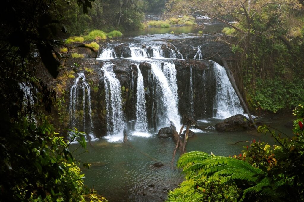

28. Babinda Boulders and Devil's Pool
- Hiking Distance: 1.3 km return (Devils Pool track)
- Duration: 20 minutes return
- Elevation: Mostly flat
- Difficulty: Easy
The Babinda Boulders freshwater swimming spot is a popular creek cascade and wash-pool area near the township of Babinda.
The water is crystal clear, and perfect for swimming or cooling off in hot, tropical Cairns weather. There is also a short trail known as the "Devils Pool Track", which follows a stretch of the river to view the scenic granite boulders.
This walk is easy and mostly flat. There are also a couple of viewing platforms along the hike where you can witness the force of the river carving through the smooth granite walls.

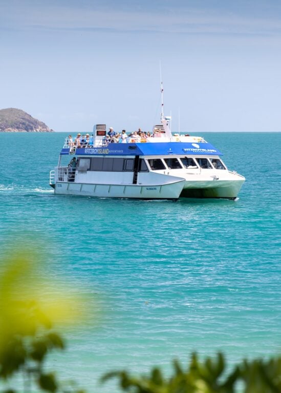
29. Fitzroy Island Lookout Track (Summit) - Best Cairns Island hike
Fitzroy Island is one of the closest islands off Cairns and certainly offers the most for people looking to do some trail hiking. Ferries depart frequently from the Cairns reef fleet terminal and only takes about 45 minutes. So, whether you want to take a short stroll to Nudie Beach or climb to the island summit, the island's your hiking oyster.
The Fitzroy Island summit hike can be completed as part of a loop with an optional stop at the island lighthouse located at the back of the island.
The trail departs from the beach near the ferry terminal and climbs steeply on a mostly sealed track. Thankfully, the views from the top are well worth the effort and one of the most unique out of all the epic hikes in Cairns!
Read: What It’s Like Staying at Fitzroy Island Resort


Save $$$ With a Half-Day Trip
Only got time to visit the island for a few hours?
Currently, there's a great deal you can snag with BackpackerDeals, offering cheaper half-day return ferry tickets. Use code OLLY5 to save yourself an extra $5.
30. The Earl Hill Track
- Hiking Distance: 3.2 km loop
- Duration: 45 minutes
- Elevation: 200 m
- Difficulty: Easy - Moderate
The Earl Hill Track is a small hill loop circuit located near the Northern Beaches suburb of Trinity Beach.
The track is popular among morning walkers and dog lovers and is made up of a few tracks, one leading to the Earl Hill summit. Furthermore, as of 2020, there is a new beach access track which means that you can start at the trailhead and finish on the shores of Trinity Beach!

31. Davies Creek Waterfall Track
- Hike Distance: 250 m
- Duration: 5 minutes to the falls
- Elevation: N/A
- Difficulty: Very easy
The Davies Creek waterfall track is a short walking trail ending at a spectacular waterfall in Davies Creek National Park. You'll find the well-marked trailhead just before the Kahlpahlim Rock hike.
Although this one is quite short, the waterfall is, in my opinion, a must-visit if you're in the Dindin/Davies Creek National Park region.
The waterfall features some shallow swimming holes just a little further upstream. So, if you've just tackled Kahlpahlim, Davies Creek is a great post-hike cool-off point.

32. Emerald Creek Falls Track
- Hiking Distance: 2 km return
- Duration: 30 minutes return
- Elevation: Mostly flat
- Difficulty: Easy
Another eucalypt-surrounded waterfall hike on the western side of the Lamb Range from Cairns is the Emerald Creek Falls track. The track is accessed via a short stretch of dirt road that isn't suitable for caravans. However, the hike itself is fairly flat and relatively easy.
The waterfall offers a larger, cascading level and deep swimming holes which makes it a perfect spot to cool off all year round. Also, Emerald Creek is one of the only dog-friendly waterfall hikes near Cairns since it lies within a State Forest.

33. Hartley's Creek Falls Hike
- Hiking Distance: 7.5 km (return)
- Duration: Roughly 1 hour each way
- Elevation: 290 m total gain (undulating)
- Difficulty: Easy
Hartley's Creek Falls is somewhat of a “local secret”, hidden at the back of Wangetti near the well-known Hartley’s Crocodile Adventures. Don’t worry though; there aren’t any crocs lurking at Hartleys Creek Falls! So, you’re free to swim and cool off at the waterfall after the short but rewarding hike.
The track is wide and easy to follow, undulating sporadically through the native scrub. Also, the trail's length follows the banks of Hartleys Creek all the way to the waterfall without needing to make any turns. So, it's quite easy to follow.
While there are some dips and steep sections, overall, the Hartleys Creek Falls track is very gentle and can be completed by anyone with an average fitness level.

34. Spring Creek Falls Track
- Hike Distance: 6.3 km return
- Duration: 2.5 – 3.5 hours return
- Elevation: roughly 300 m overall gain
- Difficulty: Moderate
The Spring Creek Falls track also known as Black Rock Falls is located just a short drive from the Port Douglas coast in the Mowbray National Park. The walk up to Spring Creek Falls doesn’t follow a set track but instead winds up the length of Spring Creek to the upper waterfalls. While there are sections of a noticeably worn track, you’ll likely end up skipping, hopping, scrambling and crawling over the rocky banks on a random course all the way to the waterfall.
Those heading north from Cairns and looking for a little-known hike and waterfall gem should definitely add this one to their Cairns hiking list!

35. Mossman Gorge Tracks
Mossman Gorge is a series of rainforest circuits and tracks that gives visitors a real taste of the ancient Daintree National Park. The tracks offer swimming holes, freshwater creeks, and huge ancient rainforest trees.
I haven't supplied hiking data for this item on the list because there are just so many tracks. However, most are quite short and fairly flat too.
If you're in the area and interested in learning more about indigenous rainforest life, I'd highly recommend booking a Dreamtime walk at Mossman Gorge. This is a great tour because you are directly supporting small indigenous businesses while learning more about rainforest life, culture and history.
You can arrange this as a full-day trip from Cairns, which also stops at Cape Tribulation and includes a cruise!

36. Devil's Thumb Hike (most Epic Cairns Hike)
- Hiking Distance: Official: 10.6 km return | Recorded: 14.8 km (with side-trip to waterfall)
- Duration: 7-9 hours
- Elevation: Total elevation gain: 1275 m |
Highest point: 1190 m AMSL - Difficulty: Difficult
The grand finale of this epic list of 36 best hikes in Cairns and surrounds is my personal favourite: the Devil's Thumb or Manjal Jimalji hike in Mossman. This is a long and steep hike through the Daintree Rainforest that finishes at a megalithic granite boulder overlooking the entire Cairns and Port Douglas Coast.
This epic view is well earned after a long 4-5 hour slog up the steep and dense mountain range. The Devils Thumb trail is marked with pink and orange ribbons to follow as you climb the towering hills. However, QLD Parks recommends bushwalking experience to navigate safely and above-average fitness to complete this hike.

37. Wankaroo Falls, Wooroonooran National Park
- Hike Distance: 13.2 kilometers (return)
- Duration: 4-5 hours return
- Elevation: ~400 meters total incline (undulating)
- Difficulty: Moderate
The Wankaroo Falls trail is an unmarked, 13.2 km return trail starting from the Golden Hole, close to Josephine Falls and the Mount Bartle Frere trailhead. The waterfall itself is a roughly 35-metre single-plunge flowing on Wankaroo Creek within the often wet Wooroonooran National Park.
This waterfall takes a bit more effort to reach than others in the area, and therefore I'd only recommend it if you've lived in Cairns for a while and looking for something new.

38: Mount Sorrow Summit at Cape Tribulation
- Hike Distance: 8.8 km return
- Duration: 3-4 hours return
- Elevation: 850 metres total elevation gain |
Mount Sorrow summit: 700M AMSL - Difficulty: Moderate – Difficult
As if we weren't done there, here's one more epic hike that shouldn't really make the list due to the distance. Regardless, I thought it should be mentioned, especially since many people plan a trip to Cape Tribulation when visiting Cairns.
The Mount Sorrow hike is rated as one of the more difficult hiking trails that is popular among adventure seekers in Cape Tribulation. However, it's certainly not as difficult or physically demanding as the Devil's Thumb or Mount Bartle Frere hikes.
The rainforest landscapes at Cape Tribulation are some of the wildest on earth. It's also one of the world's most unique locations since the rainforest creeps all the way down to the water's edge where the fringing Great Barrier Reef begins.
The Mount Sorrow trail climbs to the ridge of Mount Sorrow, one of the tallest peaks in the area. At the top, there is an official "viewpoint" that is admittedly disappointing, to say the least. However, if you continue past this for a few hundred metres up the ridge, the treeline opens up, revealing incredible views of Cape Tribulation— where the rainforest meets the reef.

Cairns Hiking Resources
So, that's it. The most comprehensive Cairns hiking guide you'll find for free, anywhere.
But it doesn't end there. Below I've compiled a comprehensive resource guide to help you plan your hiking and bushwalking trips to Cairns.
- WillyWeather and BOM are my go-to for weather and radar forecasts when planning Cairns walking tracks and bushwalks. Remember. that Cairns is a tropical region and heavy rainfall can smash the coast with little warning.
- The National Parks in the Cairns region are maintained by QLD Parks. On their website, you can find up-to-date information on trail closures and severe weather events, as well as book National Park camping sites for overnighters.
- If you're looking for guided walks and other adventure or adrenaline activities when visiting Cairns, make sure to use Viator or Get Your Guide to find the best rates. They both list only the best local operators and often give you a better price than if you were to try to find a deal in town.
- Reception and internet connectivity is sparse as you get out into the bush. Use your phone browser to download the walking track guides or maps for offline use before you hit the trails.
- I've also listed this in the gear section below but DEET is absolutely essential when hiking in Cairns. Especially in the wet season. Leeches and ticks are no joke in the Australian tropics
Cairns Hiking Tips to Stay Safe on the Trail
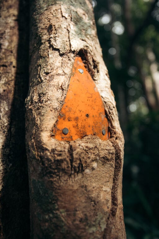
- Orange trail markers are common on some of the longer and more off-the-beaten-path Cairns walking tracks. However, the rainforest grows quickly and they are often obscured or engulfed in the foliage. Keep an eye out for them and have a physical map or GPX track with you.
- Several of the Cairns hikes in this post feature watercourses, rivers and creek crossings. So, as a precaution, only enter the water if you are 100% confident in your ability and avoid fast-flowing water at any cost.
- Cairns gets viscously hot and humid. Don't be surprised if you lose 3-4L of sweat per hour of walking. I always bring a Grayl water purifier bottle to refill and filter water from creeks to avoid dehydration.
- Plan your hike to the weather. Following heavy downpours, creeks can get flooded quickly. Check the weather and be cautious if it has been raining.
- Wait-a-while vines are everywhere on Cairns walking tracks and trails. These long, twisted vines with sharp barbs WILL catch your skin and everything you're wearing too. When you inevitably encounter one of these buggers, simply "wait a while" and peel them out, don't try to barge through.
- Bush ticks can carry life-threatening diseases. Although it's not pleasant, wear DEET and spray your shoes.
- Educate yourself on the local snakes and spiders of the North Queensland rainforest. Surprisingly, there are fewer venomous critters in Far North Queensland than in other parts of Australia. However, there are definitely some out there on the Cairns walking tracks that can kill you.
- Be Croc-wise and Cass-o-wary. While freshwater crocodiles won't attack you unless you accidentally step or jump on them, salties definitely will. Furthermore, don't assume that saltwater crocodiles won't lurk upstream in the freshwater. They have been found in creeks and rivers hundreds of kilometres from the coast!

Cairns Accommodation Guide – Where to Stay
Visiting Cairns? The best places to stay are near the Cairns Esplanade or on the sunny Northern Beaches. Below are the top 4 options for varying budgets.
- Crystalbrook Riley - If luxury and location are what you're after, you can't beat the Crystalbrook Riley. This is the best 5-star resort in Cairns and features absolutely everything you'd expect from a Crystalbrook resort.
- Fitzroy Island Resort - Sleep out on one of the picturesque Great Barrier Reef Islands at Fitzroy Island Resort. Spending the night on the island can work out cheaper than staying in town and means you get more time to explore the reef, coral beaches and rainforest walking trails.
- Gilligan's Backpackers - The best backpacker option for a great vibe in Cairns. Great place to meet like-minded travelers and has facilities including a pool. air-con, a huge shared kitchen, and a great common area!
- Pepper's Beach Club - stay at the best beach resort in the heart of Palm Cove on the Cairns Northern Beaches!
For a bigger list, don't miss my Cairns accommodation guide or as an alternative stay in FNQ, read my Port Douglas Accommodation guide too.


Essential Gear for Cairns Hikes & Bushwalks
Below I've listed a few things that I consider essential when hitting some of the longer hikes in Cairns.
For footwear, I always just use Brooks trail runners since they are light and easier to take off when you need to cross a creek or get your feet wet. In saying that, it can get a little sketchy in the bush on the snake front. Although I haven't used them, these snake gaiters should cover you if you wear trail shoes as I do.
1. Lightweight clothing
Firstly, hiking on the trails around Cairns and the Tropical North gets hot and sweaty quickly. Consequently, wearing lightweight, sweat-wicking clothing is essential. Remember though, you'll still want body coverage to avoid the bugs and wait-a-while vines.
2. Lightweight hardshell jacket
I consider this an essential hiking item for literally anywhere in the world. It will keep you dry when it rains and break the wind at the peaks and good ones pack down really small. I've had the same North Face Jacket for 6 years now and still use it daily.
3. Water bottle/purifier
Above all else, we need water. As I mentioned earlier, I rely on my Grayl water bottle purifier to store water and quickly filter and clean any freshwater I find on the trails.
4. Maps/Phone
It's wild out there. Trails can disappear quickly and the last thing you want is to get lost in the rainforest without a map.
5. DEET/Insect Repellent
Many walking tracks and hiking trails around Cairns are absolutely loaded with leeches, especially when it's wet. Mosquitos and bush ticks also thrive out there, so good repellent is essential. I recommend the red Bushmans.

Cairns Hiking FAQs
That's a hard one. My favourite hiking trail is the Devil's Thumb track. However, there are many trails ranging from quick and easy rainforest walks like the Crystal Cascades, to overnight missions like the Mount Bartle Frere trail.
Most of the best tracks are located quite a distance from the actual CBD. However, some good trails near the CBD are the White Rock Hike, the Arrow Tracks, Crystal Cascades, Fairy Falls, or the Glacier Rock lookout walk.
Cairns gets hot and wet in the Wet Season. I recommend planning your hiking adventures in the Dry Season, between June to October.
Both have great trails to explore nearby. However, I recommend renting a car either way so that you can explore both regions!
The tallest mountain in Queensland is Mount Bartle Frere (1611 m), accessible near Innisfail, a short drive south of Cairns.
While you'll likely find less venomous snakes and spiders than in the southern states, there are still some hazardous ones. Furthermore, hiking in Australia still poses dangers like slipping, falling or even drowning at waterfalls. Unfortunately, hiking incidents happen every year in FNQ, resulting in death, so please be careful out there on the trail.
More Cairns Hiking Guides & Adventures From Far North Queensland
So, that wraps up my "Cairns Hikes: 38 Best Hikes in Cairns" mega-post. Cairns is a special place that's left a permanent mark on me. It's a place I know that I'll always return to when I'm itching for some Aussie adventure. I hope this Cairns hiking guide has been useful for you and that you find some epic walking tracks, bushwalks, waterfalls and rainforest lookouts on your next trip.
If you'd prefer to chill at the beach after a long hike, then don't miss these 11 epic beaches near Cairns.
Find some more hikes that you feel should have made the list? Make sure to let me know in the comments and I'll be sure to check out the trail next time I'm in Cairns!

Lisa
Thursday 30th of September 2021
Awesome resource Olly thanks for writing this blog, I will be taking my kids along to some of these local hikes now they're a bit older.
Olly Gaspar
Thursday 30th of September 2021
No worries, they'll love it!
Michelle Wanner
Tuesday 13th of April 2021
Fantastic blog! I'm 6 months out of my chair after spinal surgery and working my way up from easy to more challenging tracks. Great advice, we have walked a few of these around Cairns and your advice is accurate. Thanks :)
Olly Gaspar
Wednesday 14th of April 2021
Hi Michelle,
Very inspiring to hear that you're just 6 months out of the chair and already on the trails, that's awesome. Very glad my blog has been useful for planning your hikes!
Olly